Alsip, Illinois facts for kids
Quick facts for kids
Alsip, Illinois
|
|||
|---|---|---|---|
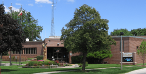
Alsip Village Hall
|
|||
|
|||
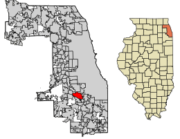
Location of Alsip in Cook County, Illinois.
|
|||
| Country | |||
| State | Illinois | ||
| County | Cook | ||
| Township | Worth | ||
| Incorporated | 1840 | ||
| Government | |||
| • Type | Mayor–council | ||
| Area | |||
| • Total | 6.63 sq mi (17.16 km2) | ||
| • Land | 6.53 sq mi (16.90 km2) | ||
| • Water | 0.10 sq mi (0.26 km2) 1.54% | ||
| Population
(2020)
|
|||
| • Total | 19,063 | ||
| • Density | 2,921.53/sq mi (1,127.97/km2) | ||
| Standard of living (2007-11) | |||
| • Per capita income | ,286 | ||
| • Median home value | 2,100 | ||
| ZIP code(s) |
60803
|
||
| Area code(s) | 708/464 | ||
| Geocode | 01010 | ||
| FIPS code | 17-01010 | ||
Alsip is a village located in Cook County, Illinois, United States. It is part of the larger Chicago metropolitan area. In 2020, about 19,063 people lived there.
Alsip was first settled in the 1830s by farmers from Germany and the Netherlands. The village got its name from Frank Alsip. He owned a brickyard that opened in the area in 1885. Alsip started to grow much more after the Tri-State Tollway was built nearby in 1959.
Contents
About Alsip, Illinois
Alsip is a village in Illinois, known for its location near Chicago. It has a rich history and is home to several important places.
Where is Alsip Located?
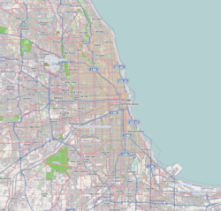
Alsip is located at coordinates 41.670433 degrees North and -87.732199 degrees West. It covers a total area of about 6.49 square miles (16.8 square kilometers). Most of this area is land, with a small part being water.
The village shares its borders with several other towns. To the west, you'll find Worth and Palos Heights. Crestwood is to the south. Oak Lawn is to the north. To the east are Merrionette Park, Blue Island, and Robbins. The Mount Greenwood neighborhood of Chicago is also nearby, to the north and east.
Most of Alsip is north of the Cal-Sag Channel. This channel is a waterway that connects to Lake Michigan. The village even has a boat launch on the canal. This allows people to access Lake Michigan from inland.
Alsip's Population and People
| Historical population | |||
|---|---|---|---|
| Census | Pop. | %± | |
| 1930 | 327 | — | |
| 1940 | 541 | 65.4% | |
| 1950 | 1,228 | 127.0% | |
| 1960 | 3,770 | 207.0% | |
| 1970 | 11,608 | 207.9% | |
| 1980 | 17,134 | 47.6% | |
| 1990 | 18,227 | 6.4% | |
| 2000 | 19,725 | 8.2% | |
| 2010 | 19,277 | −2.3% | |
| 2020 | 19,063 | −1.1% | |
| U.S. Decennial Census 2010 2020 |
|||
As of the 2020 census, Alsip had a population of 19,063 people. There were about 7,796 households in the village. The population density was around 2,877 people per square mile.
Alsip is a diverse community. Many different groups of people live there. About 51.58% of the residents were White, and 22.48% were African American. About 1.95% were Asian, and 0.70% were Native American. People of Hispanic or Latino background made up 26.52% of the population.
The average age in Alsip was 39.0 years old. About 23.5% of the population was under 18 years old. The median income for a household in Alsip was $58,768. This means half of the households earned more than this amount, and half earned less.
Education in Alsip
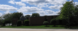
Alsip has several schools and educational opportunities for its residents.
Elementary Schools
Children in Alsip attend schools in different elementary school districts:
- Alsip-Hazelgreen-Oaklawn School District 126
- Prairie Junior High School is located in Alsip.
- Atwood Heights School District 125
- Meadow Lane Intermediate School and Hamlin Junior High School are in Alsip.
- Cook County School District 130
High Schools and Colleges
For older students, Alsip is part of the Community High School District 218. There is also Moraine Valley Community College nearby for higher education.
Private Schools
Several private schools are also an option for students in the area:
- Marist High School
- Brother Rice High School
- Mother McAuley Liberal Arts High School
- Chicago Christian High School
Businesses and Industry in Alsip
Alsip is home to several important businesses and industries. These companies provide jobs and help the local economy.
- Griffith Laboratories: This company has its international headquarters in Alsip.
- Coca-Cola Bottling Plant: One of the two Coca-Cola bottling plants in the Chicago area is located here.
- Alsip MiniMill: This factory produces a type of paperboard called corrugating medium. It uses recycled cardboard as its main material.
Transportation in Alsip
Getting around Alsip and to other areas is made easier by public transportation.
- Pace Bus Service: Pace provides bus services on routes 383 and 385. These routes connect Alsip to many different places across the Southland region.
Images for kids
See also
 In Spanish: Alsip (Illinois) para niños
 | William Lucy |
 | Charles Hayes |
 | Cleveland Robinson |


