
Amambay facts for kids
Quick facts for kids
Amambay
|
|||
|---|---|---|---|

International border on Av. Dr. Francia
|
|||
|
|||

Location of Amambay, in red, in Paraguay
|
|||
| Country | |||
| Region | Oriental | ||
| Capital | Pedro Juan Caballero | ||
| Boroughs | Pedro Juan Caballero, Capitán Matías Bado, Bella Vista Norte, Zanja Pyta, Karapa`i | ||
| Area
(2012) |
|||
| • Total | 12,933 km2 (4,993 sq mi) | ||
| Population
(2012)
|
|||
| • Total | 125,611 | ||
| • Density | 9.7124/km2 (25.1551/sq mi) | ||
| Demonym(s) | Amambayense | ||
| Time zone | UTC-04 (AST) | ||
| • Summer (DST) | UTC-03 (ADT) | ||
| ISO 3166 code | PY-13 | ||
| Website | Official website: http://amambay.gov.py/ | ||


Amambay is a department in Paraguay, a country in South America. Its capital city is Pedro Juan Caballero. The department's special code is PY-13.
The name "Amambay" comes from a mountain range called the Amambay Cordillera. In the Guaraní language, "Amambay" means "fern." This makes sense because many ferns grow in the forests of this area.
Contents
Amambay's Past
The city of Pedro Juan Caballero was founded in 1893. Another important town, Bella Vista, was started in 1902. The Amambay department itself was officially created in 1945. It was first called Department No. 10, but later became Department No. 13 after some changes.
Pedro Juan Caballero used to be known as Punta Porá. This name came from a nearby hill. People who transported yerba mate (a popular drink) used this name. Even today, a city across the border in Brazil is still called Ponta Porã.
Exploring Amambay's Geography
The Amambay department is located in the northern part of Paraguay's Oriental region. It covers an area of about 12,933 square kilometers. Around 125,611 people live here.
Amambay is known for being the highest department in Paraguay. Its land is generally between 300 and 400 meters high. The Punta Porá Hill, which is about 700 meters high, is one of the tallest spots in the entire country.
Where Amambay is Located
- North: It shares a border with Brazil. The Apa River and the Amambay Cordillera mountains separate them.
- East: It also borders Brazil, again separated by the Amambay Cordillera.
- South: It touches the Canindeyú department.
- West: It borders the Concepción and San Pedro departments.
 |
Brazil | |
||
| Concepción | Brazil | |||
| San Pedro | Canindeyú |
Rivers of Amambay
Several important rivers flow through Amambay. The Apa River is in the north. The Ypané River and the Aquidabán River are found in the central part of the department.
Amambay's Climate
The city of Pedro Juan Caballero gets a lot of rain. In 2012, it received over 1800 millimeters of rain. February was the wettest month, while May was the driest.
The average temperature in Pedro Juan Caballero in 2012 was about 22.5°C (72.5°F). December was the warmest month, with an average of 31.8°C (89.2°F). July was the coolest, averaging 17.1°C (62.8°F).
Amambay's Districts
The Amambay department is divided into 5 smaller areas called districts:
| Districts | Area (km²) |
Population (2015) |
Density |
|---|---|---|---|
| Bella Vista | 3,926 | 15,537 | 4.0 |
| Capitán Bado | 3,276 | 18,712 | 5.7 |
| Pedro Juan Caballero | 2,678 | 113,872 | 42.5 |
| Zanja Pytá | 2,106 | 7,362 | 3.5 |
| Karapaí | 1,274 | 3,780 | 3.0 |
Related pages
Images for kids
-
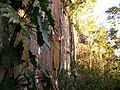
Cerro Muralla, "Wall Hill", in Amambay in the Cerro Corá National Park
-
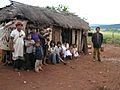
Pai Tavytera people in Amambay, 2012


See also
 In Spanish: Departamento de Amambay para niños
