
Concepción Department, Paraguay facts for kids
Quick facts for kids
Concepción
|
|||
|---|---|---|---|

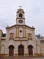
Concepción's main church
|
|||
|
|||

Location of Concepción, in red, in Paraguay
|
|||
| Country | |||
| Region | Oriental | ||
| Capital | Concepción | ||
| Districts | 11 | ||
| Area | |||
| • Total | 18,051 km2 (6,970 sq mi) | ||
| Population
(2013)
|
|||
| • Total | 189,660 | ||
| • Density | 10.5069/km2 (27.2127/sq mi) | ||
| Demonym(s) | Concepcionero (a) | ||
| Time zone | UTC-04 (AST) | ||
| • Summer (DST) | UTC-03 (ADT) | ||
| ISO 3166 code | PY-1 | ||
| Website | Official website: http://www.concepcion.gov.py/ | ||


The Concepción department (Spanish: Departamento de Concepcion) is an important area in Paraguay. It is one of the country's departments. The main city and capital of this department is Concepción. This department is known by the code PY-1 in the international system for country subdivisions.
Contents
Exploring Concepción's Geography
The Concepción department is located in the central part of Paraguay. It is in the northwest of the Oriental region, which is the eastern part of the country. The department covers a large area of 18,051 square kilometers (about 6,969 square miles). In 2013, about 189,660 people lived here. This means there are about 10.5 people per square kilometer.
Where is Concepción Located?
Concepción shares its borders with several other areas:
- To the north: It borders Mato Grosso do Sul in Brazil. The Apa river forms this border.
- To the south: It borders the San Pedro department. The Ypané river separates them.
- To the east: It borders the Amambay department.
- To the west: It borders the Presidente Hayes and Alto Paraguay departments. The Paraguay river separates Concepción from these two departments.
 |
Alto Paraguay | Mato Grosso do Sul (Brazil) | |
|
| Presidente Hayes | Amambay | |||
| San Pedro |
Rivers in Concepción
The most important river in the department is the Paraguay river. Other important rivers include the Apa and the Ypané. These rivers are very important for the department's environment and for the people who live there.
Concepción's Climate
The climate in Concepción is generally warm. In 2012, the total rainfall for the year in the city of Concepción was about 1,496 millimeters (58.9 inches). The month with the most rain was March, with about 282.3 millimeters (11.1 inches). The driest month was August, with only about 4.4 millimeters (0.17 inches) of rain.
The average temperature in Concepción during 2012 was 29.0°C (84.2°F). The warmest month, on average, was January, with an average temperature of 35.2°C (95.4°F). The coolest month, on average, was July, with an average temperature of 12.7°C (54.9°F).
Districts of Concepción
The Concepción department is divided into 11 smaller areas called districts. Each district has its own local government. Here is a list of these districts with their area and population:
| No. | Districts | Area (km²) |
Population (2015) |
Density |
|---|---|---|---|---|
| 1 | Azotey | 720.37 | 8,291 | 11.5 |
| 2 | Belén | 223.71 | 12,223 | 54.6 |
| 3 | Concepción | 944.11 | 80,622 | 85.4 |
| 4 | Horqueta | 2,082.75 | 59,374 | 28.5 |
| 5 | Loreto | 858.71 | 18,419 | 21.4 |
| 6 | Paso Barreto | 2,158.25 | 4,123 | 1.9 |
| 7 | San Alfredo | 3,990.13 | 5,155 | 1.3 |
| 8 | San Carlos del Apa | 1,890.23 | 740 | 2.6 |
| 9 | San Lázaro | 1,196.55 | 11,387 | 9.5 |
| 10 | Sargento José Félix López | 2,239.73 | 6,845 | 3.1 |
| 11 | Yby Ya'ú | 2,178.92 | 29,780 | 13.7 |
Related Pages
Images for kids
-
Concepción's main church
See also
 In Spanish: Departamento de Concepción (Paraguay) para niños
