
Presidente Hayes Department facts for kids
Quick facts for kids
Presidente Hayes
|
|||
|---|---|---|---|

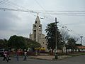
Church of Villa Hayes
|
|||
|
|||

Location of Presidente Hayes, in red, in Paraguay
|
|||
| Country | |||
| Region | Occidental | ||
| Capital | Villa Hayes | ||
| Districts | 8 | ||
| Area | |||
| • Total | 72,907 km2 (28,150 sq mi) | ||
| Population
(2013)
|
|||
| • Total | 108,520 | ||
| • Density | 1.48847/km2 (3.85512/sq mi) | ||
| Demonym(s) | Chaqueño (a) | ||
| Time zone | UTC-04 (AST) | ||
| • Summer (DST) | UTC-03 (ADT) | ||
| ISO 3166 code | PY-15 | ||


The Presidente Hayes department (which means "President Hayes Department" in Spanish) is a part of Paraguay, a country in South America. Its capital city is Villa Hayes. This department is named after Rutherford B. Hayes, a former president of the United States. He helped settle a border dispute between Paraguay and Argentina in the late 1800s.
The official code for Presidente Hayes, used for identifying regions, is PY-15.
Contents
Geography
Presidente Hayes is located in the central part of Paraguay. It is in the southwest of the "Western" (Occidental) region. The department covers a large area of about 72,907 square kilometers (about 28,150 square miles).
In 2013, about 108,520 people lived here. This means the population density is quite low. There are only about 1.5 people per square kilometer.
Borders of Presidente Hayes
Presidente Hayes shares its borders with several other areas:
- To the north: The Alto Paraguay department.
- To the south: Formosa Province in Argentina. The Pilcomayo river separates these two areas.
- To the east: The departments of Concepción, San Pedro, Cordillera, and Central. The Paraguay river forms the border here.
- To the west: The Boquerón department.
Rivers in the Department
The two most important rivers in Presidente Hayes are the Paraguay river and the Pilcomayo river. The Pilcomayo river is a smaller river that flows into the Paraguay river.
Districts
The Presidente Hayes department is divided into 8 smaller areas called districts. Each district has its own local government. The capital city, Villa Hayes, is also one of these districts.
| No. | Districts | Area (km²) |
Population (2016) |
Density (inh./km²) |
Elevation (m) |
Postal code |
|---|---|---|---|---|---|---|
| 1 | Benjamín Aceval | 10,996 | 19,594 | 1.8 | 66 | 9800 |
| 2 | General Bruguez | 6,543 | 3,216 | 0.5 | ||
| 3 | José Falcón | 1,839 | 4,067 | 2.2 | 54 | 9690 |
| 4 | Nanawa | 4.7 | 5,884 | 1,251.9 | 54 | 9950 |
| 5 | Puerto Pinasco | 15,141 | 9,380 | 0.6 | 73 | 9700 |
| 6 | Teniente Esteban Martínez | 8,015 | 3,292 | 0.4 | 123 | |
| 7 | Teniente Irala Fernández | 13,409 | 25,326 | 1.9 | ||
| 8 | Villa Hayes | 17,707 | 48,041 | 2.7 | 55 | 9900 |
Gallery
-
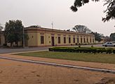
Government building of Presidente Hayes.
-
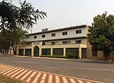
National University of Asuncion in Villa Hayes.
-
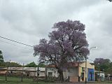
A street in Benjamín Aceval.


Related pages
Images for kids
-
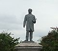
Monument in Benjamín Aceval.
-
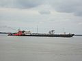
A view from Villa Hayes of a ship sailing on the Paraguay River.
-
The church of Villa Hayes.


See also
 In Spanish: Departamento de Presidente Hayes para niños
