Anchor Point, Alaska facts for kids
Quick facts for kids
Anchor Point, Alaska
K’kaq’
|
|
|---|---|
 |
|

Location of Anchor Point, Alaska
|
|
| Country | United States |
| State | Alaska |
| Borough | Kenai Peninsula |
| Area | |
| • Total | 91.76 sq mi (237.66 km2) |
| • Land | 91.65 sq mi (237.36 km2) |
| • Water | 0.12 sq mi (0.30 km2) |
| Elevation | 118 ft (36 m) |
| Population
(2020)
|
|
| • Total | 2,105 |
| • Density | 22.97/sq mi (8.87/km2) |
| Time zone | UTC-9 (Alaska (AKST)) |
| • Summer (DST) | UTC-8 (AKDT) |
| ZIP code |
99556
|
| Area code(s) | 907 |
| FIPS code | 02-03110 |
| GNIS feature ID | 1412516 |
Anchor Point is a small community in Alaska, located on the Kenai Peninsula. Its name in the Dena'ina is K’kaq’. It's known as a census-designated place (CDP), which means it's a community that doesn't have its own city government but is recognized for census purposes.
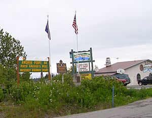
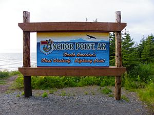
As of 2020, about 2,105 people live in Anchor Point. It's found along the Sterling Highway, which is part of Alaska State Route 1. A cool fact about Anchor Point is that it's the westernmost point in the entire North American highway system. This means you can drive further west here than anywhere else on the continent's main road network!
Contents
History of Anchor Point
The name "Anchor Point" comes from an old story. Legend says that when Captain James Cook explored this area, he lost one of his ship's anchors here.
People started settling in Anchor Point in the early 1900s. Over time, it grew into the community it is today.
Where is Anchor Point?
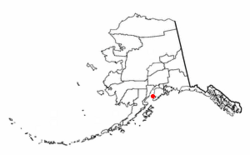
Anchor Point is located on the eastern shore of Cook Inlet. It's surrounded by other communities: Happy Valley to the north, Nikolaevsk to the northeast, and Diamond Ridge to the south.
The Anchor River flows through the southern part of the community. It empties into Cook Inlet just west of the town center.
Driving to Anchor Point
Anchor Point is the furthest west you can go on the U.S. highway system. Alaska Route 1 connects Anchor Point to other towns.
- It's about 15 miles (24 km) southeast to Homer.
- It's about 59 miles (95 km) northeast to Soldotna.
- The big city of Anchorage is about 206 miles (332 km) northeast via Route 1.
Size of the Area
The total area of Anchor Point is about 91.9 square miles (238.2 square kilometers). Most of this area is land, with a small amount of water.
What is the Economy Like?
A big part of Anchor Point's economy depends on the Anchor River. Many tourists visit to fish for salmon in the river during the summer months. The river area also has coal deposits.
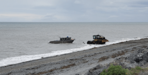
Along the coast, there are good places for clam-digging. This activity also brings visitors to the area.
Education in Anchor Point
Anchor Point is part of the Kenai Peninsula Borough School District.
- The Chapman School teaches students from pre-kindergarten up to eighth grade. It's located off the main highway.
- Older students usually go to Homer High School in the nearby town of Homer.
The Anchor Point Public Library serves the community. It has one employee and a collection of about 12,000 items for people to read and learn from.
Population and People
| Historical population | |||
|---|---|---|---|
| Census | Pop. | %± | |
| 1880 | 29 | — | |
| 1940 | 20 | — | |
| 1950 | 65 | 225.0% | |
| 1960 | 171 | 163.1% | |
| 1970 | 102 | −40.4% | |
| 1980 | 226 | 121.6% | |
| 1990 | 866 | 283.2% | |
| 2000 | 1,845 | 113.0% | |
| 2010 | 1,930 | 4.6% | |
| 2020 | 2,105 | 9.1% | |
| U.S. Decennial Census | |||
Anchor Point first appeared on the U.S. Census in 1880. Over the years, its population has grown. In 2020, there were 2,105 people living there.
Most people in Anchor Point are White, but there are also people of Native American, Asian, Black, and other backgrounds. Some residents are also of Hispanic or Latino origin.
The community has a mix of families and individuals. Many households have children under 18. The average age of people living in Anchor Point is around 39 years old.
Parks and Recreation
There are two Alaska State Parks nearby where people can enjoy nature.
- The Anchor River State Recreation Area runs along the banks of the Anchor River and down to the beach. It's a great spot for fishing and enjoying the outdoors.
- About five miles north of Anchor Point is the Stariski State Recreation Site. This is a smaller park with a campground. It sits on a bluff, offering nice views overlooking Cook Inlet.
See also
 In Spanish: Anchor Point (Alaska) para niños


