Applewood, Colorado facts for kids
Quick facts for kids
Applewood, Colorado
|
|
|---|---|

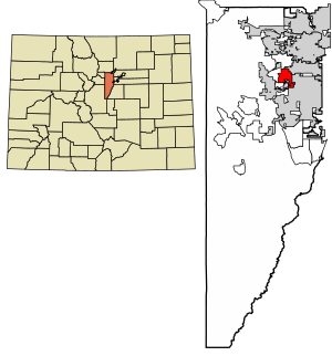
Location of the Applewood CDP in Jefferson County, Colorado.
|
|
| Country | |
| State | |
| County | Jefferson County |
| Government | |
| • Type | unincorporated community |
| Area | |
| • Total | 11.619 km2 (4.486 sq mi) |
| • Land | 10.527 km2 (4.064 sq mi) |
| • Water | 1.092 km2 (0.422 sq mi) |
| Elevation | 1,769 m (5,804 ft) |
| Population
(2020)
|
|
| • Total | 7,833 |
| • Density | 674.15/km2 (1,746.05/sq mi) |
| Time zone | UTC-7 (MST) |
| • Summer (DST) | UTC-6 (MDT) |
| ZIP Code |
Golden 80401
|
| Area codes | 303 & 720 |
| GNIS feature ID | 2407749 |
Applewood is a special kind of community in Jefferson County, Colorado, United States. It is called an "unincorporated community" and a "census-designated place" (CDP). This means it's a recognized area for counting people, but it doesn't have its own local government like a city or town. Instead, it's managed by Jefferson County.
Applewood is part of a larger area called the Denver–Aurora–Lakewood, CO Metropolitan Statistical Area. This is a big region that includes Denver and many nearby cities and towns. In 2020, about 7,833 people lived in Applewood. The mail for Applewood comes through the Golden post office, using the Zip code 80401.
Contents
Applewood's Location and Size
Applewood is located about 10 miles (16 kilometers) west of downtown Denver. It shares borders with several other communities. To the north, you'll find Fairmount. To the northeast is Wheat Ridge, and to the southeast is Lakewood. On the southwest side, it borders West Pleasant View. A natural landmark, South Table Mountain, is located to the west of Applewood.
The total area of Applewood is about 4.48 square miles (11.619 square kilometers). A small part of this area, about 0.42 square miles (1.092 square kilometers), is covered by water.
A Look at Applewood's History
Applewood has changed in size over the years. In the year 2000, for example, the area that makes up Applewood was made a bit smaller than it was in 1990. A new census-designated place called West Pleasant View was created from some parts of what used to be Applewood.
How Many People Live Here?
The United States Census Bureau first officially defined Applewood as a CDP for the 1970 census. Since then, the number of people living in Applewood has changed.
| Applewood CDP, Colorado | ||
|---|---|---|
| Year | Pop. | ±% |
| 1970 | 8,214 | — |
| 1980 | 12,040 | +46.6% |
| 1990 | 11,069 | −8.1% |
| 2000 | 7,123 | −35.6% |
| 2010 | 7,160 | +0.5% |
| 2020 | 7,833 | +9.4% |
| Source: United States Census Bureau | ||
Schools in Applewood
Students living in Applewood attend schools that are part of the Jefferson County School District R-1. This district manages many schools in the area.
Here are some of the schools that students from Applewood attend, based on where they live:
- Elementary Schools: Maple Grove, Stober, and Welchester Elementary Schools.
- Middle Schools: Everitt Middle School and Bell Middle School.
- High Schools: Most students go to either Golden High School or Wheat Ridge High School. Which high school a student attends depends on their exact address within Applewood.
See also
 In Spanish: Applewood para niños


