
Arleta, Los Angeles facts for kids
Quick facts for kids
Arleta
|
|
|---|---|

Boundaries of Arleta as drawn by the Los Angeles Times
|
|

Arleta
Location in San Fernando Valley

Arleta
Location in the Los Angeles metropolitan area
|
|
| Country | United States |
| State | California |
| County | Los Angeles |
| City | Los Angeles |
| Time zone | UTC-8 (PST) |
| • Summer (DST) | UTC-7 (PDT) |
| ZIP code |
91331
|
Arleta is a neighborhood in the San Fernando Valley area of Los Angeles, California. Many people who live here are from Latino backgrounds. A large number of residents were also born outside the United States.
Contents
Where is Arleta Located?
Arleta is surrounded by other Los Angeles neighborhoods. To the north, you'll find Mission Hills and North Hills. Sun Valley is to the east, and Pacoima is to the northeast. To the west is Panorama City.
The neighborhood covers about 4 square miles. Its borders are roughly Paxton Avenue, Laurel Canyon Boulevard, Tonopah Avenue, and Woodman Avenue.
A Brief History of Arleta
Long ago, the area that is now Arleta was mostly open land. It was part of the larger community of Pacoima. After World War II, many factories grew in the San Fernando Valley. This created more jobs for people. To house these new workers, more homes were built in the area.
Pacoima became a diverse neighborhood. Many African-American and Latino families moved there. However, the western part, which became Arleta, stayed mostly white. In the early 1960s, the 5 Freeway was built. This road created a clear separation between east and west Pacoima.
Around the same time, people in the western part wanted their own neighborhood. They asked the city to let them form a new community. In 1968, their request was approved, and Arleta became an official neighborhood.
Later, in the 1980s, many factory jobs left the valley. Some residents moved away. Arleta then became much more diverse. Today, it has a large Latino population, similar to Pacoima.
Who Lives in Arleta?
In 2000, about 31,068 people lived in Arleta. This means there were about 10,034 people for every square mile. This is an average number for Los Angeles neighborhoods. By 2008, the population had grown to an estimated 32,622 people.
The average age of residents in 2000 was 29 years old. This is also about average for the city. Arleta has a high number of young people, especially those aged 11 to 18.
Arleta is known for being "moderately diverse." It has a high percentage of Latino residents, making up about 71.7% of the population. Other groups include Asians (11.0%), whites (13.2%), and African Americans (2.2%). Many residents (46%) were born outside the U.S. Most of these people came from Mexico (55.3%) or El Salvador (11.2%).
The average household income in 2008 was about $65,649 per year. This was considered average for Los Angeles. Most homes in Arleta (80.4%) are owned by the people who live in them. About 19.6% of homes are rented. The average household has about 4 people, which is a high number for Los Angeles.
Economy in Arleta
The well-known fashion company Juicy Couture has its main office in Arleta.
Parks and Fun Places
Arleta has a great place called Branford Park. This park has many things to do, including:
- An auditorium
- Lighted and unlighted baseball fields
- Lighted outdoor basketball courts
- A play area for children
- A community room
- Indoor gyms (with and without weights)
- An outdoor gym
- A kitchen
- A music room
- Picnic tables
- A lighted soccer field
- A stage
- Lighted tennis courts
- Lighted volleyball courts
There is also another park in Arleta called Devonshire Arleta Park.
Schools in Arleta

Arleta is part of the Los Angeles Unified School District. Here are some of the schools in the neighborhood:
- Arleta High School, located at 14200 Van Nuys Boulevard
- Sharp Avenue Elementary School, at 13800 Pierce Street
- Beachy Avenue Elementary School, at 9757 Beachy Avenue
- Vena Avenue Elementary School, at 9377 Vena Avenue
- Canterbury Avenue Elementary School, at 13670 Montague Street
- Bert Corona Charter Middle School, at 9400 Remick Avenue
Getting Around Arleta
Transportation
You can reach Arleta using major freeways like the Golden State Freeway (I-5) and the Hollywood Freeway (SR 170). Important streets include Van Nuys Boulevard, Woodman Avenue, and Arleta Avenue. Other main streets are Sheldon, Branford, Osborne, and Terra Bella Streets.
Metro Rapid route 761 offers quick bus service on Van Nuys Boulevard. Metro route 158 travels up Woodman Avenue and then along Arleta Avenue and Devonshire Street. This route connects to other neighborhoods like Granada Hills, Northridge, and Chatsworth.
Libraries
The Los Angeles Public Library has a branch nearby called the Granada Hills Branch.
Famous People From Arleta
- Johnny Burnette, a rockabilly singer
- The Osmonds, a famous singing group
- Sharon Shapiro, a gymnast
Images for kids
-
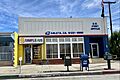
Arleta Post Office, a substation of the Pacoima Station

See also
 In Spanish: Arleta (Los Ángeles) para niños
