Arnold, Missouri facts for kids
Quick facts for kids
Arnold, Missouri
|
|
|---|---|

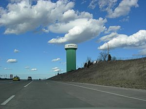
Arnold Water Tower from I-55 North
(color is sky blue since Nov 2015) |
|

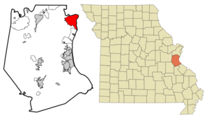
Location within Jefferson County and Missouri
|
|
| Country | United States |
| State | Missouri |
| County | Jefferson |
| Government | |
| • Type | Mayor-Administrator-Council |
| Area | |
| • Total | 11.53 sq mi (29.86 km2) |
| • Land | 11.53 sq mi (29.85 km2) |
| • Water | 0.00 sq mi (0.01 km2) |
| Elevation | 522 ft (159 m) |
| Population
(2020)
|
|
| • Total | 20,858 |
| • Density | 1,809.80/sq mi (698.79/km2) |
| Time zone | UTC-6 (Central (CST)) |
| • Summer (DST) | UTC-5 (CDT) |
| ZIP code |
63010
|
| Area code(s) | 636 |
| FIPS code | 29-01972 |
| GNIS ID | 2393991 |
Arnold is a city in Jefferson County, Missouri. It is located where the Meramec River and Mississippi River meet. Arnold is a suburb of St. Louis. It is part of the larger Greater St. Louis area. In 2020, about 20,858 people lived there. This makes Arnold the biggest community in Jefferson County.
| Top - 0-9 A B C D E F G H I J K L M N O P Q R S T U V W X Y Z |
Arnold's Early History
The first European person to settle in Arnold was Jean Baptiste Gamache. He ran a ferry boat across the Meramec River. He got land from the King of Spain for this service. His ferry was on an important old road called the King's Trace. This road connected St. Louis, Missouri to Ste. Genevieve, Missouri.
What is Eminent Domain?
Arnold was involved in a big discussion about something called eminent domain. This is when the government can buy private land for public use. They must pay a fair price for it. In 2004, the City of Arnold wanted to develop an area called the Triangle. This area was near Route 141, Interstate 55, and Church Road.
The city wanted to buy properties in this area for a new development. Most property owners agreed to sell their land. Some businesses were even offered new places to move to. However, some people did not want to sell their land. The city then tried to use eminent domain to get these properties. After some legal discussions, the city was allowed to use eminent domain for this project.
Red Light Cameras in Arnold
In 2005, Arnold was the first city in Missouri to put up red light cameras. These cameras take pictures of cars that run red lights.
Where is Arnold Located?
Arnold is located at 38°25′58″N 90°22′10″W. The city covers about 11.94 square miles (30.92 square kilometers). Most of this area is land. Only a small part is water.
People Living in Arnold
Arnold has grown over the years. In 1980, about 19,141 people lived there. By 2020, the population had grown to 20,858 people.
Many different people live in Arnold. In 2020, most residents were white. There were also people of African American, Native American, and Asian backgrounds. Many people from different races live in Arnold. The city also has a growing Bosnian community.
The average age of people in Arnold in 2020 was about 40.3 years old. About 23.2% of the people were under 18. About 18.0% were 65 or older.
Arnold's Economy
Arnold is home to some important businesses. In 2014, a company called Metal Container Corp expanded its factory in Arnold. This factory makes aluminum cans and bottles. It became the largest can manufacturing plant in the country.
Arnold also has an office for the National Geospatial-Intelligence Agency. This agency helps the government with maps and satellite images. About 900 people work there.
In 2008, Money Magazine said Arnold was one of the best and most affordable cities to live in the United States. It was ranked 12th on their list.
Parks and Fun Things to Do
Arnold has a great system of public parks. The city also has a recreation center. It has swimming pools and places to work out. Many other places in Arnold offer fun activities too. These include sports fields at churches and schools.
Arnold City Park
Arnold City Park is a large park in the city. It is about 68 acres. The park has a big fishing lake. It also has four pavilions with electricity and barbecue grills. You can find a playground there. There is also a paved trail for walking and hiking. The park has fields for sports. You can also play horseshoes, volleyball, and disc golf.
Ferd B. Lang Park
Ferd B. Lang Park is a 25-acre park in central Arnold. It has five pavilions with electricity and barbecue grills. The park also has a playground and trails for walking and hiking. There are grass fields for sports. You can also find horseshoe pits and sand volleyball courts. The Arnold Jaycees Skate Park is here too. There is a basketball half-court and a dog park.
Other Fun Places
The City of Arnold's recreation center offers many services. You can use the workout center, walking track, and swimming pool. The First Baptist Church of Arnold also has a free gymnasium. It has weight rooms, a cardio center, and an indoor walking track.
Schools and Learning
The Fox C-6 School District runs the public schools in Arnold.
- There are three elementary schools in the city: Fox, Rockport Heights, and Sherwood.
- Fox Middle School and Fox High School are also in Arnold.
The Fox school district started as a K-8 district. This means it served students from kindergarten to 8th grade. High school students used to go to schools in other towns. Fox High School opened in 1955. After that, the district served students from kindergarten through 12th grade.
Arnold also has a public library. It is a branch of the Jefferson County Library.
Jefferson College (Missouri) opened a campus in Arnold in 2007. This campus helps provide education to people in northern Jefferson County. It is a 40,000 square feet building. It is located near the Arnold Library and Recreation Center.
Famous People from Arnold
- Louisa Frederici - She was born in Arnold and married Buffalo Bill Cody.
- Frank J. Grass - A General and Chief of the National Guard Bureau.
- Dana Loesch - A spokesperson for the National Rifle Association of America.
- Kenny Wallace - A former NASCAR race car driver.
- Rusty Wallace - A former NASCAR champion race car driver.
- Mike Wells - A former NFL football player.
Places to See
- Wickes - This was once a stop on the Missouri Pacific Railroad.
See also
 In Spanish: Arnold (Misuri) para niños
 | Stephanie Wilson |
 | Charles Bolden |
 | Ronald McNair |
 | Frederick D. Gregory |

