Aromas, California facts for kids
Quick facts for kids
Aromas, California
|
|
|---|---|

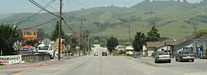
Downtown Aromas
|
|

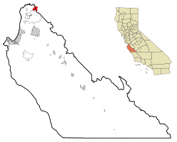
Location in Monterey County and the state of California
|
|

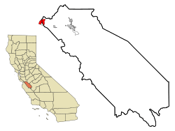
Location in San Benito County and the state of California
|
|
| Country | United States |
| State | California |
| Counties | Monterey, San Benito |
| Area | |
| • Total | 4.75 sq mi (12.3 km2) |
| • Land | 4.74 sq mi (12.3 km2) |
| • Water | 0.01 sq mi (0.03 km2) 0.22% |
| Elevation | 131 ft (40 m) |
| Population
(2020)
|
|
| • Total | 2,708 |
| • Density | 571.91/sq mi (220.82/km2) |
| Time zone | UTC-8 (PST) |
| • Summer (DST) | UTC-7 (PDT) |
| ZIP code |
95004
|
| Area code(s) | 831 |
| FIPS code | 06-02812 |
| GNIS feature ID | 1657949 |
Aromas is a small community in California, United States. Its name comes from a Spanish word meaning "Scents." It is a special type of community called a census-designated place (CDP). This means it's a place the government counts for population, but it's not officially a city or town.
Aromas is unique because it sits right on the border of two counties: Monterey County and San Benito County. In 2020, about 2,708 people lived there. The population is split almost evenly between the two counties. Aromas is one of only a few CDPs in California that are located in more than one county.
Contents
History of Aromas
This community was first known as "Sand Cut." It got this name because of a Southern Pacific Railroad tunnel built nearby in 1871. Around 1895, the name was changed to Aromas. This new name came from a nearby ranch called Rancho Las Aromitas y Agua Caliente.
Geography and Location
Aromas is located in the northern part of Monterey County and the northwestern part of San Benito County. You can find it at 36°53′13″N 121°38′29″W / 36.88694°N 121.64139°W. To the south, it borders another community called Prunedale.
U.S. Route 101 is a major road that runs along the southeastern edge of Aromas. This highway can take you about 13 miles (21 km) north to Gilroy or about 14 miles (23 km) south to Salinas.
The Aromas area covers about 4.75 square miles (12.3 km2) of land. Most of this is land, with only a tiny bit of water. The center of Aromas is on the south side of the Pajaro River valley. This river flows through a narrow pass called Pajaro Gap, which is at the southern end of the Santa Cruz Mountains.
Population in Aromas
| Historical population | |||
|---|---|---|---|
| Census | Pop. | %± | |
| 2000 | 2,797 | — | |
| 2010 | 2,650 | −5.3% | |
| 2020 | 2,708 | 2.2% | |
| U.S. Decennial Census | |||
In 2020, the population of Aromas was 2,708 people. This means there were about 571.91 inhabitants per square mile (220.82/km2) people living in each square mile.
The community is made up of people from many different backgrounds. In 2010, about 75% of the people identified as White. About 35% of the population identified as Hispanic or Latino.
Most people in Aromas live in family homes. In 2010, there were 884 households. Many of these households had children under 18 living there. The average household had about 3 people. Most homes in Aromas are owned by the people who live in them.
Schools in Aromas
Aromas is part of the Aromas-San Juan School District. This district has three schools for students.
- Aromas Elementary School is a school for students from kindergarten through 8th grade. In 2000, it had less than 400 students.
- Anzar High School opened in 1994. It was named after some of the first people to settle in the area. Anzar High School currently has 258 students.
Economy and Businesses
Aromas is home to a few important businesses.
- Graniterock has a quarry in Aromas. A quarry is a place where rocks and minerals are dug out of the ground. This specific quarry is called the A.R. Wilson quarry.
- Fireclay Tile has been making special architectural tiles in Aromas since 1986. These tiles are used in buildings and designs.
See also
 In Spanish: Aromas (California) para niños


