
Prunedale, California facts for kids
Quick facts for kids
Prunedale, California
|
|
|---|---|

Population sign for Prunedale along northbound Highway 101
|
|

Location in Monterey County and the state of California
|
|

Prunedale, California
Location in the United States
|
|
| Country | |
| State | |
| County | Monterey |
| Area | |
| • Total | 46.204 sq mi (119.67 km2) |
| • Land | 46.062 sq mi (119.30 km2) |
| • Water | 0.142 sq mi (0.37 km2) 0.31% |
| Elevation | 92 ft (28 m) |
| Population
(2020)
|
|
| • Total | 18,885 |
| • Density | 410.0/sq mi (158.3/km2) |
| Time zone | UTC-8 (PST) |
| • Summer (DST) | UTC-7 (PDT) |
| ZIP codes | |
| Area code(s) | 831 |
| FIPS code | 06-58870 |
| GNIS feature ID | 0277580 |
Prunedale is a small community in Monterey County, California, United States. It is not an official city but a "unincorporated community". This means it's a place with a shared identity that is not governed by its own local city government.
Prunedale is located about 8 miles (13 km) north of Salinas. It sits at an elevation of 92 feet (28 meters) above sea level. In 2020, about 18,885 people lived there. The area is also called a "census-designated place" (CDP) by the U.S. Census Bureau for counting purposes.
Long ago, people tried to grow plum trees in Prunedale. However, the trees did not survive because there wasn't enough water or good soil. Even so, the name "Prunedale" stuck! Today, many parts of Prunedale still feel like a quiet, rural area.
Contents
Prunedale's History
Early Days and the Post Office
One of the first people to settle in the Prunedale area was Charles Langley. He was a banker from Watsonville. Charles Langley also helped start the Prunedale post office in 1894. The post office closed in 1908 but opened again in 1953. A road in Prunedale, Langley Canyon Road, is named after his family.
It was around the time Prunedale was founded that the plum trees failed. This was due to a lack of proper watering and fertilizer. Despite this, the name Prunedale remained. The area has kept its rural feel in most places.
The Story of Highway 101
A big change for Prunedale happened between 1931 and 1932. This is when U.S. Route 101 was moved to go through Prunedale. Before this, Highway 101 went directly from Salinas to San Juan Bautista. That old road is now called San Juan Grade Road.
In 1946, Highway 101 was made wider to have four lanes. As Prunedale grew, more cars used the highway. This caused a lot of traffic. Because of the traffic, Highway 101 through Prunedale became a "Traffic Safety Corridor." This meant that traffic fines were doubled in the late 1990s and early 2000s. The speed limit was also lowered to 55 miles per hour (89 km/h).
There were plans to build a new bypass for Highway 101 around Prunedale. However, these plans did not happen. Instead, the state transportation department, Caltrans, decided to make the highway better. They added an overpass at San Miguel Canyon and improved the interchange with Highway 156. They also added more turn and merge lanes. These improvements were finished in the early 2000s. In recent years, with fewer traffic accidents, the speed limit was increased to 60 miles per hour (97 km/h).
Community Growth and Services
One of the first businesses in Prunedale was called Glenn's. Later, in the 1970s, the Prunedale Shopping Center was built. The Prunedale Senior Citizens' Center was built in 1989. This center helps older adults in the community. It provides meals and other public assistance programs. For example, it has a food bank that gives away food every two weeks.
Prunedale's Location and Landscape
Prunedale is located in the northern part of Monterey County. It shares a border with San Benito County to the northeast. To the north, you'll find the community of Aromas. To the west is the community of Elkhorn.
If you travel south on U.S. Route 101, you'll reach Salinas, which is the main city of the county, about 7 miles (11 km) away. Going north on Highway 101 will take you to Gilroy, about 20 miles (32 km) away.
The total area of Prunedale is about 46.2 square miles (119.7 square kilometers). Only a small part of this, about 0.1 square miles (0.26 square kilometers), is water. Langley Creek flows near Highway 101 through Prunedale. You can see it at the intersection of Highway 101 and Tustin Road. You can also spot it where Prunedale South Road meets Blackie Road.
Transportation in Prunedale
Prunedale has public transportation services provided by Monterey–Salinas Transit. These services can connect you to Amtrak trains at the San Jose Diridon station. Caltrans, the state transportation agency, also has a special parking area called a park and ride at the intersection of US Route 101 and California State Route 156. This allows people to park their cars and carpool or take public transport.
Nature and Environment
In the hills above Prunedale, there is a rare plant called Yadon's piperia. This is a type of wild orchid that is an endangered species. This means it is very rare and needs protection.
For outdoor fun, there are two parks nearby: Royal Oaks Park and Manzanita Park. These parks are owned by Monterey County and offer places for recreation. A lot of land in Prunedale is set aside as an "oak reserve." This helps protect California's native oak trees.
Gallery
-
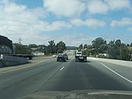
Highway 101 through Prunedale heading north
-
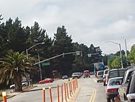
San Miguel Canyon Prunedale North intersection in Prunedale
-
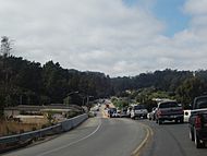
San Miguel Canyon Road from the 101 overpass in Prunedale
-
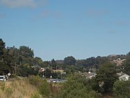
View of 101 heading north from San Miguel Canyon Road overpass in Prunedale


See also
 In Spanish: Prunedale para niños
