
Arroux facts for kids
Quick facts for kids Arroux |
|
| River | |
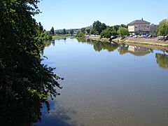
 The Arroux near the Porte d'Arroux in Autun.
|
|
| Country | |
|---|---|
| Regions | Bourgogne-Franche-Comté, Auvergne-Rhône-Alpes |
| Departments | Côte-d'Or, Saône-et-Loire, Allier |
| Tributaries | |
| - left | Drée, Mesvrin, Bourbince |
| - right | Ternin, Méchet |
| Cities | Autun, Gueugnon, Digoin |
| Source | |
| - location | Culètre, Côte-d'Or, France |
| - elevation | 430 m (1,411 ft) |
| - coordinates | 47°8′54″N 4°33′22″E / 47.14833°N 4.55611°E |
| Confluence | Loire River |
| - location | Digoin, Saône-et-Loire, France |
| - elevation | 224 m (735 ft) |
| - coordinates | 46°29′24″N 3°57′33″E / 46.49000°N 3.95917°E |
| Length | 129.4 km (80 mi) |
| Basin | 3,166 km² (1,222 sq mi) |
| Discharge | for Digoin |
| - average | 34.20 m³/s (1,208 cu ft/s) |
The Arroux is a river located in central France. It's like a natural pathway for water. This river is a "right tributary" of the Loire. This means it flows into the Loire from the right side if you are looking downstream.
Contents
Geography of the Arroux River
The Arroux river is about 129.4 kilometers (around 80 miles) long. It has a "drainage basin" that covers 3,166 square kilometers (about 1,222 square miles). A drainage basin is the entire area of land where all the rain and snowmelt eventually drain into that river.
Where the Arroux Starts and Flows
The Arroux river begins in a place called Culètre. This is a small commune (a type of local administrative area) in the south of the Côte-d'Or department in France. It starts at an altitude of about 430 meters (about 1,410 feet) above sea level.
From its start, the Arroux first flows towards the west. Then, it turns and flows towards the southwest.
The Arroux river passes through two main regions and three different departments in France. Some of the towns and communes it flows through include:
- Bourgogne-Franche-Comté region
- In Côte-d'Or: Arnay-le-Duc
- In Saône-et-Loire: Autun, Étang-sur-Arroux, Toulon-sur-Arroux, Gueugnon, Digoin
- Auvergne-Rhône-Alpes region
- In Allier: It flows through this department for only a short distance.
Finally, the Arroux river joins the Loire River near the town of Digoin. This meeting point is called a confluence.
Main Rivers Joining the Arroux
Smaller rivers that flow into a larger river are called tributaries. The main tributaries of the Arroux river are:
|
Rivers Joining from the Left:
|
Rivers Joining from the Right:
|
How Much Water Flows in the Arroux?
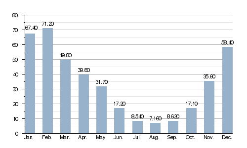
The "discharge" of a river tells us how much volume of water passes through a certain point each second. The average yearly discharge of the Arroux river is 34.20 cubic meters per second (about 1,208 cubic feet per second). This measurement is taken near Digoin in the Saône-et-Loire department.
Average monthly discharge (m3/s) at Digoin (1958 - 2017)
Gallery
-
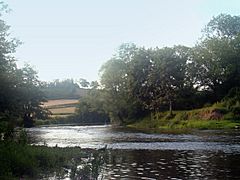
The Arroux.
-
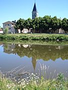
The Arroux in Vendenesse-sur-Arroux.
-
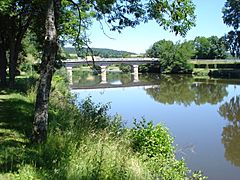
Vendenesse-sur-Arroux, bridge over the Arroux.
-
The Arroux in Gueugnon.
-
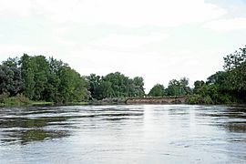
Confluence of the Arroux in the Loire.


See Also
