
Saône-et-Loire facts for kids
Quick facts for kids
Saône-et-Loire
|
||
|---|---|---|

Prefecture building of the Saône-et-Loire department, in Mâcon
|
||
|
||

Saône-et-Loire in France
|
||
| Country | France | |
| Region | Bourgogne-Franche-Comté | |
| Département | 4 March 1790 | |
| Prefecture | Mâcon | |
| Subprefecture | Autun Chalon-sur-Saône Charolles Louhans |
|
| Area | ||
| • Total | 8,574.7 km2 (3,310.7 sq mi) | |
| Population
(2011)
|
||
| • Total | 555,999 | |
| • Rank | 47th | |
| • Density | 64.8418/km2 (167.9395/sq mi) | |
| Demonym(s) | Saône-et-Loiriens | |
| Time zone | UTC+1 (CET) | |
| • Summer (DST) | UTC+2 (CEST) | |
| ISO 3166 code | FR-71 | |
| Arrondissements | 5 | |
| Cantons | 57 | |
| Communes | 573 | |
| Website | www.cg71.fr | |

Saône-et-Loire is a department in the center of France. It is part of the Bourgogne-Franche-Comté region. The department is named after two important rivers: the Saône and the Loire.
The biggest city in Saône-et-Loire is Chalon-sur-Saône. However, the main city, also called the prefecture or capital, is the smaller city of Mâcon.
Contents
History of Saône-et-Loire
Saône-et-Loire was one of the first 83 departments created in France. This happened during the French Revolution on March 4, 1790. Mâcon was chosen as its capital.
The department was formed by joining parts of older areas. These included southern Burgundy and Bresse. These areas did not naturally fit together geographically.
At first, Saône-et-Loire was split into seven smaller areas called districts. These were Autun, Bourbon-Lancy, Chalon-sur-Saône, Charolles, Louhans, Mâcon, and Semur-en-Brionnais. Later that same year, the name of Semur-en-Brionnais was changed to Marcigny.
In 1800, France created new administrative areas called arrondissements. The seven districts in Saône-et-Loire became five arrondissements: Mâcon, Autun, Chalon-sur-Saône, Charolles, and Louhans.
After the Battle of Waterloo in 1815, the Austrian army took control of the department. They stayed from June 1815 until November 1818.
In 1926, the arrondissement of Louhans was removed. But in 1942, it became an arrondissement again.
Geography of Saône-et-Loire

Saône-et-Loire is located in the Bourgogne-Franche-Comté region. It covers an area of about 8,574.7 square kilometers (3,311 square miles). This makes it the seventh largest department in France.
The department shares its borders with seven other departments:
- In the Bourgogne-Franche-Comté region:
- In the Auvergne-Rhône-Alpes region:
 |
Nièvre | Côte-d'Or | |
|
| Allier | Jura | |||
| Loire | Rhône | Ain |
There are five main natural areas within the department:
- Autunois: This area is in the northwest, around the city of Autun.
- Charolais: Located in the southwest, this region is known for its cattle and is centered around Charolles.
- Chalonnais: This northern area has Chalon-sur-Saône as its main city.
- Mâconnais: Found in the south, this region is around the city of Mâcon.
- Bresse: This area is to the east of the Saône river. Its main city is Louhans.
The two most important rivers in the department are the Loire and the Saône. The Loire forms most of the western border and flows north towards the Atlantic Ocean. The Saône is in the eastern part of the department. It flows south and joins the Rhône river near Lyon.
Climate in Saône-et-Loire
The climate in Saône-et-Loire is an "Oceanic climate," also known as a Maritime Temperate climate. This means it has mild temperatures and rainfall throughout the year.
Near Mâcon, at Charnay-lès-Mâcon, the average yearly temperature is about 11.7°C (53.1°F). July is usually the warmest month, with an average of 21.1°C (70.0°F). January is the coolest, averaging 2.8°C (37.0°F).
The department gets about 866.1 mm (34.1 inches) of rain each year. October is the wettest month, with about 96.5 mm (3.8 inches) of rain. August is the driest, with an average of 50.8 mm (2.0 inches).
Administration of Saône-et-Loire
Saône-et-Loire is governed by the General Council of Saône-et-Loire. This council is based in Mâcon. The department is part of the larger Bourgogne-Franche-Comté region.
Administrative Divisions
Saône-et-Loire is divided into several administrative parts:
- 5 arrondissements (districts).
- 57 cantons (smaller administrative areas).
- 573 communes (local municipalities or towns).
Here is a summary of the arrondissements:
| Arrondissement | Capital | Population (2011) |
Area (km²) |
Density (Inh./km²) |
Cantons | Communes |
|---|---|---|---|---|---|---|
| Autun | Autun | 88,316 | 1,900.3 | 46.5 | 11 | 83 |
| Chalon-sur-Saône | Chalon-sur-Saône | 198,850 | 1,726.0 | 115.2 | 15 | 151 |
| Charolles | Charolles | 100,359 | 2,500.3 | 40.1 | 13 | 136 |
| Louhans | Louhans | 55,220 | 1,248.5 | 44.2 | 8 | 79 |
| Mâcon | Mâcon | 113,254 | 1,199.6 | 94.4 | 10 | 124 |
| Total | 555,999 | 8,574.7 | 64.8 | 57 | 573 |
Population of Saône-et-Loire
The people who live in Saône-et-Loire are called Saône-et-Loiriens in French. For women, the term is Saône-et-Loiriennes.
In 2011, Saône-et-Loire had a population of 555,999 people. This means there were about 64.8 inhabitants per square kilometer. The arrondissement of Chalon-sur-Saône had the most people, with 198,850 residents.
Here are the cities in the department with more than 9,000 inhabitants:
| City | Population (2011) |
Arrondissement |
|---|---|---|
| Chalon-sur-Saône | 44,847 | Chalon-sur-Saône |
| Mâcon | 33,730 | Mâcon |
| Le Creusot | 22,620 | Autun |
| Montceau-les-Mines | 19,124 | Chalon-sur-Saône |
| Autun | 14,426 | Autun |
| Paray-le-Monial | 9,094 | Charolles |
Images for kids
-
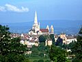
Antun Cathedral.
-
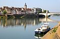
Chalon-sur-Saône and the Saône river.
-
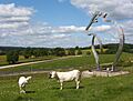
Cows outside of the Maison du Charolais, Charolles.
-
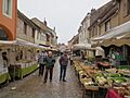
Market in Louhans.
-
La Bourbonne river near Lugny.
-
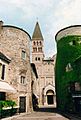
Tournus
-

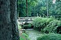
Lake of Pézanin
-
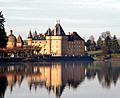
Château de La Clayette


_032.JPG)


Related pages
See also
 In Spanish: Saona y Loira para niños
