
Loire facts for kids
Quick facts for kids
Loire
|
|||
|---|---|---|---|
|
|||

Location of Loire in France
|
|||
| Country | France | ||
| Region | Auvergne-Rhône-Alpes | ||
| Département | 12 August 1793 | ||
| Prefecture | Saint-Étienne | ||
| Subprefectures | Montbrison, Roanne | ||
| Area | |||
| • Total | 4,780.6 km2 (1,845.8 sq mi) | ||
| Population
(2014)
|
|||
| • Total | 757,305 | ||
| • Density | 158.4121/km2 (410.286/sq mi) | ||
| Demonym(s) | Ligériens | ||
| Time zone | UTC+1 (CET) | ||
| • Summer (DST) | UTC+2 (CEST) | ||
| ISO 3166 code | FR-42 | ||
| Arrondissements | 3 | ||
| Cantons | 21 | ||
| Communes | 326 | ||
| Website | http://www.loire.fr/ | ||


Loire (Occitan: Léger) is a French department located in the east-central part of France. It is part of the Auvergne-Rhône-Alpes region. The department is named after the Loire river. Its main city and capital is Saint-Étienne.
Contents
History of the Loire Department
The Loire department has an interesting history. It was created during the French Revolution on March 4, 1790. At first, it was part of a larger department called Rhône-et-Loire.
How Loire Became Its Own Department
In 1793, the Rhône-et-Loire department was split into two separate departments: Rhône and Loire. The new Loire department had three main areas called districts: Montbrison, Roanne, and Saint-Étienne.
Changes in the Capital City
The first capital city of Loire was Feurs. But in 1795, the capital was moved to Montbrison. Later, in 1855, the capital moved again to Saint-Étienne, where it is today.
Important Events in Loire's History
After the famous Battle of Waterloo in 1815, soldiers from Austria occupied the Loire department. They stayed there from June 1815 until November 1818.
Geography of Loire
Loire is located in east-central France, within the Auvergne-Rhône-Alpes region. It covers an area of about 4,780.6 square kilometers (1,845.8 square miles). The department is long and narrow, stretching about 136 kilometers (85 miles) from north to south, but only about 50 kilometers (31 miles) wide from east to west.
Neighboring Departments
Loire shares its borders with seven other departments across two different regions:
- In the Bourgogne-Franche-Comté region:
* Saône-et-Loire (to the north)
- In the Auvergne-Rhône-Alpes region:
* Rhône (to the east) * Isère (to the southeast) * Ardèche (to the southeast) * Haute-Loire (to the south) * Puy-de-Dôme (to the west) * Allier (to the northwest)
 |
Allier | Saône-et-Loire | |
|
| Puy-de-Dôme | Rhône | |||
| Haute-Loire | Isère Ardèche |
Mountains and Rivers
The Loire department is in the eastern part of the Massif Central, which is a large group of mountains and plateaus in central France. Several mountain ranges can be found here:
- Monts du Forez: These mountains are in the west of the department. The highest point in Loire, Pierre-sur-Haute, is here. It stands at 1,634 meters (5,361 feet) high and is on the border with the Puy-de-Dôme department.
- Monts de la Madeleine: Located north of the Monts du Forez, these mountains form the border between Loire and the Allier department.
- Monts du Lyonnais: These mountains mark the eastern border of the Loire department.
- Pilat: This is a shorter mountain range within Loire, but it also borders four other departments: Rhône, Isère, Ardèche, and Haute-Loire.
The two most important rivers in the Loire department are:
- The Loire: This river gives the department its name. It flows through the department from southwest to northeast for about 130 kilometers (81 miles).
- The Rhône: This river is found in the southeast part of the department.
Climate in Loire
The climate in the Loire department, especially around Saint-Étienne, is an oceanic climate. This means it has mild temperatures and rainfall throughout the year.
The average yearly temperature in Andrézieux-Bouthéon, near Saint-Étienne, is about 11.5°C (52.7°F). July is usually the warmest month, with an average of 20.5°C (68.9°F). January is the coolest, averaging 3.2°C (37.8°F).
On average, the area receives about 896.6 millimeters (35.3 inches) of rain each year. December tends to be the wettest month, while April is usually the driest.
Administration of Loire
The Loire department is part of the Auvergne-Rhône-Alpes region. It is managed by the Departmental Council of the Loire, which is based in Saint-Étienne.
Divisions of the Department
Loire is divided into smaller administrative areas to help manage it. These include:
- 3 arrondissements (which are like large districts)
- 21 cantons (smaller administrative areas)
- 326 communes (which are like towns or municipalities)
Here are the three arrondissements of Loire:
| INSEE code |
Arrondissement | Capital | Population (2014) |
Area (km²) |
Density (Inh./km²) |
Communes |
|---|---|---|---|---|---|---|
| 421 | Montbrison | Montbrison | 188,635 | 1,959.5 | 96.3 | 136 |
| 422 | Roanne | Roanne | 157,268 | 1,779.9 | 88.4 | 115 |
| 423 | Saint-Étienne | Saint-Étienne | 411,402 | 1,041.2 | 395.1 | 75 |
Population of Loire
People who live in the Loire department are called Ligériens (for men) or Ligériennes (for women) in French. This name comes from Liger, which was the old Latin name for the Loire river.
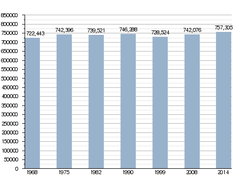
In 2014, the Loire department had a population of 757,305 people. This means there were about 158.4 inhabitants per square kilometer (410 inhabitants per square mile). The arrondissement of Saint-Étienne is the largest, with 411,402 people.
The biggest city in the department is its capital, Saint-Étienne, with 170,761 inhabitants. The other main cities, Roanne and Montbrison, have populations of 35,200 and 15,689 respectively.
Population Changes Over Time
Evolution of the population in Loire
Major Cities in Loire
Here are the most important cities in the department by population:
| City | Population (2014) |
Arrondissement |
|---|---|---|
| Saint-Étienne | 170,761 | Saint-Étienne |
| Roanne | 35,200 | Roanne |
| Saint-Chamond | 35,097 | Saint-Étienne |
| Firminy | 16,931 | Saint-Étienne |
| Montbrison | 15,689 | Montbrison |
| Rive-de-Gier | 14,730 | Saint-Étienne |
| Saint-Just-Saint-Rambert | 14,448 | Montbrison |
| Le Chambon-Feugerolles | 12,582 | Saint-Étienne |
| Riorges | 10,741 | Roanne |
| Roche-la-Molière | 9,925 | Saint-Étienne |
| Andrézieux-Bouthéon | 9,876 | Montbrison |
Gallery
-
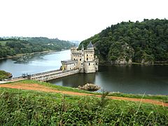
Château de La Roche, Saint-Priest-la-Roche.
-
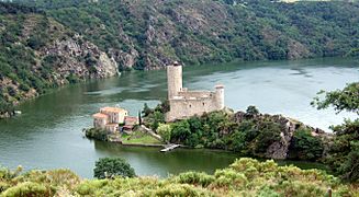
Château de Grangent, Saint-Just-Saint-Rambert.
-
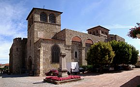
Church of Champdieu.
-
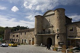
Sainte-Croix-en-Jarez.


Related pages
Images for kids
-
Source
-
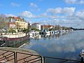
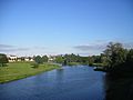
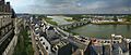
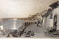
The river port of Roanne
-
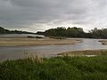
Confluence of the Allier and the Loire
-
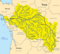
Map of the Loire basin showing the major tributaries
-
The Loire at Decize
-
The Loire spanned at Nantes
-
Loire at Bréhémont, Indre-et-Loire
-

Greengage blossom
-
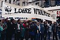
Loire Vivante WWF protests in 1989 against the proposed Serre de la Fare dam
-
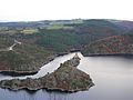
A pristine gorge of the Loire
-
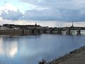
The Loire as it flows through Blois.
-
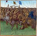
The Vikings invading in 879
-
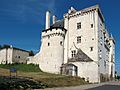
Château de Montsoreau (1453) is the only Château of the Loire Valley to be built directly in the Loire riverbed.
-
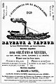
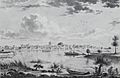
An 1840 poster advertising excursions on the river
-
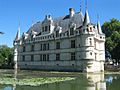
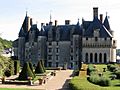
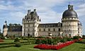
Château d'Azay-le-Rideau.
-
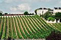
Vineyard in the Loire Valley
-
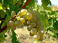
Sauvignon blanc is the principal grape of Sancerre and Pouilly-Fumé, found in the Loire Valley.
-
Amboise on the banks of the Loire
-
Chateau de Langeais
-
Château de Blois interior façades in Gothic, Renaissance and Classic styles (from right to left).
-
Château de Valençay.
-
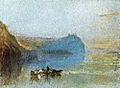
Scène of the Loire, by J. M. W. Turner.
-
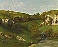
La source de la Loire, by Gustave Courbet.
-

Portrait of the Loire, by Jean-Max Albert, 1988. Musée de la Loire, Cosne-sur-Loire.
-
Les Rosiers-sur-Loire by Jean-Jacques Delusse, 1800
-
The Loire at Montsoreau, J. M. W. Turner, 1832, Château de Montsoreau-Museum of Contemporary Art.

.jpg)
.jpg)


.jpg)


See also
 In Spanish: Río Loira para niños
