Arroyo de la Laguna facts for kids
Quick facts for kids Arroyo de la Laguna |
|
|---|---|

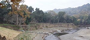
Alameda County Resource Conservation District restoration project in lower Arroyo de la Laguna will re-establish riparian terraces in eroded channel.
|
|
|
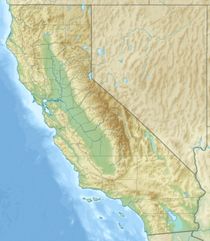
Location of the mouth of Arroyo de la Laguna in California
|
|
| Country | United States |
| State | California |
| Region | Alameda County |
| City | Pleasanton |
| Physical characteristics | |
| Main source | confluence Pleasanton 315 ft (96 m) 37°40′36″N 121°54′44″W / 37.67667°N 121.91222°W |
| River mouth | Alameda Creek south of Sunol, California 217 ft (66 m) 37°35′18″N 121°53′27″W / 37.58833°N 121.89083°W |
| Basin features | |
| Tributaries |
|
Arroyo de la Laguna is a stream in Alameda County, California, United States. It flows south for about 7.5 miles (12 kilometers). This stream starts where two other streams, South San Ramon Creek and Arroyo Mocho, meet.
Arroyo de la Laguna gets water from other smaller streams. These streams come from the Amador Valley and the eastern side of the Diablo Range mountains. Important streams that feed it include Arroyo Valle and Sinbad Creek. Arroyo de la Laguna is the main stream that flows into Alameda Creek. Alameda Creek then flows into the San Francisco Bay.
History of the Stream
A long time ago, before people built many towns, the eastern part of the Amador Valley had a large lake. This lake was known as Tulare Lake.
As the valley grew and changed, especially in the 1800s, people altered the way water drained. These changes caused the large lake to shrink. Over time, it became the stream we now call Arroyo de la Laguna.
What's Under the Ground?
The area around Arroyo de la Laguna has different layers of earth. In the northern part, a rock layer called the Tassajara Formation is found deep underground. On top of this, there is a lot of "valley fill" material. This fill is made up of sand, gravel, silt, and clay.
It can be hard to tell the difference between the Tassajara Formation and the valley fill. This is because they sometimes look very similar. The valley fill has many layers, often eight to ten, of sand and gravel. These layers are separated by softer layers of silt and clay.
Changes to the Stream
Over the years, many new buildings and developments have appeared in the upper parts of the stream's watershed. A watershed is the area of land where all the water drains into a particular stream or river.
These changes have made the lower 5 miles of Arroyo de la Laguna very unstable. This means the stream's banks and bed can easily change or erode.
 | Charles R. Drew |
 | Benjamin Banneker |
 | Jane C. Wright |
 | Roger Arliner Young |


