Alameda Creek facts for kids
Quick facts for kids Alameda Creek |
|
|---|---|

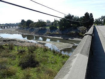
Alameda Creek at Niles, Fremont
|
|
|
Location of the mouth in California
|
|
| Other name(s) | Spanish: Arroyo de la Alameda |
| Country | United States |
| State | California |
| Region | Alameda County, Santa Clara County |
| City | Union City, California |
| Physical characteristics | |
| Main source | Packard Ridge in the Diablo Range 12 miles (19 km) east of San Jose 2,950 ft (900 m) 37°23′16″N 121°36′44″W / 37.38778°N 121.61222°W |
| River mouth | San Francisco Bay 3 miles (4.8 km) southwest of Hayward 0 ft (0 m) 37°33′48″N 122°7′51″W / 37.56333°N 122.13083°W |
| Length | 45 mi (72 km) |
| Basin features | |
| Tributaries |
|
Alameda Creek (also known as Spanish: Arroyo de la Alameda) is a large, year-round stream in the San Francisco Bay Area. This creek flows for about 45 miles (72 kilometers). It starts from a lake northeast of Packard Ridge. It then travels through Niles Canyon and a special flood control channel. Finally, it reaches the eastern shore of San Francisco Bay.
Contents
A Look Back: Alameda Creek's History
Early Explorers and Missions
Between 1769 and 1795, several Spanish expeditions passed over Alameda Creek. Important explorers like Portolà and Anza were part of these trips. An old road, El Camino Viejo, also crossed the creek near Sunol.
In 1797, Mission San José was built in Fremont. This mission did very well for 49 years. However, in 1834, the Mexican government took over the mission lands.
The Vallejo Mill and Niles
Alameda Creek became the border for the mission lands. A large area called Rancho Arroyo de la Alameda was given to Jose de Jesus Vallejo. He built a flour mill near the mouth of Niles Canyon.
The mill and the canyon's importance helped the town of Niles grow in the 1850s. Niles later became part of Fremont in 1956. Good weather, rich soil, and a growing population helped farming become very successful.
Why is Alameda Creek Important?
Alameda Creek is the most important stream in Alameda County. The county even got its name from this creek! From 1850 to 1853, Alameda Creek was the boundary between Contra Costa and Santa Clara Counties. When Alameda County was created in 1853, it was formed from parts of these two counties.
Railroads and Water Use
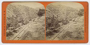
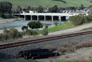
In 1869, the Central Pacific Railroad was completed through Niles Canyon. This was a key part of the First Transcontinental Railroad. This railroad ended at Alameda Terminal and Oakland Long Wharf that same year. Another railroad, the Western Pacific, also went through Niles Canyon. It connected Sacramento, California and San Jose, California in 1906.
The creek bed was once used to dig up gravel. When these gravel pits were filled with water for groundwater recharge (to refill underground water supplies), the gravel companies started pumping out a lot of water. This water was enough for 30,000 people! It was pumped back into San Francisco Bay. This pumping was later declared an illegal use of water. In 1975, the Alameda County Water District bought the quarry.
In 2015, some people damaged an inflatable dam across the creek in Fremont. This caused 50 million gallons (190 million liters) of drinking water to flow into San Francisco Bay.
Alameda Creek's Water System
What is a Watershed?
A watershed is an area of land where all the water drains into a single river, lake, or ocean. Alameda Creek has the largest watershed in the southern San Francisco Bay. It covers 700 square miles (1,813 square kilometers). This is about 20% of all the land that drains into the south Bay.
Most of the watershed is in Alameda County. The rest is in Santa Clara County.
Tributaries and Reservoirs
Many smaller streams, called tributaries, flow into Alameda Creek. These include Arroyo de la Laguna, Arroyo Valle, San Antonio Creek, and Calaveras Creek.
The watershed also has three man-made lakes, called reservoirs:
Parts of the Watershed
The Alameda Creek Watershed can be divided into six main parts:
- Alameda Creek Flood Control Channel: This is a straight channel from the Bay up to Niles Canyon. It helps control floods.
- Niles Canyon: This is the area above the flood control channel.
- Upper Alameda Creek: This part goes up into the canyons of the Sunol-Ohlone Regional Wilderness Area.
- Arroyo de la Laguna: This stream runs next to Interstate 680.
- Arroyo Valle: This stream flows through Shadow Cliffs Regional Park to Del Valle Regional Park.
- Arroyo Mocho: This part flows through the Livermore–Amador Valley.
Other smaller streams also flow into Alameda Creek. These include Valpe Creek, Bear Gulch, Leyden Creek, Indian Joe Creek, and Dry Creek.
Nature and Wildlife in Alameda Creek
Fish and Restoration Efforts
In the past, Alameda Creek was home to many fish. These included steelhead (a type of rainbow trout), coho salmon, and chinook salmon. Steelhead trout are special because they live in both fresh and saltwater.
Today, there's a big effort to bring these fish back. Steelhead in this area are considered a threatened species. Many groups, like the Alameda Creek Alliance, are working to remove barriers. These barriers stop fish from swimming upstream to lay their eggs. They are also working to improve the fish's habitat.
By the 1950s, it was thought that steelhead could no longer survive in the creek due to human-made barriers. In the 1970s, the Army Corps of Engineers straightened and reinforced the lower 12 miles (19 kilometers) of the creek. The last salmon runs were seen in 1964.
Good news came in 2009 when the Alameda County Water District removed a rubber dam. This dam had blocked trout passage. In 2010, another dam was removed, and fish ladders were planned. Fish ladders are like stairs that help fish swim around dams.
PG&E is also working to change a cement barrier further upstream in Sunol. This will help steelhead swim even farther into the watershed. When these projects are finished, steelhead will be able to reach their spawning areas in the Sunol Valley for the first time in 50 years!
Other Animals in the Creek
Scientists have found evidence of other animals that lived in Alameda Creek long ago. These include different types of native fish like Sacramento perch and Tule perch. Many of these fish still live in the creek today. However, new types of fish, like largemouth and Smallmouth basses, have been introduced.
There is also historical proof that beavers lived in the Alameda Creek watershed. In the 1820s, a fur trapper named Michel La Framboise said that "the Bay of San Francisco abounds in beaver." Another report from 1829 mentioned that over 1,500 beaver skins were collected from the natives at Mission San José. Beavers can help salmon and trout. Their dams create deep pools of water that fish can use during dry summers.
Protecting Alameda Creek
Dam Projects and Fish Passage
In 2011, the San Francisco Public Utilities Commission approved building a new dam. This new dam would replace the old Calaveras Dam, which had safety concerns. Building a fish ladder for steelhead over this new dam was not possible. It would have been too tall (290 feet) and cost too much money ($40 million). Steelhead have not been able to reach the waters above Calaveras Dam since it was built in 1925.
However, environmental groups worked with the SFPUC. They made sure that enough water would be released from the new dam to help the creek flow better in the summer. They also got a smaller fish ladder built around another dam. This smaller ladder helps fish reach important trout habitat in upper Alameda Creek. The SFPUC also removed two old dams in Niles Canyon to help fish pass through.
Removing Barriers
Downstream from San Francisco's dams, the Alameda Creek Alliance has helped a lot. Since 2001, they have helped remove 11 barriers that blocked fish passage. These efforts are making a big difference in restoring the creek's natural flow and helping fish thrive.
Alameda Creek Regional Trail
The Alameda Creek Regional Trail is a great place to explore! It runs along Alameda Creek for about 12 miles (19 kilometers). The trail starts in the Niles neighborhood of Fremont. It then goes west to the San Francisco Bay, passing through Union City and Newark.
The trail has two paths that run side-by-side. The path on the south side of the creek is paved. It's perfect for pedestrians and bicyclists. The path on the north side is unpaved. It can be used by pedestrians, bicyclists, and equestrians (people riding horses). The trail also connects directly to Coyote Hills Regional Park and Quarry Lakes Regional Recreation Area.
 | George Robert Carruthers |
 | Patricia Bath |
 | Jan Ernst Matzeliger |
 | Alexander Miles |


