Attelwil facts for kids
Quick facts for kids
Attelwil
|
||
|---|---|---|
|
||
| Country | Switzerland | |
| Canton | Aargau | |
| District | Zofingen | |
| Area | ||
| • Total | 2.22 km2 (0.86 sq mi) | |
| Elevation | 501 m (1,644 ft) | |
| Population
(December 2020)
|
||
| • Total | 302 | |
| • Density | 136.0/km2 (352.3/sq mi) | |
| Postal code |
5056
|
|
| Surrounded by | Moosleerau, Reitnau, Staffelbach, Wiliberg | |
Attelwil was a small town, also known as a former municipality, located in the Zofingen district. It was part of the canton of Aargau in Switzerland. On January 1, 2019, Attelwil joined with the nearby town of Reitnau and is no longer a separate municipality.
Contents
Attelwil's Past: A Brief History
Attelwil has a long history! The town was first mentioned in official records way back in 1306. At that time, it was known as Attelwile.
Exploring Attelwil's Geography
Attelwil covered an area of about 2.22 square kilometers (0.86 square miles). This is how the land was used:
- More than half of the land (51.8%) was used for farming. This means fields for crops and pastures for animals.
- About a third (34.2%) was covered by forests.
- The rest (13.1%) had buildings and roads.
Most of the buildings were homes (6.8%) and roads (3.2%). A small part (1.8%) was for industrial buildings.
Attelwil was located in the Zofingen district, on the left side of the upper Suhre river valley. The village of Attelwil itself was a haufendorf. This is a special type of village where houses were built close together in an unplanned way, often around a central area.
Understanding Attelwil's Coat of Arms
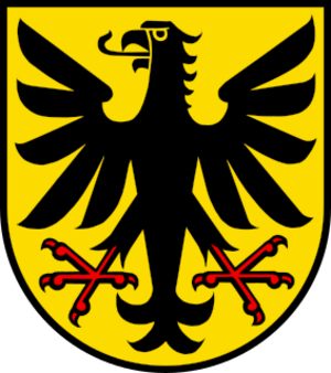
Every town has a special symbol called a coat of arms. Attelwil's coat of arms is described as Or an Eagle displayed Sable membered Gules. In simpler terms, it shows a black eagle with red claws and beak on a golden background. The eagle is shown with its wings spread out.
Who Lived in Attelwil? Demographics
Attelwil had a population of 302 people.
In 2008, the population was made up of:
- Children (0-9 years old): 8.5%
- Teenagers (10-19 years old): 16.3%
- Young adults (20-29 years old): 11.9%
- Adults (30-59 years old): 45.9%
- Seniors (60-89 years old): 17.3%
Most homes in Attelwil (about 69.2%) were owned by the people living in them. In 2000, there were 108 homes in Attelwil, with an average of 2.8 people living in each home.
In the 2007 Swiss federal election, the most popular political party was the SVP, which received 51.79% of the votes. About 53.6% of the people who could vote actually did vote in that election.
Here's how Attelwil's population changed over time:
| Historical population | ||
|---|---|---|
| Year | Pop. | ±% |
| 1798 | 179 | — |
| 1850 | 282 | +57.5% |
| 1900 | 263 | −6.7% |
| 1950 | 219 | −16.7% |
| 1990 | 282 | +28.8% |
| 2000 | 303 | +7.4% |
Attelwil's Economy: How People Worked
In 2007, Attelwil had a very low unemployment rate of only 1.05%. This means almost everyone who wanted a job had one.
People in Attelwil worked in different types of jobs:
- Primary Sector: 28 people worked in farming or other jobs that use natural resources. There were 10 businesses in this area.
- Secondary Sector: 43 people worked in manufacturing or construction. There were 5 businesses in this area.
- Tertiary Sector: 44 people worked in services, like shops, offices, or healthcare. There were 10 businesses in this area.
Many people who lived in Attelwil traveled outside the town for work. About 70.4% of the workers left Attelwil for their jobs. However, 42 people came into Attelwil to work. About 52.3% of workers used a private car to get to work, while 6.5% used public transportation.
Religion in Attelwil
Based on information from 2000:
- About 19.8% of the people were Roman Catholic.
- About 71.6% belonged to the Swiss Reformed Church.
Education in Attelwil
Many adults in Attelwil (about 85.8% of those aged 25-64) had completed higher education. This means they finished either advanced secondary school or went on to university or a specialized college.
See also
 In Spanish: Attelwil para niños
 | Chris Smalls |
 | Fred Hampton |
 | Ralph Abernathy |


