Atwater Village, Los Angeles facts for kids
Quick facts for kids
Atwater Village
|
|
|---|---|
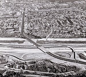
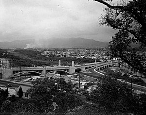
Aerial view of recently constructed Golden State Freeway (I-5) with Atwater Village in the background, separated by the Los Angeles River (1957)
|
|
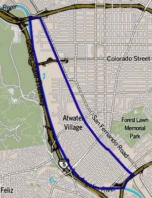
Boundaries of Atwater Village as drawn by the Los Angeles Times
|
|
| Country | |
| State | |
| County | Los Angeles |
| City | Los Angeles |
| Named for | Atwater Tract, the original railroad tract beside (or at) the water of the Los Angeles River |
| Elevation | 410 ft (120 m) |
| Time zone | UTC-8 (PST) |
| • Summer (DST) | UTC-7 (PDT) |
| ZIP Code |
90039
|
| Area codes | 213, 323 |
Atwater Village is a lively neighborhood in Los Angeles, California. It's located near the Los Angeles River, which means the soil is very rich. This area is in the northeast part of Los Angeles. It borders Griffith Park and Silver Lake to the west. To the north and east, it's next to Glendale. Glassell Park is to the south. The eastern edge of Atwater Village is marked by railroad tracks.
The neighborhood has three elementary schools. Two are public schools, and one is private. Almost half of the people living here were born outside the United States. This is a high number for Los Angeles.
Contents
Discovering Atwater Village's Past
Much of Northeast Los Angeles was once part of a large ranch called Rancho San Rafael. In 1868, parts of this ranch were bought by W.C.B. Richardson. He renamed his part Rancho Santa Eulalia.
In 1902, the entire region was divided up and sold to people who wanted to build homes. The part that became Atwater Village got its name because it was so close to the Los Angeles River. It was first called "Atwater." The word "Village" was added to its name much later, in 1986.
The first people to live here were middle-class workers. Many worked at the nearby DWP substation. Atwater Village became a popular place to live starting in the 1920s. This was because it was located between the cities of Los Angeles and Glendale. Most of the homes and buildings in Atwater Village have never been torn down. Many have been updated or used for different purposes. This means Atwater Village has one of the highest numbers of old buildings in Los Angeles County. Many were built before 1939.
In recent years, the neighborhood has seen some changes. This includes a process called gentrification.
Understanding Atwater Village's Population
How Many People Live Here?
In 2008, the city estimated that about 15,455 people lived in Atwater Village.
What the 2013 Survey Found
A survey from 2013 gave us more details about the people living in Atwater Village. For example, one area had a median income of $31,111. Another area had a median income of $72,526. The survey also looked at the different backgrounds of the residents. It found that many different groups of people live in Atwater Village.
Exploring Atwater Village's Location
Most of Atwater Village is on the old Los Angeles River flood plain. This is why the soil here is very deep and fertile.
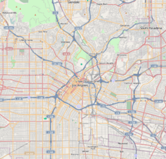
According to the Los Angeles Times "Mapping L.A." project, Atwater Village has several neighbors. To the north and east, it borders Glendale. To the southeast, it's next to Glassell Park. Echo Park is to the south. To the southwest, you'll find Los Feliz and Silver Lake. Finally, Griffith Park is to the west.
The boundaries of Atwater Village are also defined by roads and the river. The Ventura Freeway is on the north side. San Fernando Boulevard is on the east. The Los Angeles River forms the border on the south and west.
| Climate data for Atwater Village, Los Angeles | |||||||||||||
|---|---|---|---|---|---|---|---|---|---|---|---|---|---|
| Month | Jan | Feb | Mar | Apr | May | Jun | Jul | Aug | Sep | Oct | Nov | Dec | Year |
| Mean daily maximum °F (°C) | 68 (20) |
70 (21) |
70 (21) |
75 (24) |
76 (24) |
82 (28) |
87 (31) |
88 (31) |
86 (30) |
81 (27) |
74 (23) |
69 (21) |
77 (25) |
| Mean daily minimum °F (°C) | 45 (7) |
47 (8) |
48 (9) |
51 (11) |
55 (13) |
59 (15) |
62 (17) |
63 (17) |
62 (17) |
56 (13) |
49 (9) |
45 (7) |
54 (12) |
| Average precipitation inches (mm) | 3.74 (95) |
4.19 (106) |
3.56 (90) |
0.90 (23) |
0.34 (8.6) |
0.08 (2.0) |
0.02 (0.51) |
0.15 (3.8) |
0.35 (8.9) |
0.49 (12) |
1.26 (32) |
2.10 (53) |
17.17 (436) |
Education and Learning in Atwater Village
In 2000, about 22% of adults aged 25 and older in Atwater Village had a four-year college degree. This number is about average for both the city and the county of Los Angeles.
Schools in the Neighborhood
Atwater Village is home to several schools:
- Glenfeliz Boulevard Elementary School, part of LAUSD, is located at 3955 Glenfeliz Boulevard.
- Holy Trinity Elementary School is a private school at 3716 Boyce Avenue.
- Atwater Avenue Elementary School, also part of LAUSD, is at 3271 Silver Lake Boulevard.
The Local Library
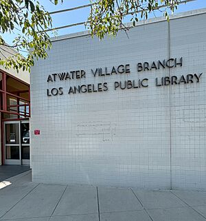
The Atwater Village community can use the Atwater Village Branch of the Los Angeles Public Library. You can find it at 3379 Glendale Boulevard. It's located east of the Los Angeles River and Interstate 5.
Getting Around Atwater Village
Atwater Village is very close to several major freeways. These include Interstate 5, SR 134, SR 2, and SR 110.
The neighborhood is also served by several Metro Bus lines. These include lines 92, 94, and 180. The Metrolink Glendale Station is also nearby. This makes it easy to travel by train.
See also
 In Spanish: Atwater Village (Los Ángeles) para niños


