Aux Rochers River facts for kids
Quick facts for kids Aux Rochers River |
|
|---|---|

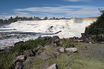
The river in August 2012
|
|
| Lua error in Module:Location_map at line 420: attempt to index field 'wikibase' (a nil value). | |
| Native name | Rivière aux Rochers |
| Country | Canada |
| Location | Sept-Rivières Regional County Municipality Côte-Nord Quebec |
| Physical characteristics | |
| Main source | 585 m (1,919 ft) |
| River mouth | Saint Lawrence River at Port-Cartier 0 m (0 ft) |
| Length | 30 km (19 mi) |
| Basin features | |
| Basin size | 4,180 square kilometres (1,610 sq mi) |
| MNR Id | EHWSX |
The Aux Rochers River (also called Rivière aux Rochers in French, meaning 'Rocky River') is a river in Quebec, Canada. It flows through a large area of land, about 4,180 square kilometres (1,610 sq mi). This river eventually flows into the Gulf of Saint Lawrence.
Contents
About the Aux Rochers River
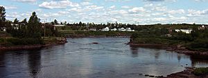
The Aux Rochers River is located near the town of Port-Cartier in Quebec. It flows into the Gulf of Saint Lawrence right in Port-Cartier.
One of its smaller rivers that flows into it, the Gravel River, is sometimes also known by the same name. The Gravel River flows south until it reaches the long Lake Walker. The main Aux Rochers River starts at the south end of Lake Walker. From there, it flows southeast for another 30 kilometres (19 mi).
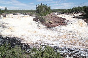
The river can be tricky to travel on because it has a strong current. It also has many rocks, which is how it got its name. Some of the smaller rocks in the river even move to different spots each year!
The southern part of the Cartier Railway uses the lower river valley. This railway then runs along the east side of Lake Quatre Lieues. After that, it follows the valley of the MacDonald River, which is another river that flows into the Aux Rochers.
Nature Around the River
The Aux Rochers River starts in a northern forest area. This area is known as the eastern spruce/moss domain of the boreal zone. The last part of the river flows through a different forest type. This area is called the fir/white birch domain of the boreal zone.
The River's Basin
The area of land that the Aux Rochers River drains is called its basin. This basin is about 135 kilometres (84 mi) long from north to south. It is also about 53 kilometres (33 mi) wide from east to west. The total area of the basin is 4,180 square kilometres (1,610 sq mi).
To the east, the basin is next to the Sainte-Marguerite River basin. To the west, it borders the Pentecôte River basin. To the north, it is next to the Manicouagan area. The lower part of the river basin is next to the Dominique River basin on its east side.
The land near the coast is flat and can be up to 15 kilometres (9.3 mi) wide. Further inland, there are rounded rocky hills that can be as high as 400 metres (1,300 ft). These hills stretch north for about 8 to 18 kilometres (5.0 to 11.2 mi). The rest of the area is a rocky plateau with steep slopes. These slopes can rise hundreds of meters from the valleys below. The highest point in the whole basin is in the north, at 930 metres (3,050 ft).
The rocks in the southern half of the basin are mostly migmatite. This is a type of rock formed from melted rock. The northern half has different kinds of rocks. These include gneisses and paragneisses, which are rocks changed by heat and pressure. The plateau and hills usually have thin soil with many rocky areas showing through. Some northern parts have till (a type of soil) that is less than 2 metres (6 ft 7 in) thick. The main valleys have large amounts of sand and gravel left by glaciers. The flat coastal area has a lot of clay and silt. These were left behind when the Goldthwait Sea covered the land after the ice age. When that sea went away, it left a layer of sandy soil.
Rivers and Waterfalls
The Aux Rochers River and its longest branch flow from north to south for 161 kilometres (100 mi). During this journey, the water drops a total of 585 metres (1,919 ft). The average amount of water flowing out of the river into the sea is about 111 cubic metres per second (3,900 cu ft/s). This flow can change a lot, from a high of 248 cubic metres per second (8,800 cu ft/s) to a low of 27.7 cubic metres per second (980 cu ft/s).
Near the coast, the Aux Rochers River winds a little. Then, it flows in a straight line where it has cut through layers of old sea sediments.
The main rivers that flow into the Aux Rochers are the Gravel, Schmon, Pasteur, and MacDonald. These rivers often have sharp turns because their valleys follow cracks in the bedrock. However, some rivers wind through wide, flat valleys in the middle of the basin.
There are also some waterfalls along these rivers. These include the Noyés Falls, which are 1.5 kilometres (0.93 mi) from where the Aux Rochers River meets the sea. You can also find MacDonald Falls on the MacDonald River and Tibasse Falls on a branch of the Pasteur River.
Lakes in the Basin
There are many large lakes in the higher parts of the land and in the foothills. In the southern half of the basin, the very long Lake Walker stretches for almost 32 kilometres (20 mi). There are two other long lakes in the southern part of the basin. Lake Pasteur is 21 by 1 kilometre (13.05 by 0.62 mi), and Lake Quatre Lieues is 15 by 0.5 kilometres (9.32 by 0.31 mi).
Overall, lakes cover about 8.46% of the entire river basin. Wetlands, which are areas of wet land, cover 0.71% of the basin. These are mostly found on the flat coastal plain where the ground is soft.
Here are some of the large lakes in the area:
| Lake | Area | Coords | Map | |
|---|---|---|---|---|
| km2 | sqmi | |||
| Grand lac du Nord | 14.8 | 5.7 | 50°54′12″N 67°05′18″W / 50.9033°N 67.0883°W | EHKXC |
| Petit lac du Nord | 13.6 | 5.3 | 50°49′41″N 67°08′42″W / 50.8280°N 67.1450°W | EHKXE |
| Lac du Nord-Est | 11.1 | 4.3 | 50°43′57″N 67°27′19″W / 50.7325°N 67.4552°W | EHKYC |
| Lake Pasteur | 18.8 | 7.3 | 50°14′34″N 66°57′53″W / 50.2427°N 66.9647°W | EHODC |
| Lake Quatre Lieues | 4.8 | 1.9 | 50°03′24″N 67°09′00″W / 50.0566°N 67.1500°W | EHTVV |
| Lake Walker | 42.5 | 16.4 | 50°18′12″N 67°09′24″W / 50.3033°N 67.1566°W | EIMFM |
Lake Walker: Quebec's Deepest Lake
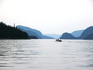
Lake Walker is a very important lake in the southern part of the river basin. It covers 42.5 square kilometres (16.4 sq mi). It is almost 32 kilometres (20 mi) long but less than 2 kilometres (1.2 mi) wide. This lake was formed in an old valley that was carved out by glaciers. The sides of this valley are very steep, rising over 400 metres (1,300 ft) in some places.
Lake Walker is 280 metres (920 ft) deep, which makes it the deepest lake in all of Quebec! Since 2006, there have been plans to create the Lake Walker National Park around the lake. This park would help protect the area. However, as of May 2019, the project was still waiting for money to get started.
A Fun Place to Visit
The Aux Rochers River is a popular spot for fishing, especially for salmon. Big salmon are known to travel through this river. For example, on June 24, 2013, a group called the Association de protection de la rivière Aux Rochers reported something exciting. They were counting fish and found that many of the salmon were very large, weighing over 25 pounds!
The Aux Rochers River is also considered a beautiful place to visit. It has many areas with rapids (fast-moving water) and small waterfalls, which add to its scenic beauty.
Protecting the River
There are two special protected areas that cover about 14.3% of the river basin. One is the Larry Lake Old Forest. This forest is between the Ronald and MacDonald Rivers. It covers an area of 8.33 square kilometres (3.22 sq mi). It was created in 2005 to protect a unique forest ecosystem.
The other protected area is the proposed Lake Pasteur Biodiversity Reserve. This area was planned in 2003 and covers a total of 635 square kilometres (245 sq mi). About 590 square kilometres (230 sq mi) of this reserve is within the Aux Rochers River basin. This reserve includes Lake Pasteur and almost all of Lake Walker.
Most of the river basin, about 90.3%, is part of the Port-Cartier–Sept-Îles Wildlife Reserve. This reserve helps protect the animals and nature in the area.
In May 2015, the Quebec government announced a new rule for sport fishing for large salmon. On sixteen salmon rivers in Quebec, including the Aux Rochers, anglers had to catch and then release large salmon. This means they couldn't keep them. Some groups, like the Quebec Atlantic Salmon Federation, felt these rules were not enough. They believed that to truly protect salmon for the future, catch-and-release should be used on almost all rivers, except for those in northern Quebec. This was because the number of Atlantic salmon was quickly going down.
 | Chris Smalls |
 | Fred Hampton |
 | Ralph Abernathy |


