Baker Branch Saint John River facts for kids
Quick facts for kids Baker Branch Saint John River |
|
|---|---|

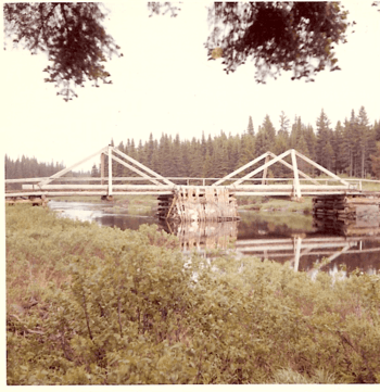
International Paper Company Bridge at Baker Lake
|
|
| Country | United States |
| Physical characteristics | |
| Main source | Maine |
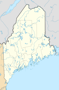
| River mouth | SW Branch Saint John River 1,100 feet (340 m) 46°28′28″N 69°54′11″W / 46.4744°N 69.9030°W |
| Length | 48.0 mi (77.2 km) |
| Basin features | |
| Progression | SW Branch – Saint John River |
| Tributaries |
|
The Baker Branch Saint John River is a river about 48.0-mile-long (77.2 km). It flows through the beautiful Maine North Woods in the northeastern United States. This river is like a smaller stream that joins a bigger one, called a tributary. The Baker Branch flows into the Saint John River (Bay of Fundy).
Contents
The River's Journey
The Baker Branch Saint John River starts from a place called Upper First Saint John Pond. This pond is located in the northwest part of Maine. As it flows, the river passes through several other ponds:
- Lower First Saint John Pond
- Second Saint John Pond
- Third Saint John Pond
- Fourth Saint John Pond
- Fifth Saint John Pond
After leaving Fourth Saint John Pond, the stream officially becomes the Baker Branch. In 1939, some of the water from Fifth Saint John Pond was sent to another river, the North Branch Penobscot River. However, most of the water still follows its original path north to Baker Lake. Eventually, the Baker Branch joins the Southwest Branch Saint John River.
A Look Back: How the River Was Used
For many years in the 1900s, the area around the Baker Branch was used for getting wood to make paper. This wood was called pulpwood. Workers would cut down Spruce and Balsam Fir trees into short pieces, about 4 feet (1.2 meters) long.
These wood pieces were then loaded onto sleds. Animals or special steam-powered machines called log haulers would pull the sleds to the nearest river or lake. When the snow and ice melted in the spring, the logs would float downstream to a paper mill. This was called a log drive.
A challenge came up because the pulpwood near the Saint John Ponds was needed at a paper mill in Millinocket, Maine. This mill was on a different river system. So, in 1921, a special railroad called the Seboomook Lake and Saint John Railroad was built. It carried the pulpwood south from Fifth Saint John Pond to Seboomook Lake. The railroad ran along the east side of the Baker Branch between the 4th and 5th Saint John Ponds.
In the 1950s, the railroad was taken apart. Instead, a canal was built to float the pulpwood from Fifth Saint John Pond to the North Branch Penobscot River. The old railroad path became a road for trucks.
Baker Lake: A Special Spot
| Baker Lake | |
|---|---|
| Location | Somerset County, Maine |
| Coordinates | 46°16′N 69°55′W / 46.267°N 69.917°W |
| Basin countries | United States |
| Max. length | 3 mi (4.8 km) |
| Max. width | 1,300 yd (1.2 km) |
| Surface area | 1,255 acres (508 ha) |
| Max. depth | 33 feet (10 m) |
| Water volume | 13,929 acre⋅ft (17,181,000 m3) |
| Surface elevation | 1,181 ft (360 m) |
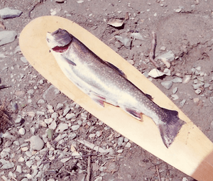
Baker Lake is the biggest lake on the Baker Branch. It's a beautiful place! Originally, the lake was home to fish like brook trout, yellow perch, fallfish, and white sucker.
In 1967, the Maine Department of Inland Fisheries and Wildlife added land-locked Atlantic salmon to the lake. Then, in 1970, they added rainbow smelt to be a food source for the salmon. Later, some muskellunge fish from Quebec found their way into Baker Lake by 1986.
The River's Path After Baker Lake
After leaving Baker Lake, the Baker Branch Saint John River continues its journey for about 28.2 kilometres (17.5 mi). It flows north, passing through some fast-moving sections called rapids. It also goes around an island before finally joining the Southwest Branch Saint John River.
The place where the Baker Branch Saint John River meets the Southwest Branch Saint John River is in Somerset County, Maine. This spot is about 9.9 kilometres (6.2 mi) east of the border between Canada and the United States.
 | Emma Amos |
 | Edward Mitchell Bannister |
 | Larry D. Alexander |
 | Ernie Barnes |


