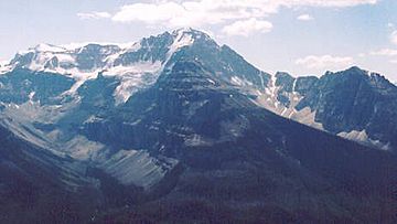
The Ball Range is a group of mountains in Canada. You can find it in Kootenay National Park. These mountains sit right on the Continental Divide. This is like a giant line that separates rivers flowing to different oceans! The Ball Range stretches between Vermilion Pass and Red Earth Pass.
This mountain range covers a large area. It is about 465 square kilometers (179 square miles). It measures 35 kilometers (22 miles) from north to south. It is also 26 kilometers (16 miles) wide from east to west.
Naming the Ball Range
The Ball Range is named after a person named John Ball. He was a politician who lived a long time ago. John Ball helped get money for a big trip called the Palliser expedition. This expedition was an important journey to explore parts of western Canada.
Tallest Mountains in the Ball Range
The Ball Range is home to many impressive mountains. Here are some of the highest peaks you can find in this range:
| Mountain or Peak |
metres |
feet |
| Mount Ball |
3,311 |
10,863 |
| Stanley Peak |
3,155 |
10,352 |
| Beatrice Peak |
3,125 |
10,253 |
| Storm Mountain |
3,158 |
10,361 |
| Isabelle Peak |
2,926 |
9,600 |
| Haiduk Peak |
2,920 |
9,581 |
| Scarab Peak |
2,918 |
9,573 |
| The Monarch |
2,895 |
9,498 |
| Copper Mountain |
2,795 |
9,170 |


