Isabelle Peak facts for kids
Quick facts for kids Isabelle Peak |
|
|---|---|

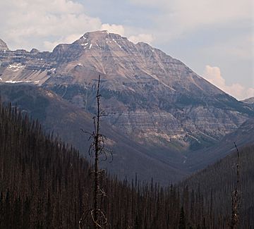
Isabelle Peak seen from the southwest
|
|
| Highest point | |
| Elevation | 2,934 m (9,626 ft) |
| Prominence | 203 m (666 ft) |
| Parent peak | Mount Ball |
| Listing | Mountains of Alberta Mountains of British Columbia |
| Geography | |
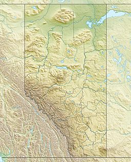
| Location | Alberta-British Columbia, Canada |
| Parent range | Ball Range Canadian Rockies |
| Topo map | NTS 82N/01 |
| Climbing | |
| First ascent | 1913 |
| Easiest route | Moderate/Difficult Scramble |
Isabelle Peak is a cool peak found right on the Continental Divide. This means it sits on the border between Banff National Park and Kootenay National Park in the amazing Canadian Rockies. It stands tall at 2,934 meters (9,626 feet) above sea level.
How Isabelle Peak Got Its Name
Isabelle Peak got its name in 1913. A person named R.D. McCaw was surveying the area for a new road. This road was called the Banff-Windermere road. Mr. McCaw was working for the British Columbia government at the time.
Mr. W.W. Bell was in charge of building this new road. He asked McCaw for a special favor. Bell wanted a mountain named after his wife, Isabelle. So, McCaw named one of his survey spots, and later the peak, "Isabelle" in her honor!
Climbing Isabelle Peak
The very first time someone climbed Isabelle Peak was in 1913. This climb was done by a group called the Interprovincial Boundary Commission.
If you want to climb it today, you can try a route on the southern side. It's known as a "scramble," which means it's a mix of hiking and easy climbing. This route is considered moderate to difficult.
Climate Around Isabelle Peak
The climate around Isabelle Peak is called a subarctic climate. This means the mountain has very cold and snowy winters. The summers are usually mild.
Temperatures can drop really low, sometimes below -20 degrees Celsius (-4 degrees Fahrenheit). With the wind chill, it can feel even colder, dropping below -30 degrees Celsius (-22 degrees Fahrenheit).
 | Bayard Rustin |
 | Jeannette Carter |
 | Jeremiah A. Brown |


