Mount Ball facts for kids
Quick facts for kids Mount Ball |
|
|---|---|

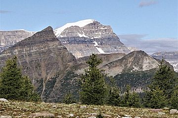
Southeast aspect from Healy Pass
|
|
| Highest point | |
| Elevation | 3,311 m (10,863 ft) |
| Prominence | 1,187 m (3,894 ft) |
| Isolation | 23.16 km (14.39 mi) |
| Parent peak | Deltaform Mountain |
| Listing | Mountains of Alberta Mountains of British Columbia |
| Geography | |
| Country | Canada |
| Parent range | Ball Range, Canadian Rockies |
| Topo map | NTS 82N/01 |
| Climbing | |
| First ascent | 1904 by J.D. Patterson, guided by Christian & Hans Kaufmann |
| Easiest route | Difficult Scramble |
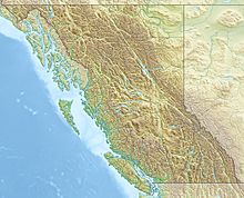
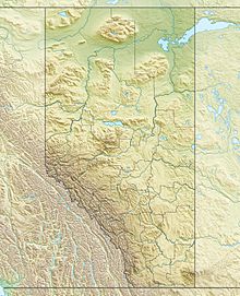
Mount Ball is a tall mountain found on the Continental Divide. This means it sits right on the line that separates where water flows in North America. It is located on the borders of Banff and Kootenay national parks in Western Canada. Mount Ball is the highest peak in the Ball Range within the amazing Canadian Rockies.
Contents
Naming Mount Ball
The mountain got its name in 1858 from a person named James Hector. He named it after John Ball, who was a politician. John Ball helped get money for an important trip called the Palliser expedition. The name was officially accepted in 1924. This was based on a map from 1863 made by John Palliser.
Climbing Mount Ball
You can climb Mount Ball using a scrambling route. Scrambling means you use both your hands and feet to climb over rocks. This route is best in late summer. It involves some "bushwhacking," which means pushing through thick bushes and trees. This makes it a bit harder to reach, so not many people try to climb it each year. The starting point for the climb is at the Marble Canyon Campground. This campground is located in Kootenay National Park.
How Mount Ball Was Formed: Geology
Mount Ball is made of sedimentary rock. This type of rock forms from layers of sand, mud, and tiny bits of sea creatures. These layers were laid down in shallow seas a very, very long time ago. This happened during periods known as the Precambrian and Jurassic times.
Later, a huge event called the Laramide orogeny occurred. This was a time when the Earth's crust moved and pushed up. During this event, the sedimentary rock of Mount Ball was pushed east. It even moved over the top of younger rock layers. This process created the tall mountains we see today.
Weather and Climate
Mount Ball is in a subarctic climate zone. This means it has very cold, snowy winters. The summers are usually mild, not too hot. Temperatures can drop below −20 °C (which is -4 °F). With the wind, it can feel even colder, sometimes below −30 °C (-22 °F).
This cold climate helps to keep glaciers on the mountain's slopes. Glaciers are large, slow-moving rivers of ice. Water from the east side of Mount Ball flows into the Bow River. This happens through a stream called Redearth Creek. Water from the west side flows into parts of the Vermilion River.
 | George Robert Carruthers |
 | Patricia Bath |
 | Jan Ernst Matzeliger |
 | Alexander Miles |


