Barnard River facts for kids
Quick facts for kids Barnard River |
|
|---|---|

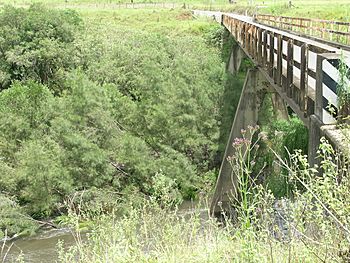
Thunderbolts Way crosses Barnard River
|
|
| Country | Australia |
| State | New South Wales |
| IBRA | New England Tablelands, Mid North Coast |
| District | Northern Tablelands |
| Local government area | Mid-Coast Council |
| Physical characteristics | |
| Main source | Great Dividing Range near Hanging Rock, east of Nundle 1,330 m (4,360 ft) |
| River mouth | confluence with the Manning River near Bretti 94 m (308 ft) |
| Length | 148 km (92 mi) |
| Basin features | |
| River system | Manning River catchment |
| Tributaries |
|
| National park | Woko National Park |
The Barnard River is a river in New South Wales, Australia. It's a perennial river, which means it flows all year round. The river is part of the larger Manning River system. You can find it in the Northern Tablelands and Mid North Coast areas of New South Wales.
Where the Barnard River Flows
The Barnard River starts on the eastern side of the Great Dividing Range. This is a big mountain range in Australia. The river begins near a place called Hanging Rock, which is east of Nundle.
As it flows, the river generally moves towards the east-southeast. Seven smaller rivers and streams join it along the way. These smaller rivers are called tributaries. Some of the main tributaries include the Bank River and the Curricabark River.
The Barnard River eventually meets and joins the Manning River. This meeting point is called a confluence. It happens near a town called Bretti. The river travels about 148 kilometres (92 mi) (about 92 miles) from where it starts to where it joins the Manning River. During its journey, the river drops about 1,240 metres (4,070 ft) (over 4,000 feet) in height.
Early Explorers
The Barnard River was first explored by a European explorer named Henry Dangar in 1825. Later, another explorer, Thomas Mitchell, gave the river its name. He named it in honor of Lt. Col. Andrew Barnard.
Barnard River Scheme
The Barnard River Scheme is a special system that moves water from one river basin to another. This is called an inter-basin water transfer. It allows up to 20,000 megalitres (710×106 cu ft) (megalitres) of water each year to be moved. This water comes from the Barnard River and the upper part of the Manning River. It is then sent into the Hunter River.
How the Water is Moved
The water is first collected at Orham Dam. This dam is created by a structure called Barnard Weir. From there, the water is pumped over the Mount Royal Range. After that, it flows by gravity into the Glenbawn Dam. This diverted water then goes into the Hunter River.
The water from the Barnard River is used to help make sure there's enough water in the Hunter River system. This is important for places like Plashett Dam and Lake Liddell. These lakes provide water for cooling the Bayswater and Liddell power stations. The power stations need a lot of water to keep their equipment cool while they make electricity. The NSW Government gives a special license to Macquarie Generation to operate this water transfer system.
 | Laphonza Butler |
 | Daisy Bates |
 | Elizabeth Piper Ensley |

