
Mount Royal Range facts for kids
Quick facts for kids Mount Royal |
|
|---|---|

|
|
| Highest point | |
| Peak | Brumlow Tops |
| Elevation | 1,586 m (5,203 ft) |
| Dimensions | |
| Length | 95 km (59 mi) S |
| Geography | |

Location in New South Wales
|
|
| Country | Australia |
| State | New South Wales |
| Region | Hunter |
| Range coordinates | 31°50′S 151°29′E / 31.833°S 151.483°E |
| Parent range | Great Dividing Range |
The Mount Royal Range is a group of mountains in the Hunter Region of New South Wales, Australia. It is a special part of the larger Great Dividing Range.
Contents
Where is the Mount Royal Range?
The Mount Royal Range is like a branch coming off the eastern side of the Great Dividing Range. It starts near Scone, New South Wales, close to a place called Ben Halls Gap. From there, it stretches for about 45 kilometers to the southeast. Then, it turns and goes about 50 kilometers to the south.
Natural Borders and Rivers
This mountain range usually forms the natural border between two important river areas. These are the areas where water flows into the Hunter River and the Manning River. Both of these rivers eventually flow into the Tasman Sea.
Tallest Peaks in the Range
The Mount Royal Range has several high points, or peaks. Some of the most well-known include:
- Brumlow Tops, which is 1,586 meters high.
- Mount Polblue, standing at 1,575 meters.
- Mount Barrington, reaching 1,555 meters.
- Mount Royal itself, at 1,185 meters.
- Mount Allyn, which is 1,125 meters tall.
- Prospero, at 1,189 meters.
- Other peaks like Gulph Mountain, Gog and Magog, and The Pinnacle.
Why is it Called Mount Royal?
The mountain range gets its name from one of its most famous peaks, Mount Royal.
Water for Power Plants
In the 1980s, a project called the Barnard River Scheme was built. Its purpose was to move water over the range into the Hunter River. This water was needed to help cool the Bayswater Power Station.
Geology and Natural Parks
The Mount Royal Range forms the northern edge of the Hunter Region. The Barrington Tops is a high, flat area that is part of this range. It is where the Barrington River begins. The Barrington Tops National Park is located here. This park is so special that it is listed as a World Heritage Site.
Gallery
-
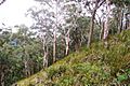
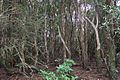
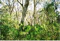
Mount Royal - eucalyptus forest
-
Mount Royal - eucalyptus forest
-
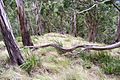
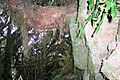
Mount Royal, basalt at 1100 metres
-
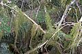
Mount Royal - cloud forest, moss & ferns
-
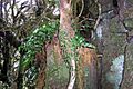
Mount Royal - cloud forest, basalt & ferns
-
Mount Royal, cloud forest, basalt, ferns & moss
-
Mount Royal, cloud forest, Hill water gum rainforest at summit
-
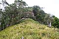
Snow Gums at Brumlow Tops summit, elevation 1586 metres, the highest point in northern New South Wales


See also
 In Spanish: Cadena del Monte Royal para niños
