Barrow Island, Barrow-in-Furness facts for kids
Quick facts for kids Barrow Island |
|
|---|---|
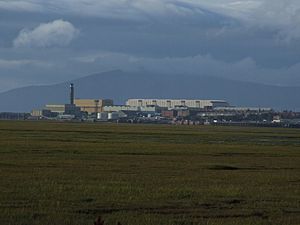 Panorama of Barrow Island viewed from Walney Channel |
|
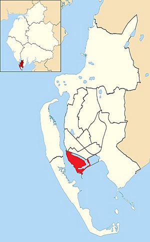 Barrow Island shown within Barrow-in-Furness |
|
| Population | 2,616 (2011) |
| District |
|
| Shire county | |
| Region | |
| Country | England |
| Sovereign state | United Kingdom |
| Post town | BARROW-IN-FURNESS |
| Postcode district | LA |
| Dialling code | 01229 |
| Police | Cumbria |
| Fire | Cumbria |
| Ambulance | North West |
| EU Parliament | North West England |
| UK Parliament |
|
Barrow Island is a special part of Barrow-in-Furness, a town in Cumbria, England. It used to be a separate island. But in the 1860s, people added land to connect its northern edge to the main town. The island is surrounded by the town's busy docks and the Walney Channel. In 2011, about 2,616 people lived here. Soon, Barrow Island will join with other areas to form a new ward called 'Old Barrow'.
| Top - 0-9 A B C D E F G H I J K L M N O P Q R S T U V W X Y Z |
History of Barrow Island
The name "Barrow-in-Furness" might come from an old Norse word, Barrae. This word meant Bare Island, and it was actually talking about Barrow Island itself.
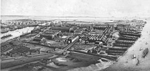
Since the 1860s, Barrow Island has been connected to the mainland. This happened when its natural water channels were changed to create two large docks. These docks are called Buccleuch Dock and Devonshire Dock. The rest of the island's channels have also become part of the dock system. Because of its long history, the island is sometimes called 'Old Barrow'.
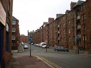
During the late 1800s, many homes were built on Barrow Island. These homes were mostly for working-class people from Scotland and Ireland. They came to work in the town's shipyard, steelworks, and jute mill.
Barrow Island is still considered one of the Islands of Furness. It is known for its many apartment buildings and huge industrial sites. Most of Barrow's shipyard is located here, including the large Devonshire Dock Hall complex. This complex was built on land reclaimed from the Walney Channel.
In 2011, about 2,616 people lived on Barrow Island. This means it has a lot of people living in a small area. The island has a primary school, a nursery, churches, pubs, a post office, and small shops. Some old shipyard buildings are being turned into new shops and offices.
Many apartments on the island have been updated and are now called 'The Maritime Apartments'. These apartments are popular with workers from BAE Systems, offshore wind farms, and construction projects. The areas around these apartments have also been improved with new parks and green spaces. These are now known as the 'Maritime Streets'.
Barrow Island is also getting a big new business park. This park is part of a huge project called The Waterfront Barrow-in-Furness. Over the next 15 years, this business park is expected to create many new skilled jobs.
The Famous Shipyard
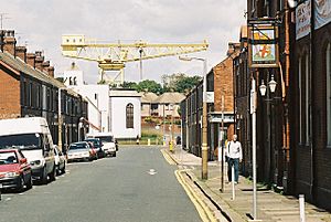
Barrow Island is home to the famous Barrow Shipyard. Today, it is owned by BAE Systems. In the past, it was owned by companies like Vickers Shipbuilding and VSEL. This shipyard is one of the biggest in the United Kingdom.
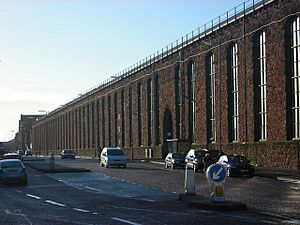
The growth of Barrow Island happened because the shipyard became so busy. Many of the shipyard buildings you see today were built by VSEL. This includes the huge VSEL Heavy Engineering Workshop and the Devonshire Dock Hall. BAE Systems plans to expand the shipyard even more. This expansion is for building new submarines as part of the Trident successor programme.
Barrow Island itself is a special area protected for its history. Many of the shipyard buildings are listed buildings, which means they are important historical sites. Some of the old apartment buildings, like the Devonshire Buildings, are also listed.
Who Lives on Barrow Island?
In 2011, there were more males than females living on Barrow Island. This is different from the average for Barrow and England. Some parts of Barrow Island have a higher number of people with long-term illnesses. The unemployment rate is also higher than the average for England.
Here are some facts about the people living on Barrow Island:
| Important Facts | Barrow Island | Barrow-in-Furness | England |
|---|---|---|---|
| Males | 53.2% | 49.5% | 49.2% |
| Females | 46.8% | 50.5% | 50.8% |
| People in good health | 70.7% | 75.9% | 81.4% |
| People aged 16–74 who are working or looking for work | 61.0% | 64.0% | 66.5% |
| People aged 16–74 with no qualifications | 28.2% | 25.4% | 22.5% |
Getting Around Barrow Island
The A590 main road crosses the northern part of Barrow Island. It then goes over Walney Bridge to Walney Island. To the south of Barrow Island, the Michaelson Road Bridge is another bridge for cars and people. It crosses Buccleuch Dock into Central Barrow. Island Road is a wide street with trees that runs through the eastern residential areas of Barrow Island.
In the past, Barrow Island had two train stations: Ramsden Dock and Shipyard Junction. It also had the Barrow-in-Furness Tramway. While the train tracks are gone, you can still see parts of the old tramlines. They are most noticeable on Island Road and Michaelson Road.
 | Dorothy Vaughan |
 | Charles Henry Turner |
 | Hildrus Poindexter |
 | Henry Cecil McBay |


