Walney Island facts for kids
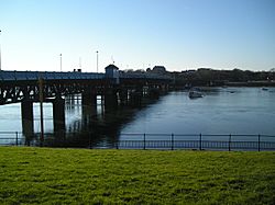
Walney From The Channelside Haven
|
|
|
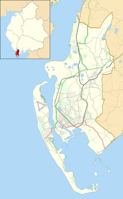
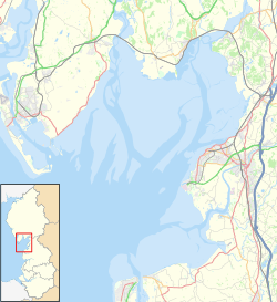
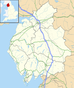
Location in Barrow-in-Furness Borough##Location in Morecambe Bay##Location in Cumbria
|
|
| Geography | |
|---|---|
| Location | Barrow-in-Furness Irish Sea |
| Coordinates | 54°06′11″N 3°15′07″W / 54.103°N 3.252°W |
| Area | 5.01 sq mi (13.0 km2) |
| Length | 11 mi (18 km) |
| Width | 1 mi (2 km) |
| Administration | |
|
England
|
|
| County | Cumbria |
| Borough | Barrow-in-Furness |
| Demographics | |
| Population | 10,651 |
| Pop. density | 2,595 /sq mi (1,001.9 /km2) |
Walney Island, also known as the Isle of Walney, is an island located off the west coast of England. It sits at the western edge of Morecambe Bay in the Irish Sea. Walney is part of Barrow-in-Furness and is separated from the mainland by the Walney Channel. The Jubilee Bridge connects the island to the mainland.
Walney is the biggest island in the Furness Islands group, both in terms of how many people live there and its size. It is also the largest English island in the Irish Sea. In 2011, about 10,651 people lived on Walney Island. This population is spread out across the island's two main areas, called Wards: Walney North and Walney South.
Walney Island was formed a very long time ago, during the last Ice Age. At that time, the River Duddon was a huge lake made of melting ice. This lake left behind a lot of mud and rocks, which eventually became Walney Island. People have found some signs of very old inhabitants, from the neolithic period (New Stone Age), in the island's sand dunes. The island's name likely comes from the Norse people. Walney was mostly a quiet, rural area until industries in Barrow-in-Furness grew in the 1800s. The building of docks at Barrow Island between 1867 and 1881 helped Walney grow as a place where people lived.
In 1898, a planned town called Vickerstown was built on the island for workers. This caused a big increase in the number of people living there. The Jubilee Bridge, which connects Walney to the mainland, was built in 1908. Today, about one-fifth of Barrow-in-Furness's total population lives on Walney. The island has two nature reserves, one at each end. Its sandy beaches also make it a popular spot for fun and relaxation.
Contents
What's in a Name? The Etymology of Walney
The name Walney is believed to come from Old Norse, a language spoken by Vikings. The ending 'ey' is common in island names, meaning "island." However, the meaning of 'waln' is less clear.
In the Domesday Book, a very old survey from 1086, the island is called Hougenai. The manor of 'Hougun' (which might be modern-day Millom) owned all the settlements in Furness. So, 'Hougenai' probably meant "island of Hougun." The Old Norse word haugr means "mound" or "hill." Other Norse meanings have also been suggested for the island's name.
Walney's Past: A Look at Its History
Scientists have found pottery and other evidence in Walney's sand dunes. This shows that people lived on the island during the Late Neolithic period (New Stone Age) and the early Bronze Age. The area of Low Furness was mostly settled by Norse people, who likely came from Ireland or the Isle of Man. You can still see their influence in many local place names, including Walney.
During the Middle Ages, monks from Furness Abbey controlled Walney and Furness. They built Biggar Dyke on Walney's east coast to protect against floods. Walney was mostly a farming area back then. Even in 1810, the poet William Wordsworth described seeing "Walney's early fields of corn" from a nearby mountain.
However, Walney soon became part of the fast-growing industry in Barrow-in-Furness. The Barrow docks were built on Barrow Island, which is in the Walney Channel. Walney Island naturally protected the docks, allowing large shipbuilding yards to develop in Barrow.
In the 1870s, Biggar Bank on Walney became a popular place for seaside fun. A regular ferry service made it even easier for people to visit. In 1897, because so many people were moving to Barrow, the company Vickers decided to build a new planned town on Walney Island. This town was called Vickerstown. People started moving into Vickerstown in 1900, and this was the beginning of Walney becoming a part of Barrow. The Walney Bridge, a special type of bridge that opens to let ships pass, was built and opened in 1908. It connected the island to the mainland.
During World War I, Vickers built submarines and other ships in Barrow. In January 1915, a German submarine approached Walney Island. The artillery battery at Fort Walney fired at the submarine, and after a short exchange of fire, the submarine left.
Walney continued to grow throughout the 1900s, with many new housing areas being built. Most of this growth happened between 1936 and 1976. The fun activities at Biggar Bank became less popular, but the island's beaches are still well-liked by local people. In 2001, Walney's population was 11,388. This was about 15% of the total population of the Borough of Barrow-in-Furness.
Walney's Geography: Location and Transport
Walney Island is located off the southwest coast of Cumbria in the Irish Sea. It is about 11 miles (18 km) long from north to south, but it's never more than 1 mile (1.6 km) wide from east to west. It has narrow sandy points at both ends. The channel that separates Walney from the Great Britain mainland is also narrow and is called Walney Channel.
The northern part of the channel leads into the Duddon Estuary. It is narrower and shallower there. When the tide is low, you can even walk across it using stepping stones known as 'Widow's Crossing'. The southern part of the channel is wider and is regularly cleared to allow ships to reach the Port of Barrow. This part opens into Morecambe Bay and includes several small islands. Some of these, like Barrow Island, Roa, and Piel, have people living on them. North of Earnsie Point, you'll find quiet beaches backed by sand dunes.
The Jubilee Bridge, which is a bascule bridge (a bridge that lifts up), has connected Walney to the mainland since 1908. This bridge is part of the A590, a main road that runs from Walney's west coast to the M6 Motorway. Sometimes, people talk about building a second bridge to make travel easier and reduce traffic. However, no serious plans have ever been made for one. The closest train station to Walney is Barrow-in-Furness. There are no long-distance bus services from the island; all bus services are provided by Stagecoach and end in Barrow.
Walney Island also has a small airport called Barrow/Walney Island Airport. It is privately owned by BAE Systems. The airport opened in 1935 and was first used by the military during World War II. Later, Barrow council bought it. Vickers bought it in 1968, and it has been owned by their successor companies ever since. A few airlines have tried to offer regular passenger flights from the island, but none of them lasted longer than two years.
Walney's Settlements: Where People Live
The main town on Walney is Vickerstown. It's basically a continuation of Barrow-in-Furness. Vickerstown is on the east coast of the island, facing Barrow, and is built around the Jubilee Bridge. The first parts of Vickerstown were built in the 1890s as a community for workers at the Vickers Shipyard. Since then, this area has grown with more suburban homes. The only places where people live on the west coast are Earnse Bay and Biggar Bank. These are just extensions of the central Vickerstown area.
Beyond Vickerstown, the island still has two older villages. North Scale is close to and north of Vickerstown on Walney's east coast. It mainly consists of suburban homes.
Biggar is the more isolated of the two villages. It's about 2 miles (3 km) south of Vickerstown. Biggar is on the east coast of the island and is more of a farming community. Farms stretch south of the village all the way to the South Walney Nature Reserve. Biggar might be the oldest settlement on Walney. Records from Furness Abbey in 1292 mention a farm (called a grange) at Biggar. Today, it is still a farming village.
Walney's Environment: Nature and Wind Farms
Walney is a low-lying, narrow, and windy island. The North-West Evening Mail newspaper says it's the windiest lowland place in England. The northern and southern ends of the island are both nature reserves. These areas have salt marshes, shingle beaches, sand dunes, and brackish (slightly salty) ponds. South Walney, in particular, is home to many birds. Many of these birds stop on the island during their migrations. South Walney is also where the Walney Bird Observatory is located.
In the north, the island provides a home for natterjack toads. You can also find the Walney geranium here, which grows only on this island. The west coast of the island has wide, sandy beaches. The east coast is more developed, facing the narrow and muddy Walney Channel.
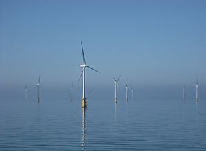
Since 2005, the coast off Walney has become an important place for building offshore wind farms. Four wind farms have already been built, and a fifth one is planned.
| Name | Number of Turbines | Capacity (MW) | Construction Began | Operation Began |
|---|---|---|---|---|
| Barrow Offshore Wind Farm | 30 | 90 | 2004 | 2006 |
| Ormonde Wind Farm | 30 | 150 | 2010 | 2011 |
| Walney Wind Farm 1 | 51 | 184 | 2010 | 2011 |
| Walney Wind Farm 2 | 51 | 183.6 | 2011 | 2011 |
| West of Duddon Sands Wind Farm | 108 | 389 | 2013 | 2014 |
| Walney Extension Wind Farm | 108 | 660 | 2017 | 2018 |
Government, Economy, and Education on Walney
Walney has two levels of local government. At the most local level, the island is part of the Borough of Barrow-in-Furness. It is divided into two wards: Walney North and Walney South. Barrow-in-Furness is also part of the larger county of Cumbria. For Cumbria, Walney is again divided into two wards. In the May 2013 Cumbria County Council elections, both Walney North and Walney South wards elected councillors from the Labour Party. In the 2011 elections for the Borough level, six Labour Party councillors were elected from the island, three from each ward. At a national level, Walney is part of the Barrow and Furness parliamentary constituency. The current Member of Parliament is Simon Fell, who won the seat in the 2019 General Election.
Walney was historically a farming area, and some farms still exist on the island, especially in its southern half. After Vickerstown was built, the defense company Vickers became the main employer on the island. This was similar to what was happening in Barrow-in-Furness generally. Vickers' successor, BAE Systems, is still a major employer in Barrow and on Walney today. Many workers on the island have skilled trades.
Walney has one secondary school, Walney School. It opened in 1952 and currently teaches 681 students. The island also has several primary schools. However, students who want to go to sixth form college or continue their further education must attend schools on the mainland in Barrow.
Sports and Culture on Walney Island
Football and rugby league are very popular amateur sports in the Furness area. The Walney Central amateur rugby league club currently plays in the Cumbria Men’s Amateur Rugby League. This club was formed in 1936 and has played on the island ever since. They reached the second round of the Challenge Cup in 1960. They also competed in the National Conference League between 1991 and 2007. In football, Vickerstown Football Club plays in the West Lancashire Football League (WFL) Premier Division. Walney Island Football Club, which started as Nautical FC in 1970, competes in the WFL Division Two.
Walney has become an important place for kitesurfing and windsurfing. It hosts one of the rounds of the British Kitesurfing Championship every year. The flat, wide beach at Earnse Bay is especially popular for these sports. Windsurfing takes place all around the island, especially on its west coast and near the mouth of Walney Channel.
In literature, Walney appears in The Railway Series books by the Rev. W. Awdry. These books were later made into the TV show Thomas the Tank Engine and Friends. The books and TV series are set on the fictional Island of Sodor. Sodor is located where Walney is, but it's much bigger. Sodor's east coast looks like Walney's, and its main town, 'Vicarstown', is in the same spot as Vickerstown.
In music, Walney is mentioned in the song "Wa'ney Island Cockfight". This song describes a traditional event between the people of North Scale and Biggar on the island. The song has been recorded by Fiddler's Dram and Martin Wyndham-Reed.
See also
 In Spanish: Isla Walney para niños
 | Selma Burke |
 | Pauline Powell Burns |
 | Frederick J. Brown |
 | Robert Blackburn |


