Basalt, Colorado facts for kids
Quick facts for kids
Basalt, Colorado
|
|
|---|---|
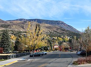
Downtown Basalt with Basalt Mountain in the background
|
|
| Nickname(s):
"The Heart of the Roaring Fork Valley"
|
|
|
|
| Country | |
| State | |
| Counties | Eagle and Pitkin |
| Incorporated | August 26, 1901 |
| Government | |
| • Type | Home Rule Town |
| Area | |
| • Total | 1.999 sq mi (5.178 km2) |
| • Land | 1.992 sq mi (5.158 km2) |
| • Water | 0.008 sq mi (0.020 km2) |
| Elevation | 6,611 ft (2,015 m) |
| Population
(2020)
|
|
| • Total | 3,984 |
| • Density | 2,000/sq mi (800/km2) |
| • CSA | 134,774 |
| Time zone | UTC−07:00 (MST) |
| • Summer (DST) | UTC−06:00 (MDT) |
| ZIP code |
81621
|
| Area code(s) | 970 |
| FIPS code | 08-04935 |
| GNIS ID | 175038 |
| Highways | |
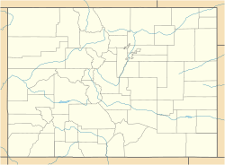
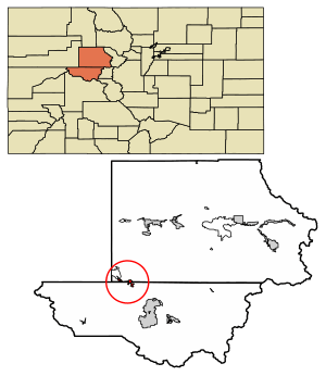
Basalt is a small town in Colorado, United States. It is a special type of town called a Home Rule Town. Basalt is located in two different counties: Eagle and Pitkin.
In 2020, about 3,984 people lived in Basalt. Most of them lived in Eagle County. Basalt is also part of a larger area known as the Edwards-Glenwood Springs, CO Combined Statistical Area.
Contents
Discovering Basalt's Past
Basalt was first called Aspen Junction. This name came from a railroad junction. This junction led to the town of Aspen, Colorado. Aspen Junction was an important stop for trains going to mining towns.
The first post office in Aspen Junction opened in 1890. The Colorado Midland Railroad first served the town. Later, the Denver & Rio Grande Railroad took over in 1901.
The town's name changed to Basalt in 1895. It became an official town on August 26, 1901. The name "Basalt" was chosen because of the unique basalt rock formations found on Basalt Mountain nearby.
Where is Basalt Located?
Basalt is found along State Highway 82. It is also where two rivers meet: the Fryingpan River and the Roaring Fork River. This meeting point is called a confluence.
In 2020, the town covered about 5.178 square kilometers (2 square miles). A small part of this area, about 0.020 square kilometers, is water.
Basalt's Population Over Time
| Historical population | |||
|---|---|---|---|
| Census | Pop. | %± | |
| 1900 | 382 | — | |
| 1910 | 235 | −38.5% | |
| 1920 | 185 | −21.3% | |
| 1930 | 148 | −20.0% | |
| 1940 | 212 | 43.2% | |
| 1950 | 173 | −18.4% | |
| 1960 | 213 | 23.1% | |
| 1970 | 419 | 96.7% | |
| 1980 | 529 | 26.3% | |
| 1990 | 1,128 | 113.2% | |
| 2000 | 2,681 | 137.7% | |
| 2010 | 3,857 | 43.9% | |
| 2020 | 3,984 | 3.3% | |
| U.S. Decennial Census | |||
In 2000, there were 2,681 people living in Basalt. There were 1,052 households, which are groups of people living together. About 637 of these were families.
Most people in Basalt were White (91.53%). A smaller number were from other racial backgrounds. About 11.75% of the population identified as Hispanic or Latino.
About 34% of households had children under 18 living with them. The average household had 2.55 people. The average family had 3.00 people.
The median age in Basalt was 34 years old. This means half the people were younger than 34 and half were older. About 23.6% of the population was under 18 years old.
Fun Things to Do in Basalt
Basalt is famous for its excellent trout fishing. The Fryingpan River is known as a "Gold Medal" fishing spot. This means it has a lot of large trout.
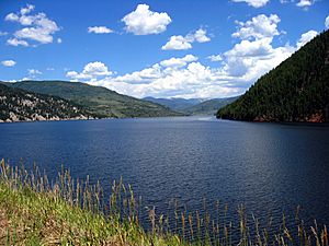
Ruedi Reservoir is also a popular place to visit. People enjoy boating and other water sports there. Basalt is a great spot for mountain biking.
There are many amazing cross-country biking trails nearby. You can also find downhill biking trails within 15 miles of Basalt. These trails offer exciting adventures for bikers.
Getting Around Basalt
- The Roaring Fork Transportation Authority (RFTA) provides bus services in Basalt.
- Basalt also has a public bike-sharing system called WE-CYCLE. It is supplied by PBSC.
Famous People From Basalt
Many notable people have connections to Basalt. Here are a few:
- Wally Dallenbach Jr. – A well-known NASCAR driver.
- Neil Diamond – A famous musician.
- Joey Diaz – A popular comedian.
- Hanna Faulhaber – A freestyle skier and Olympian.
- Ann Korologos – A former United States Secretary of Labor.
- Tom Korologos – A former United States Ambassador to Belgium.
- Christy Smith – A contestant on the TV show Survivor: The Amazon.
- Torin Yater-Wallace – An Olympian freestyle skier.
See also
 In Spanish: Basalt (Colorado) para niños
 | Chris Smalls |
 | Fred Hampton |
 | Ralph Abernathy |


