Battle Creek Falls facts for kids
Quick facts for kids Battle Creek Falls |
|
|---|---|

Battle Creek Falls and visitors
|
|
| Lua error in Module:Infobox_mapframe at line 185: attempt to index field 'wikibase' (a nil value). | |
| Location | Mount Timpanogos |
| Coordinates | 40°22′03″N 111°41′34″W / 40.36737°N 111.69287°W |
| Elevation | 5,671 ft (1,729 m) |
| Total height | 50 ft (15 m) |
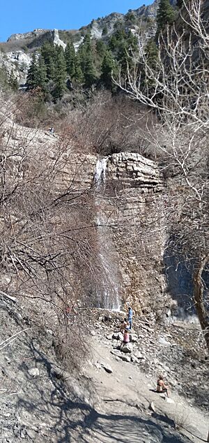
Battle Creek Falls is a beautiful waterfall located on the western side of Mount Timpanogos in Utah. You can find it just east of the city of Pleasant Grove, Utah.
It's easy to visit! You can reach the falls from the Battle Creek Trailhead, which is near the Kiwanis Park picnic area. The water plunges down onto rocks at the bottom of the cliff. You can walk right up to the base of the waterfall from the trail. Another famous waterfall, Bridal Veil Falls, is also on Mount Timpanogos. It's about 10 miles south of Battle Creek Falls.
The Natural Surroundings
Battle Creek Falls is found in a canyon on Mount Timpanogos. The area has a semi-arid climate (meaning it's quite dry) or even a desert climate.
The water for the creek comes from a natural spring higher up the mountain. The waterfall and creek flow all year round, which means they are perennial. The water is strongest in spring when snow melts from the mountains.
You'll see many types of trees around the falls. These include water birch, maple, Douglas fir, spruce, oak, aspen, and cottonwood. In spring and summer, you might spot pretty wildflowers. Some common ones are western coneflower, clematis, penstemon, and balsam root. Be careful, though, as there have been reports of poison ivy and stinging nettle in the area.
How Battle Creek Falls Got Its Name
The waterfall is named after Battle Creek. This creek actually gave the city of Pleasant Grove its first name!
The name comes from an event that happened in 1849. Pioneer settlers, led by Captain John Scott, had a conflict with a small group of Ute Indians near the creek. This event is known as the Battle Creek massacre.
 | Sharif Bey |
 | Hale Woodruff |
 | Richmond Barthé |
 | Purvis Young |

