Bay of Santander facts for kids
Quick facts for kids
Santander
|
|||
|---|---|---|---|
|
Comarca
|
|||
|
|||
 |
|||
| Country | |||
| Autonomous community | |||
| Province | |||
| Capital | Santander | ||
| Municipalities |
List
|
||
| Area | |||
| • Total | 263.0 km2 (101.5 sq mi) | ||
| Population
(2018)
|
|||
| • Total | 269,335 | ||
| • Density | 1,024.09/km2 (2,652.4/sq mi) | ||
| Time zone | UTC+1 (CET) | ||
| • Summer (DST) | UTC+2 (CEST) | ||
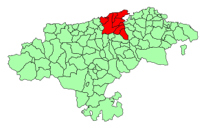
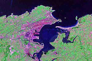
The Bay of Santander is a special area in Cantabria, Spain. It's like a big natural harbor and the largest estuary (where a river meets the sea) on Spain's northern coast. It's about 9 kilometers long and 5 kilometers wide, covering an area of 22.42 square kilometers.
Many people live around the Bay of Santander because it's close to the city of Santander. Almost half of all the people in Cantabria live here. This means there's a lot of human activity in and around the bay.
The entrance to the bay has the Sardinero beaches. Here you can see the Isle of Mouro with its lighthouse. To get inside the bay, boats pass through a narrow channel. On one side is the Magdalena Peninsula, with the Isle of the Tower and Horadada Island nearby. On the other side are the sandbanks of El Puntal. This is a long stretch of beaches and dunes that keep the inner waters of the bay calm.
Over the last few centuries, the shape of the bay has changed a lot. It's thought that more than half of the bay's original area has been filled in. This was done by drying out large marsh areas. These new lands were used for farming, to make the Port of Santander bigger, and to build new factories and homes. Today, people are working to bring back the natural seaside environment in some important areas.
Contents
Towns and Villages Around the Bay
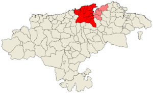
The Bay of Santander is surrounded by several towns and villages, which are part of its administrative area. These are called municipalities. Here's a look at them, including their size and how many people lived there in different years:
| Name | Area (km2) |
Population (2001) |
Population (2011) |
Population (2018) |
|---|---|---|---|---|
| Camargo | 36.6 | 24,498 | 31,498 | 30,263 |
| El Astillero | 6.8 | 14,353 | 17,854 | 18,108 |
| Miengo | 24.5 | 3,629 | 4,664 | 4,713 |
| Penagos | 31.7 | 1,703 | 1,926 | 2,108 |
| Piélagos | 83.3 | 13,035 | 23,036 | 25,223 |
| Santa Cruz de Bezana |
17.3 | 9,149 | 12,094 | 12,964 |
| Santander | 34.8 | 180,717 | 178,085 | 172,044 |
| Villaescusa | 28.0 | 3,323 | 3,735 | 3,912 |
Rivers and Waterways
Several rivers flow into the Bay of Santander. The most important one is the Ria de Solía, which enters from the south. The Ria de San Salvador flows into the middle of the bay through the Ria de Astillero. On the eastern side, you'll find the Rias of Carmen and Raos. To the west, the Ria de Cubas is where the Miera River meets the bay.
How the Bay Was Formed
The Bay of Santander was created by natural geological processes over a very long time. It formed because of a movement deep underground called a diapir. This happened during a period of mountain building called the alpinotype orogeny.
This movement brought up soft materials like clay and salt (especially a type of gypsum). These soft rocks were easier to wear away than harder rocks like sandstone or limestone. Over time, the sea eroded these weaker areas, slowly forming the large bay we see today.

Animals and Plants
The Bay of Santander is home to different types of wildlife. One bird you might see here is the Common Tern (Sterna hirundo). This area provides a habitat for various species.
See also
 In Spanish: Bahía de Santander para niños
 | Lonnie Johnson |
 | Granville Woods |
 | Lewis Howard Latimer |
 | James West |


