Beinn Mheadhoin (Cairngorms) facts for kids
Quick facts for kids Beinn Mheadhoin |
|
|---|---|

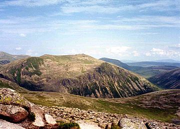
Beinn Mheadhoin from the summit of Derry Cairngorm
|
|
| Highest point | |
| Elevation | 1,182 m (3,878 ft) |
| Prominence | c. 254 m |
| Listing | Marilyn, Munro |
| Naming | |
| English translation | Middle hill |
| Language of name | Gaelic |
| Geography | |
| Location | Moray, Scotland |
| Parent range | Cairngorms |
| OS grid | NJ024017 |
| Topo map | OS Landranger 36 |
Beinn Mheadhoin is a tall mountain located in Scotland. It's considered one of the highest mountains in Great Britain. This mountain sits right in the middle of the Cairngorms mountain range. It's known for being one of the most remote, or hard-to-reach, hills in the area.
Contents
Beinn Mheadhoin: A Mountain Adventure
Beinn Mheadhoin is a special place for hikers and nature lovers. Its name means "Middle hill" in Gaelic. This mountain is part of the famous Cairngorms, a large area of mountains in Scotland.
What Makes Beinn Mheadhoin Special?
The top of Beinn Mheadhoin is wide and mostly flat. It's famous for its unique rock formations called tors. These are large, rounded boulders. They were left behind by huge sheets of ice when the last ice age ended.
Reaching the Top: The Summit Tors
The very highest point of Beinn Mheadhoin is actually the top of one of these big tors. To reach it, you need to do a little bit of easy scrambling. This means using your hands and feet to climb up the rocks. It's a fun challenge for those who make it to the summit!
How to Get There: Exploring the Routes
Beinn Mheadhoin is quite remote, meaning it's far from roads and towns. Getting to the top requires a good hike. The shortest way to reach it involves crossing a high, flat area called a plateau.
The Shortest Way: From Coire Cas
One common way to climb Beinn Mheadhoin starts from the Coire Cas car park. This car park is near the Cairn Gorm ski area. You would first head towards a ridge called Fiacaill a' Choire Chais. After that, you walk down to Loch A'an, a beautiful lake. You'll pass the famous Shelter Stone near the loch. Then, you climb up again to another lake, Loch Etchachan. From there, you head northeast to reach the summit ridge. This route is about 20 kilometers (12.4 miles) long. It involves climbing about 1,400 meters (4,593 feet) in height.
Another Path: From Glen Derry
You can also climb Beinn Mheadhoin from the south, starting in Glen Derry. This route is much longer. However, you can use a bicycle on the track for part of the way to save time. If you choose this path, you might even combine your climb with an ascent of Derry Cairngorm, another nearby mountain.
 | James Van Der Zee |
 | Alma Thomas |
 | Ellis Wilson |
 | Margaret Taylor-Burroughs |

