Belle Valley, Ohio facts for kids
Quick facts for kids
Belle Valley, Ohio
|
|
|---|---|
|
Village
|
|

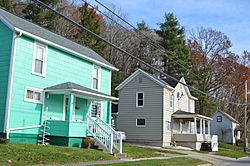
Main Street
|
|

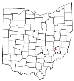
Location of Belle Valley, Ohio
|
|

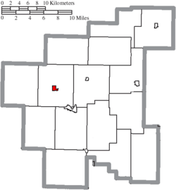
Location of Belle Valley in Noble County
|
|
| Country | United States |
| State | Ohio |
| County | Noble |
| Area | |
| • Total | 0.41 sq mi (1.05 km2) |
| • Land | 0.41 sq mi (1.05 km2) |
| • Water | 0.00 sq mi (0.00 km2) |
| Elevation | 742 ft (226 m) |
| Population
(2020)
|
|
| • Total | 201 |
| • Estimate
(2023)
|
199 |
| • Density | 493.86/sq mi (190.84/km2) |
| Time zone | UTC-5 (Eastern (EST)) |
| • Summer (DST) | UTC-4 (EDT) |
| ZIP code |
43717
|
| Area code(s) | 740 |
| FIPS code | 39-05158 |
| GNIS feature ID | 2398077 |
Belle Valley is a small village located in Noble County, Ohio, United States. In 2020, the village had a population of 201 people.
Contents
History of Belle Valley
Belle Valley began when the Cleveland and Marietta Railroad reached this area. The village officially became a village in 1905.
Sadly, in 1913, fifteen coal miners died in a mine explosion. At that time, about 1,000 people lived in Belle Valley.
During World War II, a brave soldier from Belle Valley named Harry Torhan earned special awards. He received the Silver Star and Purple Heart. He got them for helping four injured soldiers during a big battle called the Battle of the Bulge, even while under enemy fire.
Geography of Belle Valley
Belle Valley is located next to the West Fork of Duck Creek. It is also close to bigger cities like Cambridge, Marietta, and Zanesville. The village is near a major highway, Interstate 77.
According to the United States Census Bureau, Belle Valley is about 0.41 square miles (1.05 square kilometers) in size. It is all land, with no water areas.
The village is also part of the Ohio Buckeye Trail. This is a very long hiking trail that goes all around the state of Ohio. The part of the trail near Belle Valley is mostly hilly and rural. It runs through Guernsey and Noble Counties. This section stretches from Winterset to the America Electric Power Recreation Lands.
Hikers on this trail often walk on quiet dirt roads. Some parts go off-road through places like Salt Fork Wildlife Area and Seneca Lake. It also passes through Wolf Run State Park and the America Electric Power Recreation Lands. The trail also passes through other villages like Old Washington and Hoskinsville. In Belle Valley, the trail crosses Interstate 77.
People of Belle Valley
| Historical population | |||
|---|---|---|---|
| Census | Pop. | %± | |
| 1910 | 689 | — | |
| 1920 | 1,050 | 52.4% | |
| 1930 | 603 | −42.6% | |
| 1940 | 617 | 2.3% | |
| 1950 | 458 | −25.8% | |
| 1960 | 438 | −4.4% | |
| 1970 | 393 | −10.3% | |
| 1980 | 329 | −16.3% | |
| 1990 | 267 | −18.8% | |
| 2000 | 263 | −1.5% | |
| 2010 | 223 | −15.2% | |
| 2020 | 201 | −9.9% | |
| 2023 (est.) | 199 | −10.8% | |
| U.S. Decennial Census | |||
Population in 2010
In 2010, there were 223 people living in Belle Valley. There were 93 households and 64 families. The village had about 544 people per square mile (210 people per square kilometer). There were 110 homes in total.
Most of the people in the village were White (97.3%). A small number were from other races (0.9%) or two or more races (1.8%). About 0.4% of the population was Hispanic or Latino.
About 30% of households had children under 18 living with them. Almost half (45.2%) were married couples. About 25.8% of households were made up of people living alone. About 11.8% of people living alone were 65 years old or older. The average household had 2.40 people. The average family had 2.86 people.
The average age of people in the village was 40.6 years. About 23.3% of residents were under 18. About 18.8% were 65 years old or older. The population was almost evenly split between males (50.7%) and females (49.3%).
See also
 In Spanish: Belle Valley para niños

