Benson Hollow facts for kids
Quick facts for kids Benson Hollow |
|
|---|---|

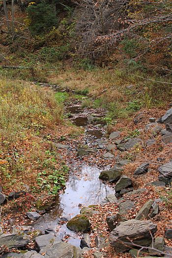
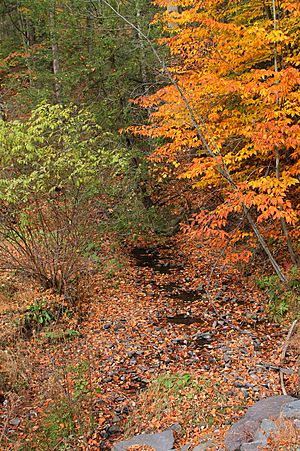
Benson Hollow looking downstream
|
|
| Physical characteristics | |
| Main source | valley to the west of Cedar Ledge in Eaton Township, Wyoming County, Pennsylvania between 1,340 and 1,360 feet (408 and 415 m) |
| River mouth | Bowman Creek in Eaton Township, Wyoming County, Pennsylvania 584 ft (178 m) 41°30′49″N 75°58′17″W / 41.51352°N 75.97140°W |
| Length | 0.9 mi (1.4 km) |
| Basin features | |
| Progression | Bowman Creek → Susquehanna River → Chesapeake Bay |
| Basin size | 1.82 sq mi (4.7 km2) |
Benson Hollow is a small tributary (a stream that flows into a larger one) of Bowman Creek in Wyoming County, Pennsylvania. It's about 0.9 miles (1.4 km) long and flows through Eaton Township. The land area that drains into this stream, called its watershed, covers about 1.82 square miles (4.7 km2).
Benson Hollow is a healthy stream, meaning its water quality is good. The land around it has different types of soil and rocks, including sand, gravel, and solid bedrock. This stream's watershed is a special place for fish, especially coldwater fish like trout, and it's also important for fish that travel to different areas.
Contents
Where Benson Hollow Flows
Benson Hollow starts in a valley located west of Cedar Ledge in Eaton Township. It flows generally south for a short distance before turning to the east. After flowing for a bit more, the stream meets and joins Bowman Creek.
Benson Hollow connects with Bowman Creek about 1.72 miles (2.77 km) upstream from where Bowman Creek itself ends.
Water Quality
The water in Benson Hollow is clean and healthy. It is not considered to be polluted or damaged.
Land and Rocks Around the Stream
The land where Benson Hollow meets Bowman Creek is about 584 feet (178 m) above sea level. Where the stream begins, its elevation is higher, between 1,340 and 1,360 feet (410 and 410 m) above sea level.
Long ago, during the Ice Age, melting ice from Benson Hollow helped create a delta (a landform shaped like a triangle) in the valley of Bowman Creek. The very start of the stream is in a deeply cut area.
The bottom of Benson Hollow is made of gravel. The land along the stream's lower parts has different types of soil and rocks. In the upper parts, you can find alluvium (soil deposited by water) and even a small lake. The valley where the stream flows is surrounded by Till (rocky material left by glaciers) and solid bedrock made of sandstone and shale.
The Stream's Watershed
The watershed (the area of land that collects water for the stream) of Benson Hollow covers about 1.82 square miles (4.7 km2). The entire stream is located within the Tunkhannock area, as mapped by the United States Geological Survey.
Benson Hollow is considered a "first-order" stream, which means it's a small stream that doesn't have other smaller streams flowing into it.
A single culvert (a pipe or tunnel carrying water under a road) crosses Benson Hollow in one spot. Upstream from this culvert, you might see areas where sand and gravel have settled. Downstream, there's a large scour pool (a deep hole in the streambed caused by fast-moving water). These are common features around culverts.
History of the Name
Benson Hollow doesn't have a unique name of its own. It gets its name from the valley it flows through. The valley was officially added to the Geographic Names Information System on August 2, 1979.
Animals and Plants
The area around Benson Hollow is special because it's a "High-Quality Coldwater Fishery" and a "Migratory Fishery." This means the water is very clean and cold, which is perfect for certain types of fish. Wild trout naturally live and reproduce in this stream, from where it starts all the way to where it joins Bowman Creek.
 | Stephanie Wilson |
 | Charles Bolden |
 | Ronald McNair |
 | Frederick D. Gregory |


