Bibra Lake, Western Australia facts for kids
Quick facts for kids Bibra LakePerth, Western Australia |
|||||||||||||||
|---|---|---|---|---|---|---|---|---|---|---|---|---|---|---|---|
 |
|||||||||||||||
| Population | 5,954 (2011 census) | ||||||||||||||
| • Density | 472.5/km2 (1,224/sq mi) | ||||||||||||||
| Established | 1967 | ||||||||||||||
| Postcode(s) | 6163 | ||||||||||||||
| Area | 12.6 km2 (4.9 sq mi) | ||||||||||||||
| Location | 20 km (12 mi) from Perth | ||||||||||||||
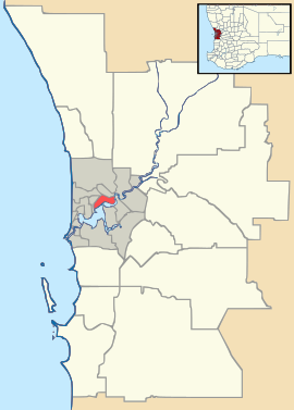
| LGA(s) | City of Cockburn | ||||||||||||||
| State electorate(s) |
|
||||||||||||||
| Federal Division(s) | Fremantle | ||||||||||||||
|
|||||||||||||||
Bibra Lake is a suburb in Perth, Western Australia. It gets its name from a large freshwater lake located inside its borders. This area is part of the City of Cockburn. Its postcode is 6163. Bibra Lake is about 20 kilometers (12 miles) south of Perth city.
Contents
History of Bibra Lake
How Bibra Lake Got Its Name
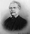
The lake was first recorded in May 1842 by a surveyor named Augustus Charles Gregory. He wrote down its Aboriginal name as Walubup. The next year, Benedict von Bibra surveyed his own land near the lake. He recorded the name as Walliabup. This version was used on maps for over 50 years.
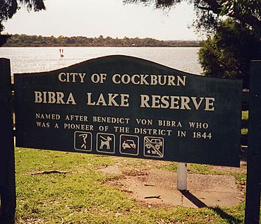
In 1843, Benedict von Bibra bought land by the lake. He used it as a camping spot. This helped him shorten his trips between his carpentry businesses in Perth and Fremantle. He guessed that the area would become a deep lake in winter. He was right!
By 1877, local people still remembered Benedict von Bibra. They started calling the lake "Bibra's Lake." This new name was added to maps. In 1967, "Bibra Lake" officially replaced the Aboriginal name. In 1898, the lake area was set aside for fun activities. It became a popular place for picnics and sports.
AWAS Camp During World War II
During World War II, there was a military camp at Bibra Lake. It was home to the 66 Searchlight battery and the 116 Light Anti-Aircraft regiment. Many women from the Australian Women's Army Service (AWAS) lived and worked here. They helped defend Australia. This freed up men to fight on the front lines.
After the war, the camp was taken down. All its buildings and materials were sold. In 2015, community members rediscovered the camp's old site. Today, parts of the camp are threatened by a planned highway extension.
Geography of Bibra Lake
| Bibra Lake | |
|---|---|
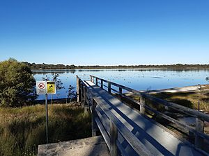
Bibra Lake, seen from the western shore
|
|
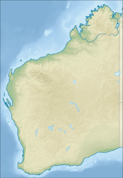
| Location | Perth, Western Australia |
| Coordinates | 32°05′37″S 115°49′33″E / 32.09361°S 115.82583°E |
| Type | Freshwater |
| Basin countries | Australia |
| Designation | Beeliar Regional Park |
Bibra Lake is surrounded by major roads. The Roe Highway is to the north. Stock Road is to the west. The Kwinana Freeway is to the east. A freight rail line runs to the south.
Bibra Lake is one of several lakes that form the Beeliar Regional Park. This park is a protected natural area. The lake has special electric traps to help reduce mosquitoes. There is also a cycle way around the lake. This path lets you visit bird hides, where you can watch birds without disturbing them.
Fun Things to Do in Bibra Lake
Bibra Lake has a large area for businesses and factories. But it also has many fun places for recreation.
You can visit Adventure World theme park here. There's also a bungee jumping tower for thrill-seekers. If you like ice skating, check out Cockburn Ice Arena. You can also play paintball or laser tag with friends.
Bibra Lake is also home to two special primary schools. One uses the Waldorf teaching method. The other uses the Montessori method.
 | Georgia Louise Harris Brown |
 | Julian Abele |
 | Norma Merrick Sklarek |
 | William Sidney Pittman |


