Big Lagoon (California) facts for kids
Quick facts for kids Big Lagoon |
|
|---|---|

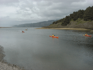
Kayaks at the south end of Big Lagoon
|
|
| Location | Humboldt County, California |
| Coordinates | 41°11′00″N 124°07′00″W / 41.18333°N 124.11667°W |
| Type | Lagoon |
| Primary inflows | Maple Creek |
| Primary outflows | Pacific Ocean |
| Basin countries | United States |
| Max. length | 3.8 mi (6 km) |
| Max. width | 1.4 mi (2 km) |
| Surface area | 1,470 acres (5.9 km2) |
| Max. depth | 22 feet (6.7 m) |
| Shore length1 | 9 miles (14 km) |
| Surface elevation | 20 feet (6.1 m) |
| Frozen | No |
| 1 Shore length is not a well-defined measure. | |
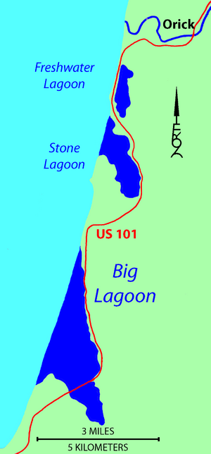
Big Lagoon is a large, beautiful body of water in Humboldt County, California. It's the biggest of three similar lagoons found within Humboldt Lagoons State Park.
Imagine a shallow bay almost completely closed off from the ocean by a sandbar. That's what a lagoon is! Big Lagoon is one of these cool places. It sits between the towns of Trinidad to the south and Orick to the north.
These lagoons are very important. They serve as resting spots for many waterfowl (birds that live near water) that fly along the Pacific Flyway. This is like a superhighway in the sky for birds migrating between Lake Earl (about 40 miles north) and Humboldt Bay (about 30 miles south).
How Big Lagoon Was Formed
Big Lagoon is a lot like other coastal areas in northern California. It's a flat area of land made of soil and sand, surrounded by tall hills. The hills next to Big Lagoon are made of different kinds of rock. Some are very old, from a group called the Franciscan Assemblage. Others are sandstone from ancient sand dunes.
Scientists have studied the area around Humboldt Bay. They found that the Earth's plates moving (called tectonic activity) have caused the sea level to change over hundreds of years. Sometimes the land goes up, and sometimes it sinks down.
When the land goes up, the area might become a freshwater wetland or a forest of Sitka spruce trees. When it sinks, it can become a salt marsh or a place where shellfish live.
Right now, a sandbar usually separates Big Lagoon from the Pacific Ocean during the summer. But in winter, heavy rain can make the water level in the lagoon rise. When the water gets high enough, or during big storms, the sandbar can break open. This allows the lagoon water to flow into the sea. Then, ocean tides can flow into the lagoon until waves build the sandbar back up again.
A Look at Big Lagoon's Past
Big Lagoon has a rich history, both natural and human. You might even see Roosevelt elk grazing in the wetlands south of the lagoon. They sometimes appear near U.S. Route 101 where it crosses the lagoon.
In the 1900s, a company called Hammond Lumber Company had a sawmill here. They built a log pond where Maple Creek flows into the south end of Big Lagoon. This pond was used to store logs.
During World War II, the United States Navy used the coastal part of Big Lagoon as a place to test rockets from the air. Today, you can easily access Big Lagoon by canoe. There's a park on the south shore near the community of Big Lagoon and the Big Lagoon Rancheria.
 | Jewel Prestage |
 | Ella Baker |
 | Fannie Lou Hamer |


