
Orick, California facts for kids
Quick facts for kids
Orick
|
|
|---|---|
 |
|

Orick
Location in California
|
|
| Country | United States |
| State | California |
| County | Humboldt County |
| Area | |
| • Total | 4.850 sq mi (12.561 km2) |
| • Land | 4.746 sq mi (12.291 km2) |
| • Water | 0.104 sq mi (0.270 km2) 2.15% |
| Elevation | 26 ft (8 m) |
| Population
(2020)
|
|
| • Total | 328 |
| • Density | 67.63/sq mi (26.11/km2) |
| Time zone | UTC-8 (Pacific (PST)) |
| • Summer (DST) | UTC-7 (PDT) |
| ZIP Code |
95555
|
| Area code(s) | 707 |
| FIPS code | 06-54218 |
| GNIS feature IDs | 230092, 2611444 |
Orick is a small community located in Humboldt County, California. It sits right next to Redwood Creek. Orick is about 43 miles (69 km) north of Eureka. It is only 26 feet (8 meters) above sea level. In 2020, about 328 people lived there.
Orick was once known by other names like Arekw, Orekw, and Oreq. The Yurok people, who are the native people of this area, called it 'O'rekw . This name means "mouth of the river." Special minerals called orickite and coyoteite were found nearby at Coyote Peak.
Contents
- History of Orick: A Look Back in Time
- Geography and Nature Around Orick
- Climate: What's the Weather Like?
- Population and People of Orick
- Economy: How People Make a Living
- Parks and Fun Things to Do
- Education: Learning in Orick
- Infrastructure: Services in Town
- Orick in Pop Culture
- Images for kids
- See also
History of Orick: A Look Back in Time
The name Orick comes from the Yurok word O'rekw, meaning "mouth of the river." The Yurok people had many villages in this area. O'rekw was one of five places where they held important "jumping dances."
Early Settlers and Gold Rush Days
New settlers arrived in the 1850s during the Gold Rush. They came after Josiah Gregg found Humboldt Bay. Orick was a stop for miners heading to the Trinity area. People also tried to find gold in the beach sands nearby. However, the gold wasn't easy to find, and the local gold rush ended by the 1870s.
The first post office in Orick opened in 1887. Early travelers used to go along the beaches. But in 1894, a wagon road was built. This road connected Eureka to Crescent City.
Lumber, Ferries, and the Orick Inn
After the gold rush, people started cutting down trees for lumber. Dairy farmers used the flat, open land for their farms. Before a bridge was built in 1903, people crossed Redwood Creek using Swan's Ferry.

Robert Swan was a local rancher who owned the ferry and a store. Later, Elmer L. Devlin bought the store and built the first Orick Inn. The first inn burned down in 1918, but it was rebuilt by 1922. The Orick Inn was famous for its homemade food. Many important people stayed there, including opera singer Madame Ernestine Schumann-Heink, actors Fred MacMurray and Ronald Colman, and President Herbert Hoover.
In 1924, the Redwood Highway reached Orick. By the 1930s, this highway connected San Francisco all the way to Oregon. This brought many tourists who wanted to see the giant redwood trees.
After World War II, Orick became a busy town for lumber and timber mills. There was a big demand for wood after the war. This business was strong for about 15 years. But then, mills moved to bigger towns, and the Redwood National Park was created. This led to the mills in Orick closing down.
The Story of Big Diamond the Elephant
On October 1, 1927, a circus elephant named "Big Diamond" had a funny adventure. It was helping pull ten trucks that were stuck in new highway construction, about five miles north of Orick. After freeing the trucks, Big Diamond collapsed.
The circus owner told a highway worker that the elephant's skin was valuable. He said the worker could keep the money if he removed the elephant's remains. The worker skinned and buried the elephant. But it turned out the skin wasn't useful after all!
Many years later, the elephant's bones were dug up. At first, people thought they were the bones of a mammoth. But old newspaper stories helped people realize it was Big Diamond. In May 1993, a special plaque was placed near where the bones were found to remember Big Diamond.
Geography and Nature Around Orick
Orick is located in the California Coast Range, very close to the Pacific Ocean. U.S. Route 101 runs through the town. Redwood Creek cuts through Orick. The town is about 15 miles (24 km) south of the northern border of Humboldt County. It is also about 15 miles (24 km) north of Trinidad.
The Orick/Gold Bluff Beach area stretches for about 10 miles (16 km) along the beach. People mined for gold here from 1852 to the 1880s. They found gold in the black sands on and near the beach. This gold might have come from materials carried down the Klamath River, which flows into the Pacific Ocean 20 miles (32 km) north of Orick.
Protecting Orick from Floods
Orick has experienced floods in the past, including big ones in 1950, 1953, 1955, and 1964. To protect the town, the U.S. Army Corps of Engineers built earthen walls, called levees, along Redwood Creek from 1966 to 1968. These levees help control the water flow.
Climate: What's the Weather Like?
Orick has a type of weather called a "warm-summer Mediterranean climate." This means it has warm, dry summers. The average monthly temperature in summer doesn't go above 71.6°F (22°C).
Even though it's near the coast, Orick can have warmer summer days because it's a few miles inland and surrounded by hills. On average, there are only about 0.7 days a year when the temperature goes above 90°F (32°C). The average high in September is about 70°F (21°C).
In winter, it can get cold enough for frost. On average, there are about 38 days with frost each year. The temperature rarely drops below 17°F (-8°C). Orick gets a lot of rain, about 67.3 inches (1709 mm) per year, making it a very wet Mediterranean climate.
| Climate data for Orick | |||||||||||||
|---|---|---|---|---|---|---|---|---|---|---|---|---|---|
| Month | Jan | Feb | Mar | Apr | May | Jun | Jul | Aug | Sep | Oct | Nov | Dec | Year |
| Record high °F (°C) | 71 (22) |
77 (25) |
80 (27) |
88 (31) |
93 (34) |
99 (37) |
96 (36) |
97 (36) |
99 (37) |
90 (32) |
75 (24) |
68 (20) |
99 (37) |
| Mean daily maximum °F (°C) | 52.2 (11.2) |
55.2 (12.9) |
57.0 (13.9) |
59.5 (15.3) |
62.8 (17.1) |
65.8 (18.8) |
68.7 (20.4) |
69.6 (20.9) |
70.7 (21.5) |
65.7 (18.7) |
57.0 (13.9) |
52.0 (11.1) |
61.4 (16.3) |
| Daily mean °F (°C) | 44.4 (6.9) |
46.6 (8.1) |
47.7 (8.7) |
49.6 (9.8) |
52.9 (11.6) |
56.1 (13.4) |
58.6 (14.8) |
59.4 (15.2) |
58.5 (14.7) |
54.3 (12.4) |
48.7 (9.3) |
44.8 (7.1) |
51.8 (11.0) |
| Mean daily minimum °F (°C) | 36.9 (2.7) |
37.9 (3.3) |
38.1 (3.4) |
39.7 (4.3) |
43 (6) |
46 (8) |
48.7 (9.3) |
48.9 (9.4) |
46.2 (7.9) |
43.2 (6.2) |
40.5 (4.7) |
37.6 (3.1) |
42.2 (5.7) |
| Record low °F (°C) | 19 (−7) |
21 (−6) |
25 (−4) |
17 (−8) |
27 (−3) |
31 (−1) |
31 (−1) |
31 (−1) |
31 (−1) |
25 (−4) |
23 (−5) |
17 (−8) |
17 (−8) |
| Average precipitation inches (mm) | 10.8 (275) |
9.4 (240) |
9.0 (229) |
5.0 (126) |
3.3 (84) |
1.4 (35) |
0.3 (8) |
0.5 (13) |
1.3 (32) |
4.7 (119) |
9.5 (242) |
12.0 (306) |
67.2 (1,709) |
| Average precipitation days | 16 | 15 | 16 | 12 | 9 | 5 | 2 | 3 | 5 | 9 | 15 | 17 | 124 |
Population and People of Orick
| Historical population | |||
|---|---|---|---|
| Census | Pop. | %± | |
| 2010 | 357 | — | |
| 2020 | 328 | −8.1% | |
| 2021 (est.) | 300 | −16.0% | |
| US Census | |||
In 2010, Orick had a population of 357 people. By 2020, the population had decreased to 328.
Here's a look at the different groups of people living in Orick:
| Racial and ethnic composition | 2010 | 2020 |
|---|---|---|
| White (non-Hispanic) | 77.03% | 69.21% |
| Two or more races (non-Hispanic) | 5.6% | 12.2% |
| Hispanic or Latino (of any race) | 5.6% | 9.15% |
| Native American (non-Hispanic) | 10.36% | 4.88% |
| Other (non-Hispanic) | 0.56% | 1.83% |
| Black or African American (non-Hispanic) | 0.0% | 0.91% |
| Asian (non-Hispanic) | 0.0% | 0.91% |
| Pacific Islander (non-Hispanic) | 0.84% | 0.91% |
Most people in Orick live in households. In 2010, there were 166 households. About 20% of these households had children under 18. The average household had about 2 people.
Economy: How People Make a Living
Orick is surrounded by beautiful state and national parks. It's also part of many walking and biking trails. These include trails in the Redwood National and State Parks, the Redwood Creek Estuary Trail, and the California Coastal Trail.
Many tourists visit Orick throughout the year. In 2010, about 35,000 tourists came each month on average. More people visit in August (over 70,000) and fewer in February (around 13,000). About 20% of these visitors stay overnight in the parks.
Parks and Fun Things to Do
The Redwood National Park Thomas H. Kuchel Visitor Center is located on U.S. Route 101 just before you reach Orick. This is a great place to learn about the giant redwood trees. The Redwood National Park Southern Operation Center is right in town.
Education: Learning in Orick
Orick has its own school, the Orick Elementary School. It teaches students from kindergarten through 8th grade. Sometimes, the school faces challenges like low student numbers.
Infrastructure: Services in Town
Orick is connected by U.S. Highway 101 and smaller local roads.
The town has its own fire service, which started in 1955. Water service began in 1976. Both are managed by the Orick Community Services District. This district also provides water to the Redwood National Park Visitors’ Center. The Orick Community Hall is also maintained by the district.
Orick in Pop Culture
- Orick was featured in the PlayStation 3 video game Resistance 2.
- The town can be seen briefly in the 2018 movie Jurassic World: Fallen Kingdom. In the movie, it's shown a few miles from the Lockwood Estate, where dinosaurs are auctioned.
Images for kids
-
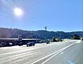
A view of Orick, California
See also
 In Spanish: Orick (California) para niños
