
Big Thompson River facts for kids
Quick facts for kids Big Thompson River |
|
|---|---|

The headwaters of the Big Thompson River are in Rocky Mountain National Park.
|
|
| Country | United States |
| State | Colorado |
| City | Loveland |
| Physical characteristics | |
| Main source | Rocky Mountains 11,310 ft (3,450 m) 40°25′41″N 105°47′29″W / 40.42806°N 105.79139°W |
| River mouth | South Platte River Near Greeley 4,670 ft (1,420 m) 40°21′16″N 104°45′37″W / 40.35444°N 104.76028°W |
| Length | 78 mi (126 km) |
| Basin features | |
| Tributaries |
|
The Big Thompson River is a river in Colorado, United States. It is about 78 miles (123 km) long. The river flows into the South Platte River. It starts high up in the mountains and flows through different towns and areas.
Contents
Where the River Flows

The Big Thompson River begins in Rocky Mountain National Park in Larimer County, Colorado. It flows east through a beautiful area called Moraine Park. Then it reaches the town of Estes Park.
In Estes Park, the river's water is held back by a dam, forming Lake Estes. After the lake, the river flows into the Big Thompson Canyon. Another part of the river, called the North Fork Big Thompson River, also starts in Rocky Mountain National Park. It joins the main Big Thompson River in the town of Drake.
From Lake Estes, the river drops a lot in height as it flows through the amazing 25-mile (40 km) Big Thompson Canyon. It then leaves the mountains west of Loveland. The river continues flowing east across the flat plains into Weld County. It meets the South Platte River about 5 miles (8 km) south of Greeley. Another small river, the Little Thompson River, also joins it nearby.
The water in the Big Thompson River is carefully managed. This is done by a group called the Northern Colorado Water Conservancy District. They make sure the water is used well for different needs.
The Big Thompson Flood of 1976

On July 31, 1976, a terrible flash flood happened in the Big Thompson Canyon. A flash flood is a very sudden and fast flood. This flood was caused by a huge thunderstorm that stayed in one spot. It dumped 12 inches (300 millimeters) of rain in less than four hours. This was more than three-quarters of the rain the area usually gets in a whole year!
Around 9 p.m., a wall of water, over 20 feet (6 meters) high, rushed down the canyon. It moved very fast, destroying many things. The flood ruined 400 cars, 418 houses, and 52 businesses. It also washed out most of U.S. Route 34, a main road. This flood was much stronger than any other flood recorded in the area for over a hundred years. Sadly, 143 people lost their lives, and five of them were never found.
Years later, in 2008, a man who was thought to have died in the flood was found alive. He was living in Oklahoma. He and his family had left a cabin before the flood without telling anyone.
The Big Thompson Flood of 2013
The Big Thompson Canyon was hit by another flood in September 2013. This flood was part of the larger 2013 Colorado floods that affected many areas. While it wasn't as strong as the 1976 flood, it still caused a lot of damage.
The storms sent enough water down the canyon to wash out the highway in many places. The flood also damaged a dam called the Dille Diversion Dam. The biggest damage was to Loveland's power plant, which uses water to make electricity. The Idylwilde Reservoir, which held water for the plant, was completely filled with mud and rocks. The dam itself broke free, and the power plant building was filled with water and mud.
The old dam was later taken down, and its materials were used to help fix the highway. The park in the area was also rebuilt to handle future floods better. The city also replaced its old power lines in the canyon.
Images for kids
-
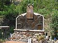
A memorial in Drake for those lost in the 1976 flood.
-
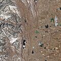
This image shows the steep land and few plants in the Big Thompson Canyon. These factors made the 1976 flood worse.


