2013 Colorado floods facts for kids
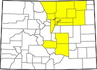
Disaster emergencies were declared by Governor John Hickenlooper in 14 counties (highlighted) in Colorado.
|
|
| Date | September 9, 2013 – September 30, 2013 |
|---|---|
| Location | Colorado, primarily the Front Range, El Paso County and Boulder County, as well as portions of metro Denver |
| Deaths | 8 dead, 1 missing/presumed dead |
| Property damage | Estimated over $1 billion |
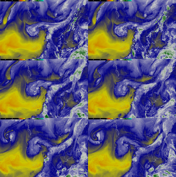
The 2013 Colorado floods were a series of major natural disasters in the U.S. state of Colorado. Starting on September 11, 2013, a slow-moving cold front (a boundary where cold air pushes into warm air) got stuck over Colorado. It met warm, wet air from the south, like during a monsoon.
This mix caused very heavy rain and huge floods along Colorado's Front Range. This area stretches from Colorado Springs north to Fort Collins. The rain got much worse on September 11 and 12. Boulder County was hit the hardest. It received over 9 inches of rain on September 12 alone. By September 15, some areas had received up to 17 inches of rain. This is almost as much rain as Boulder County usually gets in a whole year!
The floods spread across nearly 200 miles from north to south. They affected 17 counties. Governor John Hickenlooper declared a disaster emergency on September 12, 2013. This covered 14 counties, including Adams, Boulder, and Larimer. By September 15, the U.S. government also declared these areas emergencies.
Contents
Why the Floods Happened
Before the storms began on September 9, Colorado had been very dry. The U.S. Drought Monitor said that lots of moisture came from the Gulf of Mexico and the Pacific Ocean. Some of this moisture was from tropical storms. This wet air, combined with the stuck cold front, caused the widespread heavy rain. In some parts of Boulder County, over 20 inches of rain fell. This led to many flash floods, damaged homes, and sadly, some deaths.
Past Floods in Colorado
Colorado is a dry state, but it has a history of flash floods. The earliest recorded flood in Boulder was in 1894. It destroyed a street and flooded much of the downtown area. Another big flood hit Colorado in 1965.
The Big Thompson River starts near Estes Park in northern Colorado. On July 31, 1976, the Big Thompson Flood of 1976 occurred. In just one hour, 8 inches of rain fell. A total of 12 inches fell in the first three hours. This flash flood killed 144 people. It caused about $35 million in damage back then, which would be about $140 million today.
In comparison, the 2013 floods had about 15 inches of rain over a week. This killed 8 people and caused an estimated $2 billion in damage. So, the 2013 flood had more total rainfall. However, the 1976 flood was more intense. The rain fell much faster, catching many people by surprise.
During the 2013 floods, the Big Thompson River near Loveland had very fast water flow. But in 1976, the water flow was much, much faster. So, while 2013 saw the heaviest rainfall, it was not the worst flooding Colorado has ever experienced.
Impact of the Floods
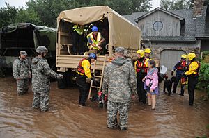
At least eight people died in the floods. Two more were missing and believed to be dead. Over 11,000 people had to leave their homes. The town of Lyons in Boulder County was completely cut off by the flooding. Several earth dams along the Front Range broke or were overflowed.
On September 12, Boulder Creek had a huge amount of water flowing through it. It usually flows at about 150-200 cubic feet per second. During the flood, it reached over 5,000 cubic feet per second! This caused serious damage to buildings along the creek.
By September 14, five people had died. More than 500 people were unaccounted for, but this did not mean they were all missing. Many were just in areas that were hard to reach.
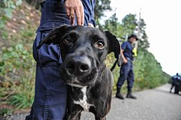
Rescue teams saved at least 1,750 people and 300 pets. They used both air and ground rescues. But rescue efforts were sometimes difficult because of continued rain and low clouds. These conditions kept National Guard helicopters on the ground.
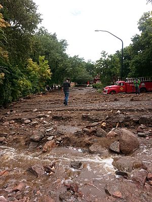
Nearly 19,000 homes were damaged, and over 1,500 homes were completely destroyed. The Colorado Department of Transportation estimated that at least 30 state highway bridges were destroyed. Another 20 were badly damaged. Repairing these roads and bridges was expected to cost many millions of dollars. Miles of train tracks were also washed out or covered by water.
Rainfall totals from September 9–15, 2013, showed huge amounts of rain. Areas like Aurora, Boulder, and Estes Park saw significant totals. Several spots in Boulder city recorded 15 to 20 inches of rain.
Impact by County
- Aurora in Arapahoe County had flash flooding. Over 2 inches of rain fell in just six hours.
- Boulder County received more rain in five days than it usually gets in a whole year. Three deaths were confirmed here. Over 1,600 people were evacuated. 262 homes were destroyed, and almost 300 more were damaged. Roads in Big Thompson Canyon and Buckhorn Canyon were badly damaged. The town of Jamestown lost 20% of its homes and 50% of its roads.
- The Denver area had more flooding in its eastern parts. The city itself received almost 4 inches of rain.
- El Paso County saw Fountain Creek flood. Fort Carson reported almost 19 inches of rain. One person died in Colorado Springs.
- In Jefferson County, Colorado, flooding in Coal Creek Canyon damaged Highway 72, causing it to close. The town of Evergreen had an evacuation notice when Bear Creek (Colorado) reached a flood stage of 9 feet.
- Larimer County was also hit hard. Over 1,100 square miles were affected. 1,500 homes and 200 businesses were destroyed. Another 4,500 homes and 500 businesses were damaged. Roads in Big Thompson Canyon were so damaged that towns like Drake and Glen Haven were cut off. Both U.S. Highways 36 and 34, which lead to Estes Park, were severely damaged. Hundreds of Estes Park residents were also isolated.
- In Logan County, the South Platte River flooded. It reached 11.2 feet high. Many roads were damaged.
- In Morgan County, towns like Goodrich and Orchard had to be evacuated. Floodwaters reached 13 feet high.
- Weld County was flooded by the South Platte River. Flooding affected 3,000 homes, over 350 businesses, and many farms. 122 bridges were damaged. Parts of Greeley and Evans were under mandatory evacuation. Some neighborhoods were completely underwater.
Environmental Concerns
The floods affected farms in northeast Colorado. Water covered fields and pastures, which was expected to cause significant damage to crops.
Many oil and gas wells were shut down. Some were under rushing water. There were worries about broken pipes and storage tanks being swept away, which could cause pollution. One spill released over 5,000 gallons of crude oil into the South Platte River.
Sewage treatment plants were also affected. They released millions of gallons of untreated or partly treated sewage. This led to higher levels of bacteria like E. coli in the water, which can be unsafe.
There were also concerns about fracking wells. Fracking is a process used to get oil from the Earth. Over 1,900 fracking wells were flooded. Water used in fracking, called "produced water," can contain toxic substances. When this water mixed with floodwaters, it could spread these substances across the state.
Scientists are still studying the long-term environmental effects. Past studies show that nature can recover quickly after floods. But pollution from sewage, oil, and fracking wastewater could slow down or change this natural recovery. For example, animals that drink from natural water sources could get sick from the high levels of bacteria.
Help and Support
President Barack Obama first declared a state of emergency for Boulder, El Paso, and Larimer counties. Later, 12 more counties were added. This allowed federal search and rescue teams to help. It also provided supplies like food, water, and generators. Obama also declared a major disaster for Boulder County. This provided federal help for things like temporary housing and home repairs.
A bill was introduced in Congress by Rep. Cory Gardner to help Colorado get more money for road repairs. The floods damaged 200 miles of highway. This bill would allow Colorado to get more than the usual $100 million limit for emergency road projects.
The U.S. federal government had a shutdown from October 1–17, 2013. This temporarily stopped federal money for recovery efforts in Colorado. The state of Colorado started paying the National Guard for their work. They hoped the Federal Emergency Management Agency (FEMA) would pay them back later.
When the government shutdown ended, funding for Colorado's relief efforts was included. The cap for road repair money was raised to $450 million. This kind of increase is common for areas hit by major disasters, like states affected by Hurricane Sandy or Hurricane Katrina.
Other Help
Many organizations also helped flood victims. These included the American Red Cross, The Salvation Army, Save the Children, and the United Way. They accepted donations to help those affected by the floods.
See also
In Spanish: Inundaciones de Colorado de 2013 para niños
 | Aurelia Browder |
 | Nannie Helen Burroughs |
 | Michelle Alexander |


