Bitterwater Creek facts for kids
Quick facts for kids Bitterwater Creek |
|
|---|---|
|
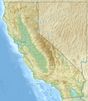
Location of the mouth of Bitterwater Creek in California
|
|
| Native name | Arroyo de Matarano |
| Country | United States |
| State | California |
| Region | San Luis Obispo County, Kern County |
| Physical characteristics | |
| Main source | source 35°27′32″N 120°00′48″W / 35.45889°N 120.01333°W |
| River mouth | mouth Antelope Valley (Kern County), Kern County 735 ft (224 m) 35°38′30″N 119°57′03″W / 35.64167°N 119.95083°W |
| Basin features | |
| Tributaries |
|
Bitterwater Creek is a stream in California, USA. It flows through parts of San Luis Obispo County and Kern County. This creek was originally known by its Spanish name, Arroyo de Matarano, which means "Matarano Creek."
Contents
Where is Bitterwater Creek?
Starting Point of the Creek
Bitterwater Creek begins where two smaller streams, Walnut Creek and Yeguas Creek, meet. This meeting point is in San Luis Obispo County. It's located west of the Temblor Range mountains. It's also east of a large, flat area called the Carrizo Plain. This area is part of the famous San Andreas Fault zone.
How the Creek Flows
The creek first flows northwest through the fault zone. Then, it turns and flows northeast. It passes through the Temblor Range mountains. It also goes south of some hills known as the Shale Hills. Finally, it reaches the Antelope Valley. This is about four miles southeast of a place called Point of Rocks.
History of Bitterwater Creek
An Important Stop on an Old Trail
In the 1800s, Bitterwater Creek was an important stop for travelers. It was a water source along an old trail called El Camino Viejo. This trail was used in Alta California, which is now part of modern-day California. The creek was located between two other stops: Aguaje Del Diablo to the south and Las Tinajas de Los Indios to the north. It was also east of Point of Rocks.
Who Was Juan Matarano?
The creek's original name, Arroyo de Matarano, came from a person named Juan Matarano. He was a well-known Mexican Californio in the mid-1800s. He was a mesteñero, which means a "mustang runner." Mustang runners were people who caught wild horses in the western part of the southern San Joaquin Valley.
The Corral de Matarano
A place called the Corral de Matarano was also named after him. This corral was located near the mouth of the Arroyo. It was a natural stone enclosure formed by sandstone rocks. People added low stone walls to block the openings. This made it a perfect place to gather and hold horses, cattle, and sheep. Water was usually found about eight miles upstream at Ceder Canyon. This was a bit further than the water at Las Tinajas de Los Indios.
Name Change to Bitterwater Creek
The name of the stream was officially changed in March 1909. The U.S. Board on Geographic Names decided to rename it Bitterwater Creek. This new name describes the taste of the creek's water.


