Black Fork Mohican River facts for kids
Quick facts for kids Black Fork Mohican River |
|
|---|---|

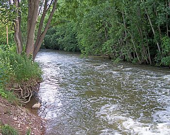
The Black Fork downstream of the dam of Charles Mill Lake in Ashland County, Ohio
|
|
| Country | United States |
| Physical characteristics | |
| Main source | Richland County, Ohio 40°47′18″N 82°36′20″W / 40.78833°N 82.60556°W |
| River mouth | near Loudonville, Ohio 40°36′30″N 82°15′14″W / 40.60833°N 82.25389°W |
| Length | 58.4 mi (94.0 km) |
| Basin features | |
| Basin size | 351 sq mi (910 km2) |
The Black Fork is a cool river in north-central Ohio, United States. It's about 58.4 miles (94.0 km) long. This river is a main branch, or tributary, of the Mohican River.
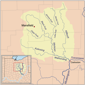
The Black Fork is part of a much bigger water system. Its water flows into the Mohican River. From there, it goes into the Walhonding River, then the Muskingum River, and finally the Ohio River. All these rivers eventually lead to the mighty Mississippi River. This whole area that the Black Fork drains is called its watershed. It covers about 351 square miles (910 km2)!
Historically, people have called this river by other names too. Some old maps or records might show it as "Armstrongs Creek" or "Black Fork Creek."
Where the Black Fork River Starts and Flows
The Black Fork River begins in Richland County, Ohio. Its source is about 7 miles (11 km) west of the city of Mansfield.
From its starting point, the river first flows north. It passes right through the city of Shelby. After Shelby, it turns and flows eastward across the northern part of Richland County.
Journey Through Ohio Counties
The river then makes another turn, heading southeast. It continues this direction for the rest of its journey. This path takes it through eastern Richland County and into southern Ashland County. Along the way, it flows past towns like Perrysville and Loudonville.
The Black Fork's journey ends when it meets another river. It joins the Clear Fork in Ashland County. Together, these two rivers form the main Mohican River. This meeting point is about 2 miles (3.2 km) southwest of Loudonville.
Charles Mill Lake: A River's Transformation
In Ashland County, there's a special dam on the Black Fork River. The United States Army Corps of Engineers built this dam. It was finished in 1936.
This dam is important because it creates Charles Mill Lake. The lake is a large reservoir formed by the river's water. It's a popular spot for fishing and boating!
 | William Lucy |
 | Charles Hayes |
 | Cleveland Robinson |


