Charles Mill Lake facts for kids
Quick facts for kids Charles Mill Lake |
|
|---|---|

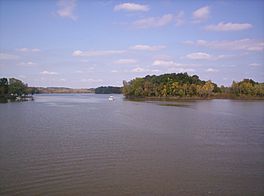
View from the Ohio 430 bridge in Ashland County, Ohio looking north
|
|
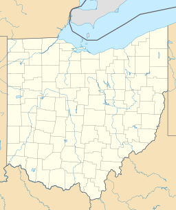
| Location | Ashland / Richland counties, Ohio, U.S. |
| Coordinates | 40°45′49.6″N 82°22′26.4″W / 40.763778°N 82.374000°W |
| Type | reservoir |
| Primary inflows | Black Fork of the Mohican River |
| Primary outflows | Black Fork of the Mohican River |
| Catchment area | 215 sq mi (560 km2) |
| Basin countries | United States |
| Max. length | 5.2 mi (8.4 km) to 19.8 mi (31.9 km) |
| Surface area | 1,350 acres (5.5 km2) to 6,050 acres (24.5 km2) |
| Surface elevation | 1,093 ft (333 m) |
Charles Mill Lake is a large reservoir in central Ohio. It's a great spot for outdoor activities like boating, camping, fishing, hunting, and hiking. The lake is located where State Routes 430 and 603 meet.
You can find Charles Mill Lake in both Richland County (near Mansfield) and Ashland County (near Mifflin). The main dam for the lake is in Ashland County. This lake is part of the Black Fork of the Mohican River. Many local people sometimes call it Mifflin Lake because it's so close to Mifflin, Ohio. The lake is mostly used by people living nearby who enjoy fishing or boating. You can get to the marina from State Route 430.
Contents
History of Charles Mill Lake
The area around Charles Mill Lake has a rich history, especially during the War of 1812. This was a time when settlers and Native American groups sometimes had conflicts.
Early Conflicts in the Area
During the War of 1812, there were some difficult events near where the dam is now. After some Native American groups, like the Piqua Indians, moved from their homes in Greentown, tensions grew. There were incidents where settlers and Native Americans clashed. For example, the families of Frederick Zimmer and James Copus experienced these conflicts.
Remembering the Past
Today, you can find a historical marker at the lake. It tells stories about the "Frontier Violence During the War of 1812" and "English-Allied Indian Attacks." There's also a monument on Route 603, close to the dam, that honors these historical events.
How Charles Mill Lake Got Its Name
The name "Charles Mill Lake" comes from a person named J. Charles. He used to run a sawmill in the area where the park below the dam is now. A sawmill is a place where logs are cut into lumber. This mill was operating around 1874, according to an old map called Caldwell's Atlas of Ashland County.
Understanding the Charles Mill Dam
The Charles Mill Dam is a very important structure. It helps manage the water in the Black Fork of the Mohican River.
Where is the Dam Located?
The Charles Mill Dam is about 10 miles (16 km) east of Mansfield, Ohio, and 10 miles (16 km) southwest of Ashland, Ohio. Even though the lake is in two counties, the dam itself is located in Ashland County.
Building the Dam
The dam was built between 1935 and 1936. Its main job is to help with flood control, which means it prevents too much water from causing floods. But it's also used for fun activities like recreation, and for managing fish and wildlife.
How the Dam Works
The Charles Mill Dam is an "earth fill dam." This means it's made mostly of earth and has a special clay core inside that stops water from seeping through. The dam is about 48 feet (15 m) high, 1,390 feet (420 m) long, and 20 feet (6.1 m) wide.
The system that helps control floods also includes two smaller walls called dikes and one levee. These structures, along with the dam, hold back water from a large area of 215 square miles (560 km2). This is the "drainage area" that feeds water into the dam.
The dam also has two spillways. These are like emergency exits for water. They help handle any extra water that goes above the maximum amount the dam is designed to hold. There are also five gates that let water pass through the dam in a controlled way.
Lake Levels and Size
During the summer, the lake is usually kept at about 31 feet (9.4 m) deep near the dam. At this level, the lake covers about 1,350 acres (5.5 km2) of water surface. The water backs up the Black Fork for about 5.2 miles (8.4 km).
When the dam is holding the most flood water it can, the lake can grow much larger. It would cover about 6,050 acres (24.5 km2) of water surface. At that point, the water would stretch back up the Black Fork for about 19.8 miles (31.9 km)!
 | Percy Lavon Julian |
 | Katherine Johnson |
 | George Washington Carver |
 | Annie Easley |


