Blackstone Edge facts for kids
Quick facts for kids Blackstone Edge |
|
|---|---|

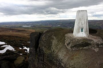
The highest point of Blackstone Edge
|
|
| Highest point | |
| Elevation | 1,549 ft (472 m) |
| Geography | |
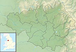
| Location | Littleborough, Greater Manchester, England |
| Parent range | Pennines |
| OS grid | SD977163 |
Blackstone Edge is a tall, rocky ridge in the Pennine hills of England. It stands 1,549 feet (472 meters) high. This area is surrounded by open moorland. It sits right on the border between Greater Manchester and West Yorkshire.
Contents
History of Blackstone Edge
Ancient Roads and Markers
A famous old road called Blackstone Edge Long Causeway passes by the ridge. People once thought it was a Roman road. However, after studies by James Maxim, it is now believed to be a turnpike or packhorse route from 1735. A turnpike was a road where you paid a toll to use it. A packhorse route was used by horses carrying goods.
Next to this old road is the Aiggin Stone. This is a tall stone pillar that might have been a way-marker. It also marks the boundary between the counties. The stone has a cross and the letters I and T carved into it. Its name might come from French words meaning "needle" or "eagle."
Blackstone Edge During the English Civil War
During the English Civil War in the 1640s, Blackstone Edge was important. This war was fought between the Parliamentarians (called "Roundheads") and the Royalists (called "Cavaliers"). The Parliamentarians sent 800 soldiers to build defenses here. They successfully defended it against an attack by the Royalist cavalry.
Famous Visitors and Meetings
Around 1700, a traveler named Celia Fiennes wrote about her journey over Blackstone Edge. Later, in 1846, a huge meeting took place here. Up to 30,000 people gathered to support Chartism. Chartism was a movement where working-class people wanted more rights, like the right to vote.
Sports and Views at Blackstone Edge
Walking and Climbing
Blackstone Edge is a popular spot for people who love to walk and climb. Rock climbers use its routes for both traditional climbing and bouldering. The crag was even featured in an early rock-climbing guide from 1913.
There are several walking paths around Blackstone Edge. One popular route starts from Hollingworth Lake near Littleborough. Another path connects Blackstone Edge to Hebden Bridge. The Pennine Way, a very long walking path that goes across England, also passes along the top of Blackstone Edge.
Amazing Views
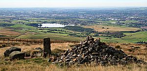
From the top of Blackstone Edge, you can see far and wide. On a clear day, you might spot Manchester city centre. You can also see Winter Hill in the West Pennine Moors. If the weather is very clear, you might even see mountains in North Wales!
Cycling Challenges
Halifax Road, which climbs up towards Blackstone Edge reservoir, is a favorite route for cyclists. It's a challenging climb, rising 240 meters from the center of Littleborough. This makes it a recognized "category 3 climb" for cyclists.
 | Charles R. Drew |
 | Benjamin Banneker |
 | Jane C. Wright |
 | Roger Arliner Young |


