Boat Encampment facts for kids
Quick facts for kids
Boat Encampment
|
|
|---|---|
| Country | Canada |
| Province | British Columbia |
| Region | Columbia Valley/East Kootenay |
| Regional District | Columbia-Shuswap |
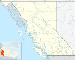
Boat Encampment is a ghost town in southeastern British Columbia, Canada. It was once an important spot on the Columbia River, especially for fur traders. Today, it's a quiet area, about 151 kilometers (94 miles) northwest of Golden and 159 kilometers (99 miles) north of Revelstoke.
Contents
Where Was Boat Encampment?
The original location of Boat Encampment was on a long, wooded point between the mouths of the Canoe River and the Wood River. Over time, its exact spot on maps changed a bit.
Later, a highway bridge was built nearby, and this bridge area became known as Boat Encampment. In 1943, this historic place was named a National Historic Site of Canada. However, in 1973, the area was flooded when the Mica Dam created the large Kinbasket Lake. Because of this, the historic marker had to be moved. In 2000, a new memorial plaque was placed at a visitor site on the south side of the Columbia River.
Why Was This Place Important?
Boat Encampment became famous because of David Thompson, a fur trader from the North West Company. In 1810, he was trying to cross the Continental Divide (the main mountain range) but was blocked by a group of Native Americans. This forced him and his team to find a new route north.
Thompson's Journey
- In January 1811, after a very difficult journey, Thompson's group reached the Boat Encampment area.
- Some of his team members left because they were unhappy.
- The rest of the group tried to go further up the Columbia River but decided to return to Boat Encampment.
- They built a cabin there and spent the winter.
- During this time, Thompson built a canoe using cedar wood, as birch bark was not available. He named the nearby waterway the Canoe River.
- In the spring, they continued their journey down the Columbia River to the coast.
A Key Fur Trade Route
Within a few years, the new route Thompson found, called the Athabasca Pass, became the main way for fur traders to cross the mountains. When the North West Company joined with the Hudson's Bay Company (HBC) in 1821, the HBC continued to use this route. It was part of their "Express" route, which connected the west coast with Hudson Bay once or twice a year. From Boat Encampment, it was about 1,477 kilometers (918 miles) by river to Fort Vancouver.
The trail from Boat Encampment went northeast along the Wood River, through places like Athabasca Pass, and ended at Jasper House. Over time, the eastern end of the trail moved further west.
At Boat Encampment, there were cabins, stables for horses, and a boathouse. Fur traders traveling east would swap their boats for horses and snowshoes. Those traveling west would do the opposite. Sometimes, groups had to wait for weeks for the other party to arrive. After 1849, the HBC started using a different route through Tête Jaune Cache and the Fraser River, so Boat Encampment became less important.
Later, from the late 1890s to early 1900s, Boat Encampment was known as a mining camp.
What Was It Called Before?
Boat Encampment had several earlier names:
- Canoe camp
- Portage Point
- Rocky Mountain Portage
- Mountain House
The name "Boat Encampment" became common in the 1830s. Around 1900, it was also sometimes called "Big Bend," but this name was used for a larger area too. The mountain pass itself was also known as Rocky Mountain Portage, Columbia Pass, or Boat Encampment Pass.
Famous Visitors
Many important people visited Boat Encampment over the years:
- 1825: Governor George Simpson of the Hudson's Bay Company.
- 1827, 1828: Francis Ermatinger, another fur trader.
- 1828: David Douglas, a famous botanist (plant scientist).
- 1838: Fathers Blanchet and Demers held the first Catholic mass on the mainland of what would become British Columbia.
- 1845: Lieutenant Henry Warre drew sketches of the area during his travels.
- 1846, 1847: Paul Kane also made sketches. His later paintings based on these drawings sometimes made the landscape look even more dramatic than it was.
Ferries and Bridges
At Boat Encampment, the Columbia River was about 55 meters (60 yards) wide. The Canoe River mouth was about 36 meters (40 yards) wide. Downstream, there were dangerous rapids called the Dalles des Morts.
- A ferry was set up in 1900 but stopped running a few years later.
- In 1910, a new ferry was started to connect the Big Bend area with Tête Jaune. This ferry could carry horses and wagons and operated until at least 1916.
- A highway bridge was built by 1936. The official opening of the highway was held at this bridge in June 1940.
- By 1973, when the dam flooded the area, the highway was not used much anymore.
- In 1970–71, a tall logging truck damaged the bridge, but it was repaired. Warning signs were then put up to prevent future damage.
Images for kids
 | DeHart Hubbard |
 | Wilma Rudolph |
 | Jesse Owens |
 | Jackie Joyner-Kersee |
 | Major Taylor |


