Borough of Bedford facts for kids
Quick facts for kids
Bedford
Borough of Bedford
|
||
|---|---|---|
|
Borough and unitary authority
|
||
|
||
|
||
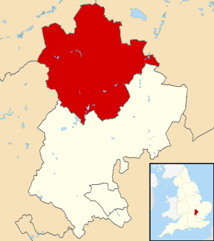
Bedford shown within Bedfordshire
|
||
| Sovereign state | ||
| Country | ||
| Region | East of England | |
| Ceremonial county | Bedfordshire | |
| Administrative HQ | Borough Hall, Bedford | |
| Government | ||
| • Type | Unitary Authority | |
| Area | ||
| • Total | 476.4 km2 (183.9 sq mi) | |
| Population
(2005 est.)
|
||
| • Total | 173,292 | |
| • Rank | 113th | |
| Ethnicity (2021) | ||
| • Ethnic groups |
List
|
|
| Religion (2021) | ||
| • Religion |
List
47.6% Christianity
34.1% no religion 11.2% other 7.1% Islam |
|
| Time zone | GMT | |
| • Summer (DST) | British Summer Time | |
| ONS code | 00KB | |
| NUTS 3 | UKH22 | |
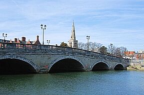
Bedford, also known as the Borough of Bedford, is a town in England. It's located in the county of Bedfordshire. Bedford is special because it's a "unitary authority." This means its local government, the Bedford Borough Council, handles most public services. These services include things like schools, social care, and transport for the area. Bedford is also the main town of Bedfordshire.
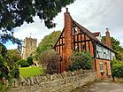
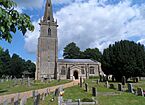
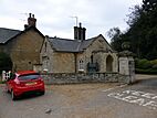
The Bedford area includes the town itself and nearby places like Kempston and Biddenham. It also has many smaller villages. Most people in the borough live in the main town area and five large villages around it. This main area makes up less than 6% of the borough's total land. A new settlement called Wixams was built south of Bedford, with its first residents moving in during 2009.
Contents
History of Bedford
Early Beginnings
The town of Bedford has a very long history. It was a special type of town called a "borough" even before official records began. The oldest surviving document about Bedford was written around 1166 by King Henry II. This document confirmed that Bedford could keep its old rights and customs. Later, in 1835, Bedford officially became a "municipal borough" under a new law.
Changing Boundaries
On April 1, 1974, the area of Bedford changed. The old borough of Bedford joined with Kempston Urban District and Bedford Rural District. This new, larger area was first called the "District of Bedford." In 1975, it was given "borough status" and renamed North Bedfordshire. However, in 1992, the borough changed its name back to Bedford.
Becoming a Unitary Authority
In 2009, there was a big change in how local government worked in Bedfordshire. The Bedford Borough Council became a "unitary authority." This meant it took over many responsibilities that were previously handled by the larger Bedfordshire County Council. These new responsibilities included things like education, social services, and managing local transport.
How Bedford is Governed
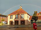
The local government for Bedford is the Bedford Borough Council. This council is based at Borough Hall. This building is located on Cauldwell Street, right by the River Great Ouse in the center of Bedford. Before 2009, it was called County Hall and was the main office for Bedfordshire County Council.
The area governed by the Bedford Borough Council is divided into 28 smaller sections. These sections are called "wards." People living in each ward vote for their representatives to be on the Borough Council.
Local Parishes
Most of the main town area of Bedford doesn't have its own local parish council. However, a parish called Brickhill was created within this area in 2004. The rest of the borough, especially the rural parts, is divided into smaller areas called "civil parishes." These parishes often have their own local councils. Kempston is the only parish in the borough that has a "town council."
Some of the parishes in the Bedford Borough include:
- Biddenham
- Bromham
- Cardington
- Clapham
- Cople
- Elstow
- Great Barford
- Harrold
- Kempston
- Oakley
- Pavenham
- Renhold
- Sharnbrook
- Stewartby
- Thurleigh
- Turvey
- Willington
- Wixams
- Wootton
Freedom of the Borough
The "Freedom of the Borough" is a special honor given by the Bedford Borough Council. It's a way to recognize people or groups who have done great things for the area. It's a very old tradition.
Honored Individuals
- Etienne Stott: He received this honor on December 11, 2012.
Honored Military Units
Several military groups have also received this special recognition:
- Bedfordshire and Hertfordshire Regiment: Honored in November 1955.
- RAF Cardington: Received the honor on July 16, 1959.
- 1st Battalion Royal Anglian Regiment: Honored in 1980.
- RAF Henlow: Received the honor on September 26, 1992.
- 134 (Bedford) Squadron Air Training Corps: Honored on August 1, 1999.
See also
 In Spanish: Bedford (autoridad unitaria) para niños
 | Mary Eliza Mahoney |
 | Susie King Taylor |
 | Ida Gray |
 | Eliza Ann Grier |


