Bottle Creek Indian Mounds facts for kids

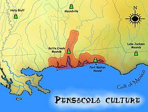
Bottle Creek Mounds and related Mississippian sites
|
|
| Location | Stockton, Alabama, Baldwin County, Alabama, |
|---|---|
| Region | Baldwin County, Alabama |
| Coordinates | 31°0′31.69″N 87°56′26.04″W / 31.0088028°N 87.9405667°W |
| History | |
| Founded | 1250 |
| Abandoned | 1550 |
| Cultures | Pensacola culture |
| Site notes | |
| Excavation dates | 1932 |
| Archaeologists | David L. DeJarnette |
| Architecture | |
| Architectural styles | platform mound |
| Architectural details | Number of temples: |
|
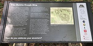
Bottle Creek Site
|
|
| NRHP reference No. | 74000398 |
| Significant dates | |
| Added to NRHP | December 2, 1974 |
| Designated NHL | April 19, 1994 |
The Bottle Creek Indian Mounds (also called 1BA2) is an amazing ancient site. It is found on a swampy island in the Mobile–Tensaw River Delta in Alabama, United States. This special place was once home to the Pensacola culture people. They were part of the larger Mississippian culture.
Bottle Creek is the biggest Mississippian site on the central Gulf Coast. It helps us understand the history of the Mobile-Tensaw delta long ago. Because it is so important, it was named a National Historic Landmark in 1995. It is one of only two such sites in Alabama.
Contents
What are the Bottle Creek Mounds?
The Bottle Creek site was used between the years 1250 and 1550. It was a very important place for people to meet and trade. It connected different Mississippian groups along the coast and in the Southeastern United States.
The site is on Mound Island, north of Mobile. It has 18 large platform mounds. These mounds are like big, flat-topped hills built by people. The tallest mound is about 45 feet (14 meters) high. Five of these mounds are placed around a central open area called a plaza.
Why was this location special?
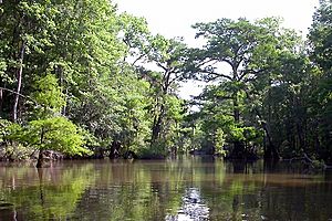
Bottle Creek was the largest chiefdom (a type of community led by a chief) in the north-central Gulf Coast. It was hard to reach by walking because it was surrounded by swamp. But it was easy to get to by dugout canoe. Canoes were the main way people traveled in this area.
The site is near where the Tombigbee and Alabama rivers meet. This area has many small streams and waterways. Bottle Creek was a center for ceremonies, social gatherings, politics, religion, and trade. It was important for the entire Mobile Delta region.
How was the site discovered?
People first mapped the Bottle Creek site in the 1880s. But its hidden location in the middle of the delta kept it safe. It was surrounded by swamp and huge cypress trees. This protected it from people who might have damaged other ancient sites.
Even though it seemed remote, Bottle Creek was a main gateway to the Pensacola society. It was first studied by experts in 1932. David L. DeJarnette, from the Alabama Museum of Natural History, led this work. He wanted to see if Bottle Creek was connected to Moundville. Moundville is another large ancient site linked by a river system.
The Bottle Creek site was added to the National Register of Historic Places in 1974.
Visiting Bottle Creek Mounds
Because the site is in a remote area, you can only visit it by watercraft. Tours leave from Stockton, Alabama. Boat tours usually take about 4 hours. If you go by canoe or kayak, it can take 6 to 8 hours.
The trips include traveling to Mound Island. Guides share information about the Mississippian culture people who lived there. You can learn about their sports, food, and way of life. You can also visit the top of the largest mound.
See also
 In Spanish: Montículos de Bottle Creek para niños
 | Percy Lavon Julian |
 | Katherine Johnson |
 | George Washington Carver |
 | Annie Easley |


