Boulder River (southwestern Montana) facts for kids
Quick facts for kids Boulder River |
|
|---|---|
|
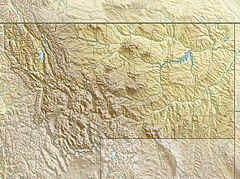
Location of the mouth of the southwestern Boulder River in Montana
|
|
| Country | United States |
| State | Montana |
| County | Jefferson |
| Physical characteristics | |
| Main source | Continental Divide Boulder Mountains, Beaverhead-Deerlodge National Forest 7,339 ft (2,237 m) 46°11′22″N 112°31′54″W / 46.18944°N 112.53167°W |
| River mouth | Jefferson River Cardwell 4,278 ft (1,304 m) 45°52′01″N 111°56′44″W / 45.86694°N 111.94556°W |
| Length | 77.3 mi (124.4 km) |
The Boulder River is a cool river in southwestern Montana, in the United States. It's about 77-mile (124 km) long. This river flows into the Jefferson River.
Where Does the River Start and End?
The Boulder River starts high up in the Rocky Mountains. It begins near the continental divide, which is like a big line where water flows to different oceans. This spot is in the Beaverhead-Deerlodge National Forest in Jefferson County.
From there, the river flows east and then southeast. It passes by the town of Boulder. Finally, it turns south and joins the Jefferson River near a place called Cardwell.
Fish You Can Find Here
The Boulder River is a great place for fishing! Many different kinds of fish live in its waters.
You can find several types of trout here, including:
Brown trout are most common closer to where the river meets the Jefferson River. The other types of fish, like brook, rainbow trout, and mountain whitefish, are more common further upstream, especially above the town of Boulder.
River Health and Water Use
Like many rivers, the Boulder River is used by people. The lower 12 miles (19 km) of the river has less water sometimes. This is because some water is taken out for irrigation, which helps farmers water their crops.
Also, near the community of Basin, the water can be affected by old mining areas. This means the water quality might not be as clear in those spots.
 | Madam C. J. Walker |
 | Janet Emerson Bashen |
 | Annie Turnbo Malone |
 | Maggie L. Walker |


