Boyle Heights, Los Angeles facts for kids
Quick facts for kids
Boyle Heights
|
|
|---|---|
|
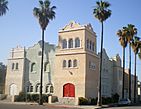
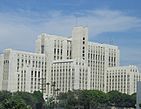
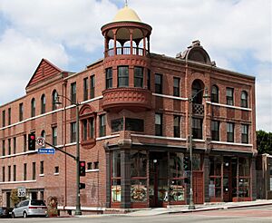
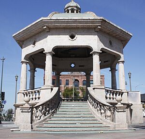
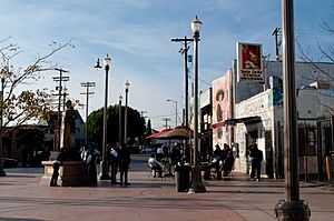
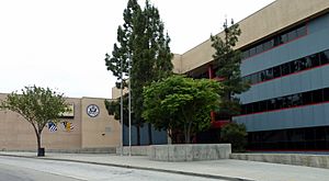
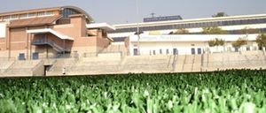
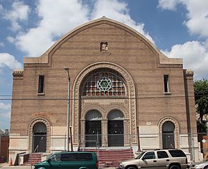
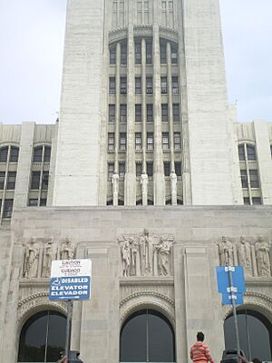
Top: Mariachi Plaza; St. Mary's Church; bottom: Calvary Church; LAC+USC Medical Center.
|
|
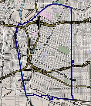
Boundaries of Boyle Heights
as drawn by the Los Angeles Times |
|
| Country | United States |
| State | California |
| County | Los Angeles |
| City | Los Angeles |
| Area | |
| • Total | 6.5 sq mi (17 km2) |
| Population
(2000)
|
|
| • Total | 92,785 |
| • Density | 14,262/sq mi (5,507/km2) |
| ZIP Codes |
90023, 90033, 90063
|
| Area code(s) | 213/323 |
Boyle Heights is a historic neighborhood in Los Angeles, California. It is located east of the Los Angeles River. This area is well-known for its strong Chicano/Mexican American culture. It is home to famous places like Mariachi Plaza and hosts fun events such as the yearly Día de los Muertos (Day of the Dead) celebrations.
Contents
History of Boyle Heights
Boyle Heights was once called Paredón Blanco, which means "White Bluff" in Spanish. In 1845, a small group of Tongva people moved here. They were forced to leave their old village, Yaanga, by a German immigrant.
In 1846, the United States took control of Los Angeles. The Tongva people were moved again, and their settlement was destroyed. This pushed the last generation of Yaangavit villagers into another part of the city.
The area was later named after Andrew Boyle. He was an Irishman who bought 22 acres of land overlooking the Los Angeles River in 1858. He started growing grapes and making wine. His son-in-law, William Workman, helped build important things for the area.
In the early 1900s, Boyle Heights was special. It was one of the few places where people of different backgrounds could live without rules stopping them. This meant Japanese, Mexican, and other families could find homes here.
A Diverse Community
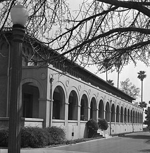
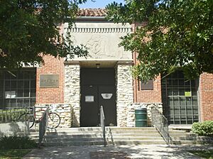
From the 1920s to the 1960s, Boyle Heights was a very diverse place. Many Jewish, Mexican, and Japanese immigrants lived there. There were also people from Yugoslavia, Armenia, Africa, and Russia.
A sociologist named Bruce Phillips studied Jewish communities. He said that Jewish families left Boyle Heights not because of racism. Instead, banks made it hard for people to get home loans in the area. This practice is called "redlining." Also, many freeways were built through the community.
Freeway Construction and Changes
In 1961, work began on the East LA Interchange. This is a huge highway system, much larger than average. It handles about 1.7 million vehicles every day. This makes it one of the busiest and most polluted areas in the world.
These changes affected Boyle Heights. Even with these challenges, the neighborhood has remained a strong, multicultural place. It is known for celebrating its different cultures.
In 2017, some residents protested new businesses moving in. They felt these changes were making the neighborhood too expensive for local families. This idea has even been shown in TV shows like Vida and Gentefied, which are set in Boyle Heights.
Who Lives in Boyle Heights?
In 2000, about 92,785 people lived in Boyle Heights. The neighborhood was mostly Latino (94%). There were also smaller groups of Asian (2.3%), White (2.0%), and African American (0.9%) residents.
The average household income was $33,235, which was lower than other parts of Los Angeles. The people living here were also quite young. The average age was just 25 years old.
By 2011, about 95% of the community was Hispanic and Latino. This included Mexican Americans, Mexican immigrants, and people from Central America. A writer for the Los Angeles Times said that the diversity in Boyle Heights today is mostly within the Latino community itself.
Education in Boyle Heights
In 2000, only about 5% of adults aged 25 and older in Boyle Heights had a four-year degree. This was a low percentage compared to the rest of the city and county. Also, many residents in that age group had not finished high school.
Public Schools
- SIATech Boyle Heights Independent Study, Charter High School, 501 South Boyle Avenue
- Extera Public School, Charter Elementary, 1942 E. 2nd Street and 2226 E. 3rd Street
- Extera Public School #2, Charter Elementary, 1015 S. Lorena Street
- Francisco Bravo Medical Magnet High School, alternative, 1200 North Cornwell Street
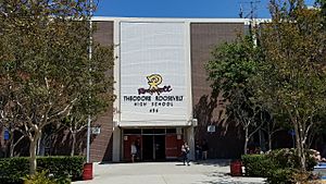
- Theodore Roosevelt High School, 456 South Mathews Street
- Mendez High School 1200 Playa Del Sol
- Animo Oscar De La Hoya Charter High School, 1114 South Lorena Street
- Boyle Heights Continuation School, 544 South Mathews Street
- Central Juvenile Hall, 1605 Eastlake Avenue
- Hollenbeck Middle School, 2510 East Sixth Street
- Robert Louis Stevenson Middle School, 725 South Indiana Street
- KIPP Los Angeles College Preparatory, charter middle, 2810 Whittier Boulevard
- Murchison Street Elementary School, 1501 Murchison Street
- Evergreen Avenue Elementary School, 2730 Ganahl Street
- Sheridan Street Elementary School, 416 North Cornwell Street
- Malabar Street Elementary School, 3200 East Malabar Street
- Breed Street Elementary School, 2226 East Third Street
- First Street Elementary School, 2820 East First Street
- Second Street Elementary School, 1942 East Second Street
- Soto Street Elementary School, 1020 South Soto Street
- Euclid Avenue Elementary School, 806 Euclid Avenue
- Sunrise Elementary School, 2821 East Seventh Street
- Utah Street Elementary School, 255 Gabriel Garcia Marquez Street
- Bridge Street Elementary School, 605 North Boyle Avenue
- Garza (Carmen Lomas) Primary Center, elementary, 2750 East Hostetter Street
- Christopher Dena Elementary School, 1314 Dacotah Street
- Learning Works Charter School, 1916 East First Street
- Lorena Street Elementary School, 1015 South Lorena Street
- PUENTE Learning Center, 501 South Boyle Avenue
- East Los Angeles Occupational Center (Adult Education), 2100 Marengo Street
- Endeavor College Preparatory Charter School, 1263 S Soto St, Los Angeles, CA 90023
Private Schools
- Bishop Mora Salesian High School, 960 South Soto Street
- Santa Teresita Elementary School, 2646 Zonal Avenue
- Assumption Elementary School, 3016 Winter Street
- Saint Mary Catholic Elementary School, 416 South Saint Louis Street
- Our Lady of Talpa, elementary, 411 South Evergreen Avenue
- East Los Angeles Light and Life Christian School, 207 South Dacotah Street
- Santa Isabel Elementary School, 2424 Whittier Boulevard
- Dolores Mission School, elementary, 170 South Gless Street
- Cristo Viene Christian School, 3607 Whittier Boulevard
- Resurrection, elementary, 3360 East Opal Street
- White Memorial Adventist School, 1605 New Jersey Street
- PUENTE Learning Center, 501 South Boyle Avenue
Famous Places in Boyle Heights
Still Standing Today
- Breed Street Shul: A historic Jewish temple.
- Self-Help Graphics and Art: This place was the first to create a free public celebration of Day of the Dead in the country.
- Los Angeles County+USC Medical Center/Keck School of Medicine of USC: A large hospital and medical school.
- Los Angeles County Department of Coroner: Where investigations into deaths happen.
- Estrada Courts Murals: Famous wall paintings.
- Evergreen Cemetery: A historic cemetery.
- Hazard Park: A local park.
- Mariachi Plaza: A central gathering spot, especially for mariachi musicians.
- Hollenbeck Park: Another popular park.
- Linda Vista Community Hospital: A former hospital, now apartments.
- Sears Building: A large, historic building.
- Malabar Public Library: A local library.
- Lucha Underground Temple: Where the TV show Lucha Underground was filmed.
- St. Mary's Catholic Church: A historic church.
No Longer Standing
- Soto-Michigan Jewish Community Center
- Aliso Village
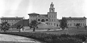
- Sisters Orphan Home: This building was taken down because of earthquake damage and freeway construction.
Notable People from Boyle Heights
Many interesting people have come from Boyle Heights!
Sports Stars
- Lillian Copeland (1904–1964): An Olympic discus champion who set world records.
- William Harmatz: A famous jockey.
- Ron Mix (born 1938): A Football Hall of Famer.
- Donald Sterling: Former owner of the Los Angeles Clippers basketball team.
Artists and Performers
- Oscar Zeta Acosta: A lawyer, writer, and community activist.
- Lou Adler: A record producer and manager.
- Herb Alpert: A famous musician.
- Greg Boyle: A Catholic priest and community activist.
- Richard Duardo: A master printmaker and artist.
- Norman Granz: A musician.
- Josefina López: A writer.
- Anthony Quinn: A well-known actor.
- Andy Russell: An international singing star.
- Julius Shulman: A photographer.
- Taboo: A rapper.
- will.i.am: A recording artist and music producer.
- Kenny Endo: A taiko drummer.
- Rubén Guevara: A writer, poet, musician, and activist.
Other Notable People
- Irma Resendez (born 1961): An advocate, author, and founder of an organization.
See also
 In Spanish: Boyle Heights para niños
 | Emma Amos |
 | Edward Mitchell Bannister |
 | Larry D. Alexander |
 | Ernie Barnes |


