Brady Peak facts for kids
Quick facts for kids Brady Peak |
|
|---|---|

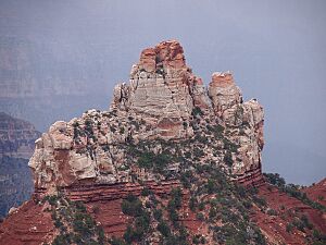
Southwest aspect, from Vista Encantada
|
|
| Highest point | |
| Elevation | 8,121 ft (2,475 m) |
| Prominence | 481 ft (147 m) |
| Isolation | 2.07 mi (3.33 km) |
| Parent peak | Mount Hayden (8,362 ft) |
| Geography | |
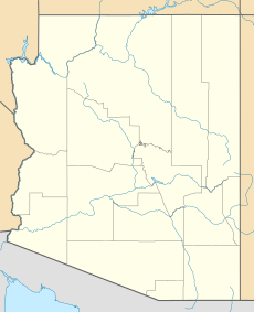
| Location | Grand Canyon National Park Coconino County, Arizona, US |
| Parent range | Kaibab Plateau Colorado Plateau |
| Topo map | USGS Walhalla Plateau |
| Geology | |
| Age of rock | Permian |
| Type of rock | Coconino Sandstone, Hermit Shale |
| Climbing | |
| Easiest route | class 5.2 climbing |
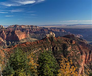
Brady Peak is a mountain in the Grand Canyon area of northern Arizona, United States. It stands about 8,121 feet (2,475 meters) tall. You can find it about one mile northeast of the Vista Encantada viewpoint on the Grand Canyon's North Rim. From there, it rises an amazing 4,800 feet (1,463 meters) above the bottom of Nankoweap Canyon.
The mountain's closest taller neighbor is Mount Hayden, which is about two miles to the north. Another peak, Alsap Butte, is one mile to the northeast. Brady Peak is named after Peter Rainsford Brady (1825–1902). He was an important pioneer and politician in the early days of the Arizona Territory. The name "Brady Peak" was officially recognized in 1932 by the U.S. Board on Geographic Names. The area around Brady Peak has a cold semi-arid climate, which means it's usually dry and cool.
What is Brady Peak Made Of?
The very top of Brady Peak is made of a light-colored rock called Coconino Sandstone. This sandstone formed about 265 million years ago from ancient sand dunes. It's one of the younger rock layers you can see in the Grand Canyon.
Below the Coconino Sandstone, you'll find a reddish, sloped rock layer called the Hermit Formation. Underneath that is the Supai Group. Any rain that falls on Brady Peak eventually flows into the Colorado River through a stream called Nankoweap Creek.
 | Isaac Myers |
 | D. Hamilton Jackson |
 | A. Philip Randolph |


