Bransfield Strait facts for kids
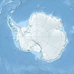
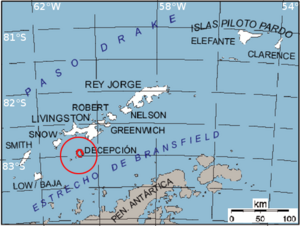
The Bransfield Strait is a wide stretch of ocean located in Antarctica. It is also sometimes called the Fleet Sea. This strait is about 100 kilometers (62 miles) wide and stretches for about 480 kilometers (300 miles). It lies between the South Shetland Islands and the Antarctic Peninsula.
Contents
History of the Strait
The Bransfield Strait was named around 1825 by James Weddell. He was a Master in the Royal Navy. The strait was named after Edward Bransfield, another Royal Navy Master. Edward Bransfield had mapped the South Shetland Islands in 1820.
The country of Argentina calls this area the Mar de la Flota, which means "Sea of the Fleet."
A Ship Incident
On November 23, 2007, a ship called the MS Explorer hit an iceberg and sank in the strait. Luckily, all 154 people on board were rescued safely, and no one was hurt.
What the Strait is Like
Underneath the Bransfield Strait, there is a deep underwater valley. This valley is known as the Bransfield Trough. It is about 400 kilometers (250 miles) long and 2 kilometers (1.2 miles) deep. This trough is located between the South Shetland Island chain and the Antarctic Peninsula.
How the Trough Formed
The Bransfield Trough was created by the Earth's crust slowly pulling apart. This process, called "rifting," started about 4 million years ago. Because the Earth's crust is still pulling apart, there are often earthquakes and volcanoes in this area.
The strait also has a chain of underwater mountains called seamounts. These seamounts are actually old volcanoes. One of them is the Orca Seamount. Even though it's not erupting now, scientists think it was active in the recent past. They have found warmer water around it. Tiny living things that love hot temperatures have also been found near the Orca Seamount. This might mean that hot water from the seamount travels through cracks in the seafloor. It could also mean that ocean currents carry warm water from Deception Island, which is an active volcano nearby.
Special Geographic Spots
There are a few interesting rock formations in the Bransfield Strait:
Nomad Rock
Nomad Rock is a single, isolated rock in the strait. It is about 9 kilometers (5 nautical miles) off the northern coast of Trinity Peninsula. It's also about 17 kilometers (9 nautical miles) northeast of Cape Legoupil. This rock was named by the United Kingdom Antarctic Place-Names Committee. They chose the name "Nomad" because there was some confusion about where different points along this coast were located on maps.
Zélée Rocks
The Zélée Rocks are a group of rocks in the Bransfield Strait. Some of these rocks stick out of the water, while others are just below the surface. They are located about 31 kilometers (17 nautical miles) north of Prime Head. Prime Head is the very northern tip of the Antarctic Peninsula.
These rocks were found by a French expedition between 1837 and 1840. The expedition was led by Captain Jules Dumont d'Urville. He named the rocks after one of his expedition's ships, a small warship called the Zélée.
A Protected Ocean Area
A special part of the Bransfield Strait, covering about 1,021 square kilometers (394 square miles), is protected. This area is off the western and southern coasts of Low Island. It has been named an Antarctic Specially Protected Area (ASPA 152).
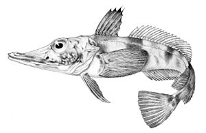
This area is important because it's one of only two known places near the United States’s Palmer Station where scientists can use special nets to study fish and other creatures that live on the seafloor. Scientists from Palmer Station have been collecting fish here since the early 1970s. It is known as a very important place where several fish species lay their eggs. These include the Black Rockcod and the Blackfin Icefish.
See also
 In Spanish: Estrecho de Bransfield para niños
 | Laphonza Butler |
 | Daisy Bates |
 | Elizabeth Piper Ensley |


