British Columbia Highway 16 facts for kids
Quick facts for kids
Highway 16 |
||||
|---|---|---|---|---|
| Yellowhead Highway Trans-Canada Highway |
||||
|
Highway 16 highlighted in red.
|
||||
| Route information | ||||
| Length | 1,173 km (729 mi) | |||
| Existed | 1953–present | |||
| Haida Gwaii segment | ||||
| Length | 101 km (63 mi) | |||
| North end | Masset | |||
| South end | ||||
| Mainland segment | ||||
| Length | 1,072 km (666 mi) | |||
| West end | ||||
| Major junctions |
||||
| East end | Alberta border continues as |
|||
| Highway system | ||||
British Columbia provincial highways
|
||||
Highway 16 is a major road in British Columbia, Canada. It is a key part of the Yellowhead Highway. This larger highway stretches across Western Canada. Highway 16 is also part of the Trans-Canada Highway system. It follows the route of the northern Canadian National Railway line very closely.
The number "16" was first given to this highway in 1942. Back then, it was shorter and located a bit more to the north. It originally ran from New Hazelton to Aleza Lake. Over the years, the highway was extended. In 1947, its western end moved to the coastal city of Prince Rupert. By 1953, it was re-aligned to reach Prince George. In 1969, a new section opened, extending east into Yellowhead Pass. This part was built to be usable in all types of weather. Finally, in 1984, Highway 16 was extended to the Haida Gwaii islands. BC Ferries started offering service along this route the next year.
Contents
Exploring British Columbia's Highway 16
Highway 16 is a very long road, covering about 1,173 kilometers (729 miles) in British Columbia. It connects many different communities and landscapes.
The Haida Gwaii Island Section
The first part of Highway 16 is on Graham Island, one of the Haida Gwaii islands. This section is about 101 kilometers (63 miles) long. It starts in the village of Masset on the northern coast.
From Masset, the highway travels south for about 38 kilometers (24 miles) to Port Clements. It then winds along the edge of Naikoon Provincial Park. After another 27 kilometers (17 miles), it reaches the community of Tlell. The Haida Gwaii section of Highway 16 ends about 36 kilometers (22 miles) south of Tlell, in Skidegate.
The Mainland Journey
To continue on Highway 16 from Haida Gwaii, you take a ferry across the Hecate Strait. This ferry ride is about 172 kilometers (107 miles) long. It takes you northeast to Prince Rupert on the mainland.
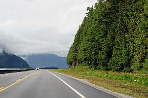
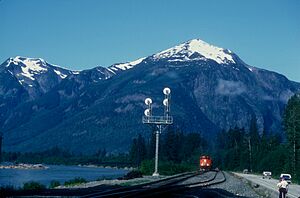
From Prince Rupert, Highway 16 begins its long journey east. It winds through the amazing Coast Mountain Ranges. The highway follows the Skeena River for about 151 kilometers (94 miles) to the city of Terrace.
Near Kitwanga, Highway 37 joins Highway 16. After another 43 kilometers (27 miles) northeast, Highway 16 reaches New Hazelton. Here, it turns southeast, following the Bulkley River. About 68 kilometers (42 miles) later, the highway arrives in Smithers. It then continues southeast for another 64 kilometers (40 miles) to the village of Houston.
In Houston, Highway 16 runs alongside the upper part of the Bulkley River. It goes about 81 kilometers (50 miles) east to where it meets Highway 35, south of Burns Lake. After passing through Fraser Lake, Highway 16 travels about 128 kilometers (80 miles) east. It then reaches Highway 27 in Vanderhoof.
About 97 kilometers (60 miles) east of Vanderhoof, Highway 16 reaches its halfway point in British Columbia. This is when it enters Prince George, meeting Highway 97. Highway 16 then travels through Prince George for about 9 kilometers (6 miles) before leaving the city.
About 120 kilometers (75 miles) east of Prince George, Highway 16 reaches Dome Creek. Here, it meets the Fraser River and turns southeast. It follows the Fraser River upstream for about 82 kilometers (51 miles) to McBride. The highway then continues upstream for another 64 kilometers (40 miles). This brings it to its junction with Highway 5 at Tête Jaune Cache.
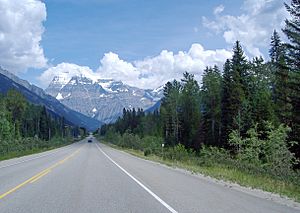
Just 14 kilometers (9 miles) east of Tête Jaune Cache, Highway 16 enters Mount Robson Provincial Park. It travels through this beautiful park for about 63 kilometers (39 miles). Finally, it reaches the border between British Columbia and Alberta within Yellowhead Pass.
Major Connections
Highway 16 connects with many other important roads and places. Here are some of the main connections from west to east:
- In Masset, it starts at Hodges Avenue / Towhill Road. This is the western end of the Yellowhead Highway.
- In Skidegate, it connects to the Skidegate Ferry Terminal, where you can take a BC Ferries boat to Prince Rupert.
- In Prince Rupert, it connects to the Prince Rupert Ferry Terminal.
- In Terrace, it meets Highway 113 and Highway 37.
- In Kitwanga, it connects with Highway 37 again, which is also known as the Stewart-Cassiar Highway.
- Near Burns Lake, it meets Highway 35.
- Near Vanderhoof, it connects with Highway 27.
- In Prince George, it has a major junction with Highway 97. Highway 97 goes north to Dawson Creek and south to Vancouver.
- Near Tête Jaune Cache, it meets Highway 5, which is also part of the Yellowhead Highway and goes south to Vancouver.
- Finally, Highway 16 crosses into Alberta at Yellowhead Pass, continuing as Highway 16 in Alberta.
 | Emma Amos |
 | Edward Mitchell Bannister |
 | Larry D. Alexander |
 | Ernie Barnes |


