Broad Run (Little Muncy Creek tributary) facts for kids
Quick facts for kids Broad Run |
|
|---|---|

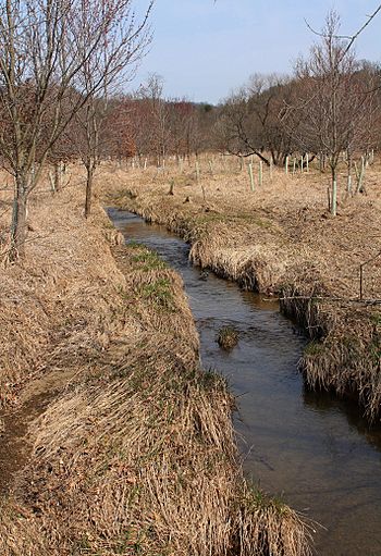
Broad Run looking upstream
|
|
| Physical characteristics | |
| Main source | Ball Ridge in Moreland Township, Lycoming County, Pennsylvania 1,023 ft (312 m) |
| River mouth | Little Muncy Creek in Moreland Township, Lycoming County, Pennsylvania near Moreland 620 ft (190 m) 41°11′13″N 76°40′08″W / 41.18684°N 76.66894°W |
| Length | 3.7 mi (6.0 km) |
| Basin features | |
| Progression | Little Muncy Creek → Muncy Creek → West Branch Susquehanna River → Susquehanna River → Chesapeake Bay |
| Basin size | 2.94 sq mi (7.6 km2) |
| Tributaries |
|
Broad Run is a small stream, also called a tributary, that flows into Little Muncy Creek. You can find it in Lycoming County, Pennsylvania, in the United States. This stream is about 3.7 miles (6.0 km) long. It flows through an area called Moreland Township.
The area of land that drains into Broad Run, known as its watershed, covers about 2.94 square miles (7.6 km2). A bridge carrying State Route 2067 crosses over Broad Run. The stream is known as a Coldwater Fishery, which means its waters are cold enough for certain types of fish to live there.
Contents
Where Does Broad Run Flow?
Broad Run starts on a place called Ball Ridge in Moreland Township. From there, it flows generally south. Along its journey, it crosses Pennsylvania Route 118. Several smaller, unnamed streams join Broad Run as it flows.
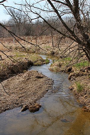
The stream winds through a valley. It eventually reaches the end of its valley and turns west for a short distance. Finally, Broad Run turns south and meets up with Little Muncy Creek. This meeting point is about 8.84 miles (14.23 km) upstream from where Little Muncy Creek itself ends.
How High Is Broad Run?
The land where Broad Run begins, its source, is about 1,023 feet (312 m) above sea level. Where Broad Run joins Little Muncy Creek, its mouth, the elevation is about 620 feet (190 m) above sea level. This difference in height helps the water flow downhill.
What Lives in Broad Run?

The watershed of Broad Run is the entire area of land where water drains into the stream. This area is about 2.94 square miles (7.6 km2). Broad Run is located entirely within the Hughesville quadrangle, which is a specific map area used by the United States Geological Survey. The mouth of the stream is less than 1 mile (1.6 km) from the town of Moreland.
Broad Run is officially classified as a Coldwater Fishery. This means the water stays cool enough for fish like trout to thrive.
History of Broad Run
Broad Run was officially added to the Geographic Names Information System on August 2, 1979. This system helps keep track of names and locations of places in the United States.
A concrete bridge was built over Broad Run in 1930. This bridge carries State Route 2067 and is about 25.9 feet (7.9 m) long. Later, in 2016, a company called XTO Energy received a permit related to controlling soil erosion and sediment. Broad Run was one of the streams that would receive water from the area covered by this permit.
 | Isaac Myers |
 | D. Hamilton Jackson |
 | A. Philip Randolph |


